Clay Center Se Topo Map Kansas
To zoom in, hover over the map of Clay Center Se
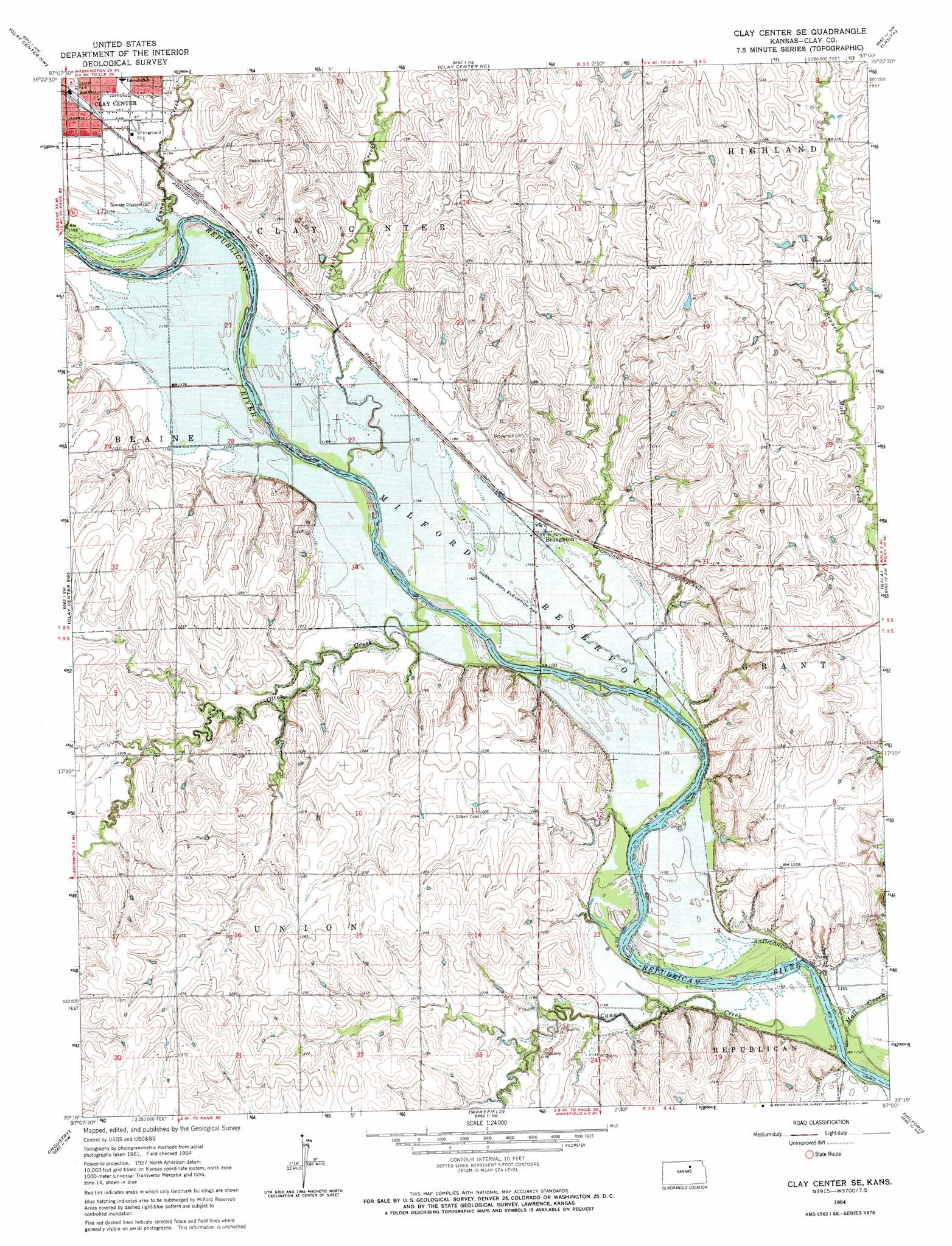
USGS Topo Quad 39097c1 - 1:24,000 scale
| Topo Map Name: | Clay Center Se |
| USGS Topo Quad ID: | 39097c1 |
| Print Size: | ca. 21 1/4" wide x 27" high |
| Southeast Coordinates: | 39.25° N latitude / 97° W longitude |
| Map Center Coordinates: | 39.3125° N latitude / 97.0625° W longitude |
| U.S. State: | KS |
| Filename: | o39097c1.jpg |
| Download Map JPG Image: | Clay Center Se topo map 1:24,000 scale |
| Map Type: | Topographic |
| Topo Series: | 7.5´ |
| Map Scale: | 1:24,000 |
| Source of Map Images: | United States Geological Survey (USGS) |
| Alternate Map Versions: |
Clay Center SE KS 1964, updated 1965 Download PDF Buy paper map Clay Center SE KS 2009 Download PDF Buy paper map Clay Center SE KS 2012 Download PDF Buy paper map Clay Center SE KS 2016 Download PDF Buy paper map |
1:24,000 Topo Quads surrounding Clay Center Se
Clifton |
Linn Sw |
Linn Se |
Kimeo |
Greenleaf Se |
Miltonvale Ne |
Clay Center Nw |
Clay Center Ne |
Lasita |
Randolph |
Idana |
Clay Center Sw |
Clay Center Se |
Bala |
Riley |
Longford |
Industry |
Wakefield |
Milford |
Fort Riley Ne |
Manchester |
Buckeye |
Upland |
Milford Dam |
Junction City |
> Back to 39097a1 at 1:100,000 scale
> Back to 39096a1 at 1:250,000 scale
> Back to U.S. Topo Maps home
Clay Center Se topo map: Gazetteer
Clay Center Se: Parks
Dexter Park elevation 365m 1197′Clay Center Se: Populated Places
Broughton (historical) elevation 360m 1181′Clay Center Se: Streams
Cane Creek elevation 345m 1131′Finney Creek elevation 357m 1171′
Lincoln Creek elevation 354m 1161′
Mall Creek elevation 348m 1141′
Otter Creek elevation 353m 1158′
Clay Center Se digital topo map on disk
Buy this Clay Center Se topo map showing relief, roads, GPS coordinates and other geographical features, as a high-resolution digital map file on DVD: