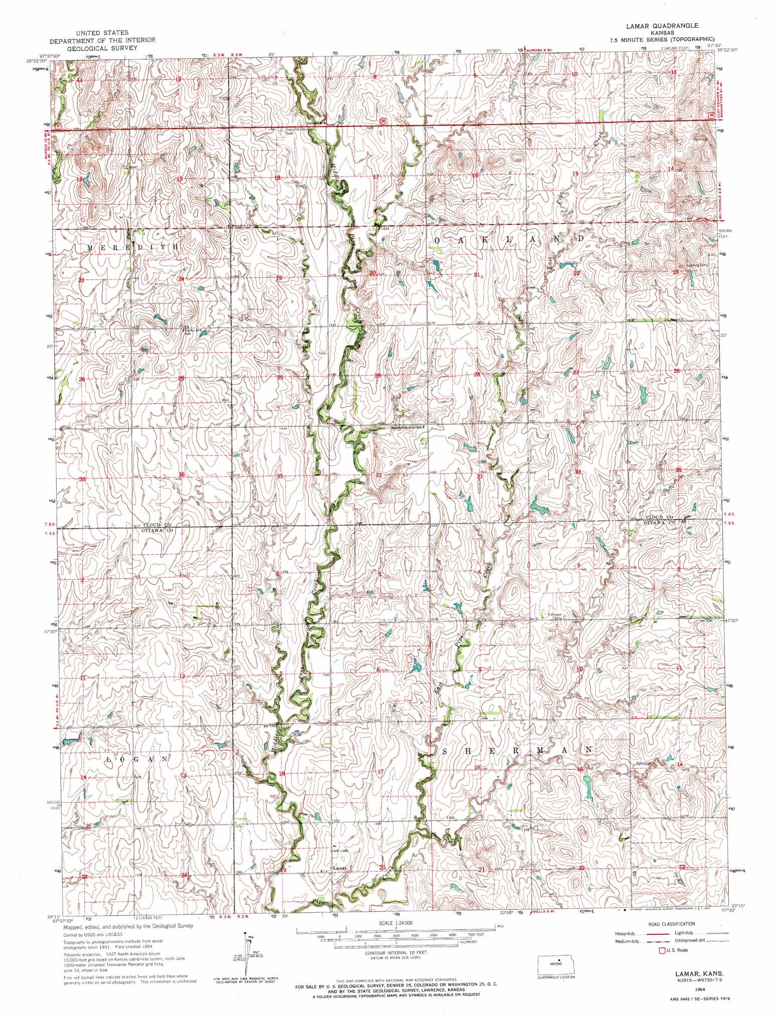
Lamar Topo Map Kansas
To zoom in, hover over the map of Lamar
USGS Topo Quad 39097c5 - 1:24,000 scale
| Topo Map Name: | Lamar |
| USGS Topo Quad ID: | 39097c5 |
| Print Size: | ca. 21 1/4" wide x 27" high |
| Southeast Coordinates: | 39.25° N latitude / 97.5° W longitude |
| Map Center Coordinates: | 39.3125° N latitude / 97.5625° W longitude |
| U.S. State: | KS |
| Filename: | o39097c5.jpg |
| Download Map JPG Image: | Lamar topo map 1:24,000 scale |
| Map Type: | Topographic |
| Topo Series: | 7.5´ |
| Map Scale: | 1:24,000 |
| Source of Map Images: | United States Geological Survey (USGS) |
| Alternate Map Versions: |
Lamar KS 1964, updated 1965 Download PDF Buy paper map Lamar KS 2009 Download PDF Buy paper map Lamar KS 2012 Download PDF Buy paper map Lamar KS 2015 Download PDF Buy paper map |
1:24,000 Topo Quads surrounding Lamar
Jamestown |
Concordia |
Rice |
Clyde |
Clifton |
Glasco Ne |
Aurora Nw |
Aurora |
Miltonvale Nw |
Miltonvale Ne |
Glasco |
Aurora Sw |
Lamar |
Miltonvale |
Idana |
Tescott Ne |
Minneapolis North |
Wells |
Manchester Nw |
Longford |
Tescott Se |
Minneapolis South |
Bennington |
Vine Creek |
Manchester |
> Back to 39097a1 at 1:100,000 scale
> Back to 39096a1 at 1:250,000 scale
> Back to U.S. Topo Maps home
Lamar topo map: Gazetteer
Lamar: Populated Places
Lamar elevation 417m 1368′Lamar: Streams
East Pipe Creek elevation 408m 1338′Lamar digital topo map on disk
Buy this Lamar topo map showing relief, roads, GPS coordinates and other geographical features, as a high-resolution digital map file on DVD: