Glasco Ne Topo Map Kansas
To zoom in, hover over the map of Glasco Ne
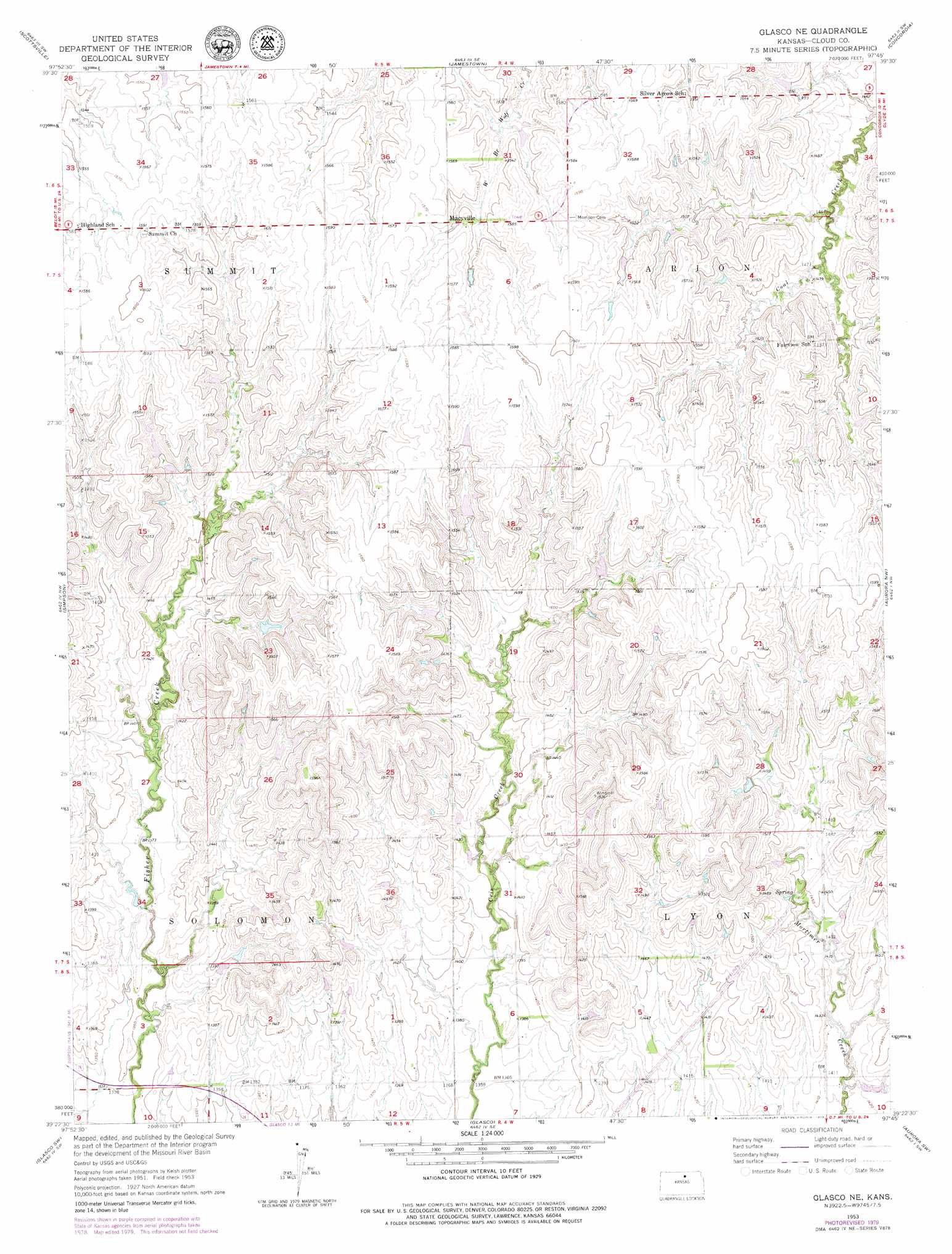
USGS Topo Quad 39097d7 - 1:24,000 scale
| Topo Map Name: | Glasco Ne |
| USGS Topo Quad ID: | 39097d7 |
| Print Size: | ca. 21 1/4" wide x 27" high |
| Southeast Coordinates: | 39.375° N latitude / 97.75° W longitude |
| Map Center Coordinates: | 39.4375° N latitude / 97.8125° W longitude |
| U.S. State: | KS |
| Filename: | o39097d7.jpg |
| Download Map JPG Image: | Glasco Ne topo map 1:24,000 scale |
| Map Type: | Topographic |
| Topo Series: | 7.5´ |
| Map Scale: | 1:24,000 |
| Source of Map Images: | United States Geological Survey (USGS) |
| Alternate Map Versions: |
Glasco NE KS 1953, updated 1954 Download PDF Buy paper map Glasco NE KS 1953, updated 1976 Download PDF Buy paper map Glasco NE KS 1953, updated 1979 Download PDF Buy paper map Glasco NE KS 2009 Download PDF Buy paper map Glasco NE KS 2012 Download PDF Buy paper map Glasco NE KS 2015 Download PDF Buy paper map |
1:24,000 Topo Quads surrounding Glasco Ne
Randall |
Jamestown Nw |
Kackley |
Condordia Nw |
Wayne |
Jewell Se |
Scottsville |
Jamestown |
Concordia |
Rice |
Beloit |
Simpson |
Glasco Ne |
Aurora Nw |
Aurora |
Beloit Se |
Glasco Sw |
Glasco |
Aurora Sw |
Lamar |
Barnard |
Ada |
Tescott Ne |
Minneapolis North |
Wells |
> Back to 39097a1 at 1:100,000 scale
> Back to 39096a1 at 1:250,000 scale
> Back to U.S. Topo Maps home
Glasco Ne digital topo map on disk
Buy this Glasco Ne topo map showing relief, roads, GPS coordinates and other geographical features, as a high-resolution digital map file on DVD: