Lincoln Topo Map Kansas
To zoom in, hover over the map of Lincoln
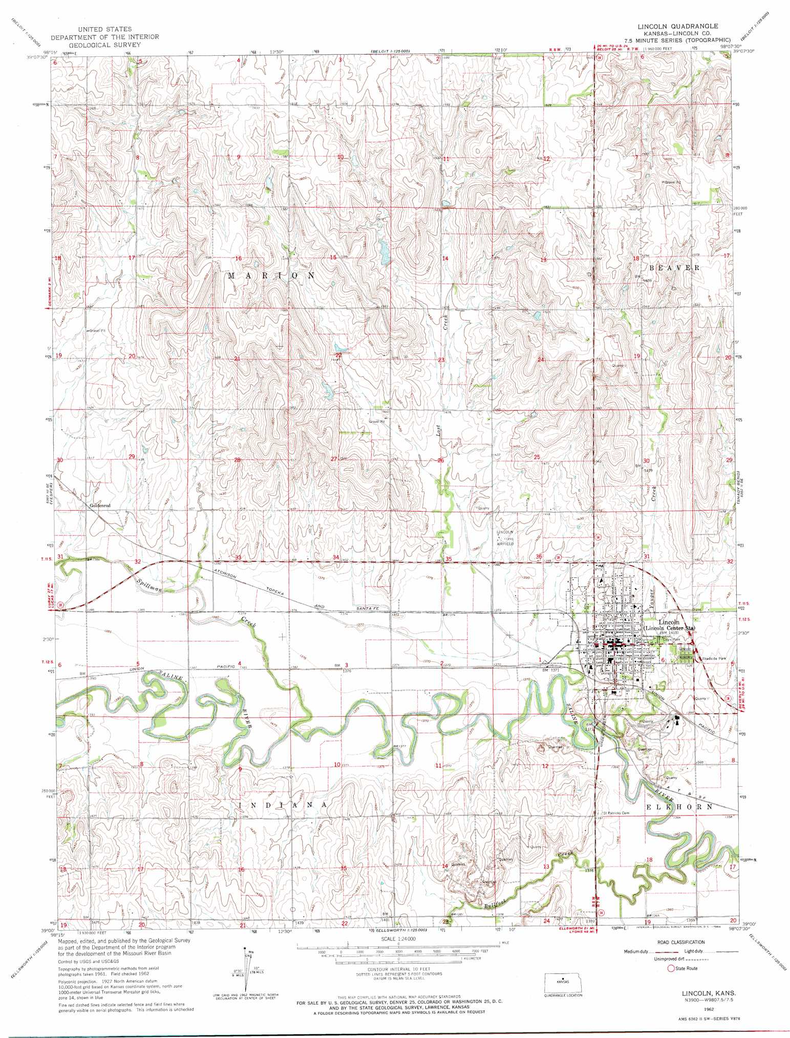
USGS Topo Quad 39098a2 - 1:24,000 scale
| Topo Map Name: | Lincoln |
| USGS Topo Quad ID: | 39098a2 |
| Print Size: | ca. 21 1/4" wide x 27" high |
| Southeast Coordinates: | 39° N latitude / 98.125° W longitude |
| Map Center Coordinates: | 39.0625° N latitude / 98.1875° W longitude |
| U.S. State: | KS |
| Filename: | o39098a2.jpg |
| Download Map JPG Image: | Lincoln topo map 1:24,000 scale |
| Map Type: | Topographic |
| Topo Series: | 7.5´ |
| Map Scale: | 1:24,000 |
| Source of Map Images: | United States Geological Survey (USGS) |
| Alternate Map Versions: |
Lincoln KS 1962, updated 1964 Download PDF Buy paper map Lincoln KS 2009 Download PDF Buy paper map Lincoln KS 2012 Download PDF Buy paper map Lincoln KS 2016 Download PDF Buy paper map |
1:24,000 Topo Quads surrounding Lincoln
Tipton |
Blue Hill |
Beloit Sw |
Beloit Se |
Glasco Sw |
Hunter |
Ash Grove |
Lincoln Nw |
Barnard |
Ada |
Sylvan Grove |
Vesper |
Lincoln |
Shady Bend |
Tescott |
Wilson Nw |
Wilson Ne |
Westfall Nw |
Westfall |
Juniata |
Wilson |
Black Wolf |
Westfall Sw |
Westfall Se |
Brookville Sw |
> Back to 39098a1 at 1:100,000 scale
> Back to 39098a1 at 1:250,000 scale
> Back to U.S. Topo Maps home
Lincoln topo map: Gazetteer
Lincoln: Airports
Lincoln Municipal Airport elevation 424m 1391′Lincoln: Populated Places
Goldenrod elevation 425m 1394′Lincoln elevation 432m 1417′
Lincoln: Streams
Bullfoot Creek elevation 408m 1338′Lost Creek elevation 415m 1361′
Spillman Creek elevation 418m 1371′
Yauger Creek elevation 411m 1348′
Lincoln digital topo map on disk
Buy this Lincoln topo map showing relief, roads, GPS coordinates and other geographical features, as a high-resolution digital map file on DVD: