Barnard Topo Map Kansas
To zoom in, hover over the map of Barnard
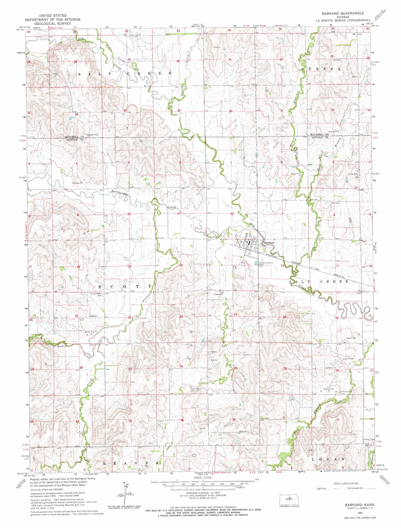
USGS Topo Quad 39098b1 - 1:24,000 scale
| Topo Map Name: | Barnard |
| USGS Topo Quad ID: | 39098b1 |
| Print Size: | ca. 21 1/4" wide x 27" high |
| Southeast Coordinates: | 39.125° N latitude / 98° W longitude |
| Map Center Coordinates: | 39.1875° N latitude / 98.0625° W longitude |
| U.S. State: | KS |
| Filename: | o39098b1.jpg |
| Download Map JPG Image: | Barnard topo map 1:24,000 scale |
| Map Type: | Topographic |
| Topo Series: | 7.5´ |
| Map Scale: | 1:24,000 |
| Source of Map Images: | United States Geological Survey (USGS) |
| Alternate Map Versions: |
Barnard KS 1964, updated 1965 Download PDF Buy paper map Barnard KS 1964, updated 1966 Download PDF Buy paper map Barnard KS 2010 Download PDF Buy paper map Barnard KS 2012 Download PDF Buy paper map Barnard KS 2015 Download PDF Buy paper map |
1:24,000 Topo Quads surrounding Barnard
Glen Elder South |
Solomon Rapids |
Beloit |
Simpson |
Glasco Ne |
Blue Hill |
Beloit Sw |
Beloit Se |
Glasco Sw |
Glasco |
Ash Grove |
Lincoln Nw |
Barnard |
Ada |
Tescott Ne |
Vesper |
Lincoln |
Shady Bend |
Tescott |
Tescott Se |
Wilson Ne |
Westfall Nw |
Westfall |
Juniata |
Culver |
> Back to 39098a1 at 1:100,000 scale
> Back to 39098a1 at 1:250,000 scale
> Back to U.S. Topo Maps home
Barnard topo map: Gazetteer
Barnard: Populated Places
Barnard elevation 401m 1315′Barnard: Streams
Battle Creek elevation 412m 1351′East Branch Third Creek elevation 406m 1332′
Fifth Creek elevation 403m 1322′
Fourth Creek elevation 403m 1322′
Prosser Creek elevation 404m 1325′
Rattlesnake Creek elevation 397m 1302′
Third Creek elevation 397m 1302′
West Branch Third Creek elevation 406m 1332′
Barnard digital topo map on disk
Buy this Barnard topo map showing relief, roads, GPS coordinates and other geographical features, as a high-resolution digital map file on DVD: