Randall Topo Map Kansas
To zoom in, hover over the map of Randall
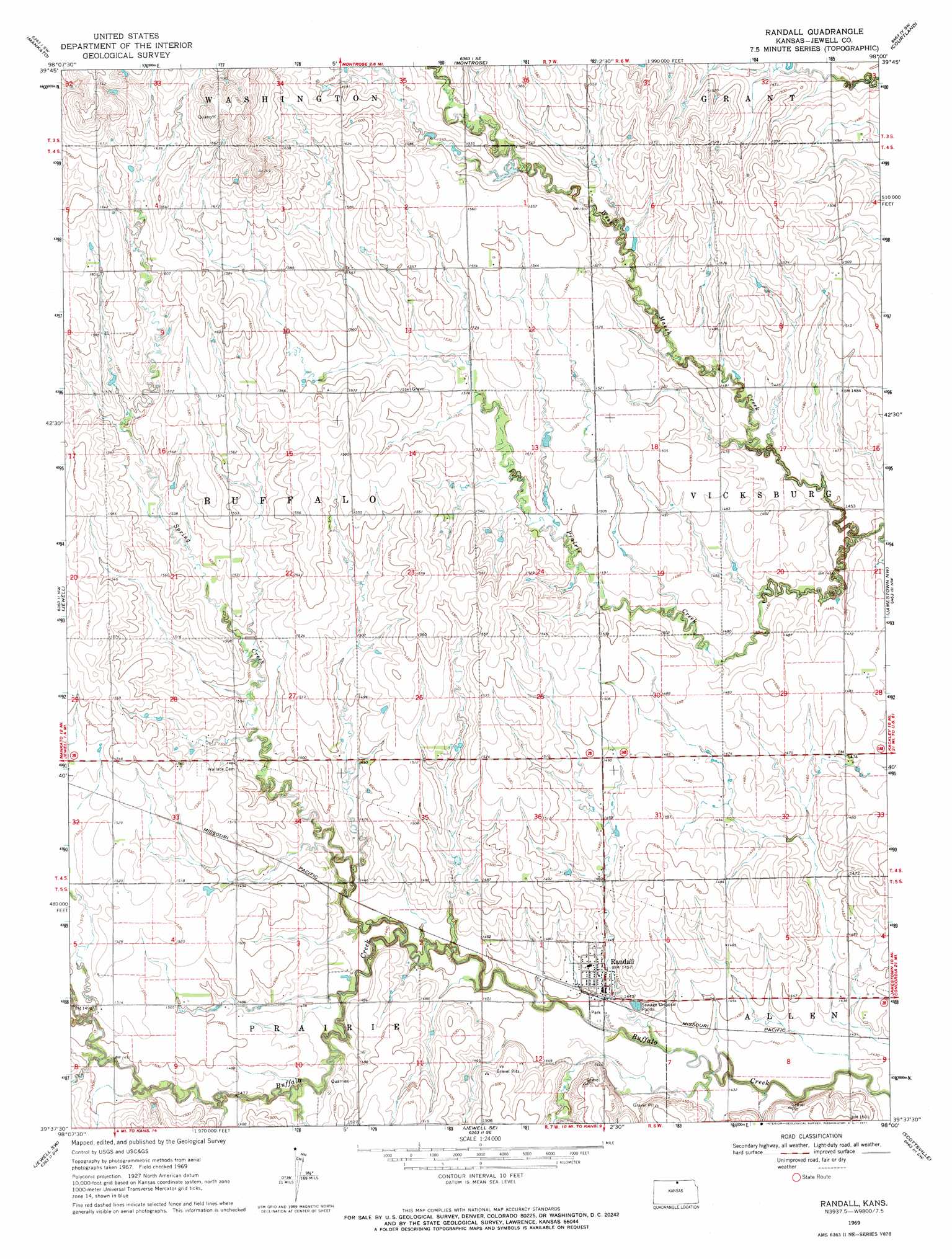
USGS Topo Quad 39098f1 - 1:24,000 scale
| Topo Map Name: | Randall |
| USGS Topo Quad ID: | 39098f1 |
| Print Size: | ca. 21 1/4" wide x 27" high |
| Southeast Coordinates: | 39.625° N latitude / 98° W longitude |
| Map Center Coordinates: | 39.6875° N latitude / 98.0625° W longitude |
| U.S. State: | KS |
| Filename: | o39098f1.jpg |
| Download Map JPG Image: | Randall topo map 1:24,000 scale |
| Map Type: | Topographic |
| Topo Series: | 7.5´ |
| Map Scale: | 1:24,000 |
| Source of Map Images: | United States Geological Survey (USGS) |
| Alternate Map Versions: |
Randall KS 1969, updated 1971 Download PDF Buy paper map Randall KS 2009 Download PDF Buy paper map Randall KS 2012 Download PDF Buy paper map Randall KS 2015 Download PDF Buy paper map |
1:24,000 Topo Quads surrounding Randall
Northbranch |
Mankato Nw |
Webber |
Scandia Nw |
Republic |
Burr Oak |
Mankato |
Montrose |
Courtland |
Scandia |
Ionia |
Jewell |
Randall |
Jamestown Nw |
Kackley |
Glen Elder North |
Jewell Sw |
Jewell Se |
Scottsville |
Jamestown |
Glen Elder South |
Solomon Rapids |
Beloit |
Simpson |
Glasco Ne |
> Back to 39098e1 at 1:100,000 scale
> Back to 39098a1 at 1:250,000 scale
> Back to U.S. Topo Maps home
Randall topo map: Gazetteer
Randall: Populated Places
Randall elevation 444m 1456′Randall: Streams
Prairie Creek elevation 439m 1440′Spring Creek elevation 454m 1489′
Randall digital topo map on disk
Buy this Randall topo map showing relief, roads, GPS coordinates and other geographical features, as a high-resolution digital map file on DVD: