Gaylord Topo Map Kansas
To zoom in, hover over the map of Gaylord
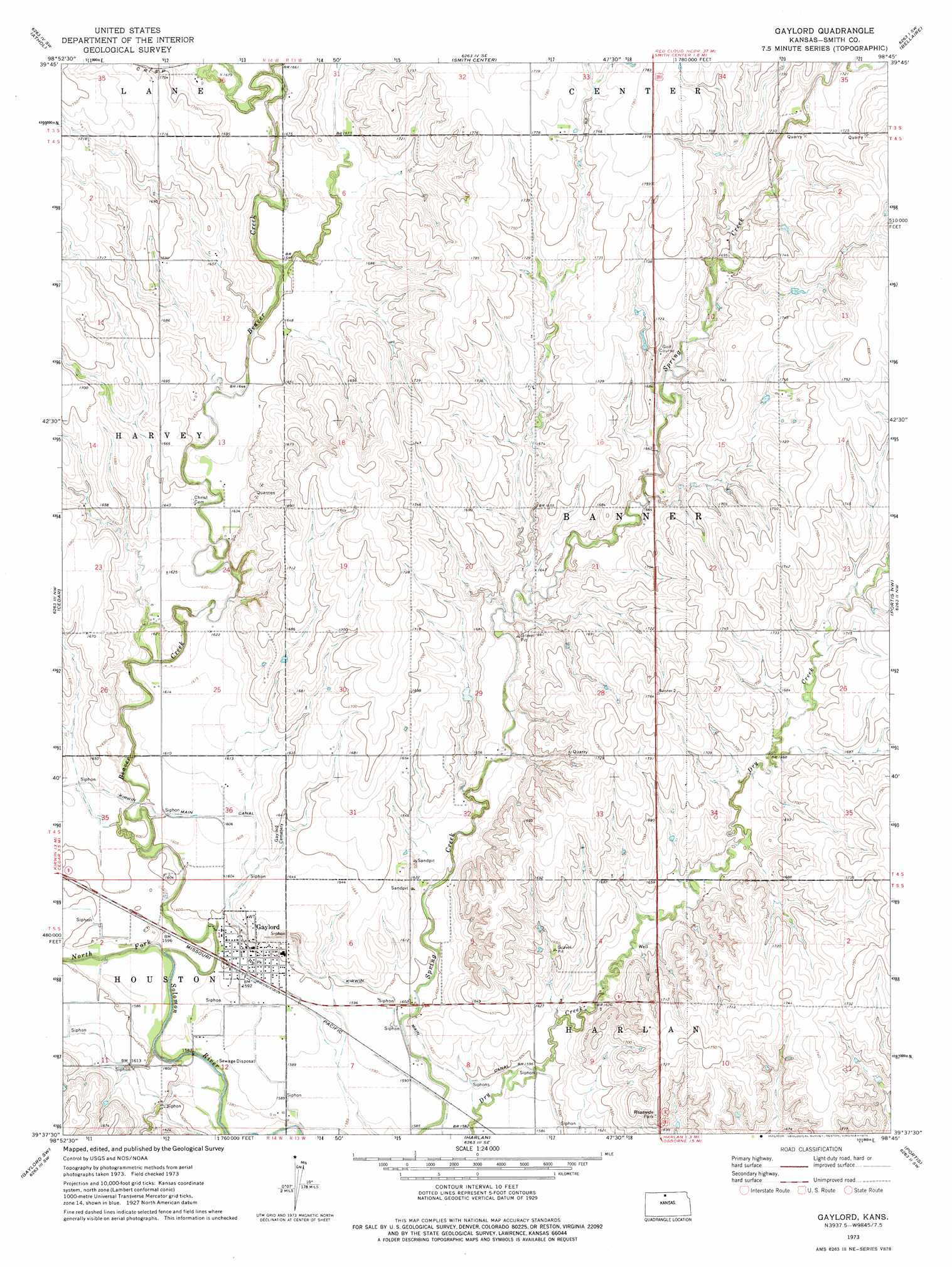
USGS Topo Quad 39098f7 - 1:24,000 scale
| Topo Map Name: | Gaylord |
| USGS Topo Quad ID: | 39098f7 |
| Print Size: | ca. 21 1/4" wide x 27" high |
| Southeast Coordinates: | 39.625° N latitude / 98.75° W longitude |
| Map Center Coordinates: | 39.6875° N latitude / 98.8125° W longitude |
| U.S. State: | KS |
| Filename: | o39098f7.jpg |
| Download Map JPG Image: | Gaylord topo map 1:24,000 scale |
| Map Type: | Topographic |
| Topo Series: | 7.5´ |
| Map Scale: | 1:24,000 |
| Source of Map Images: | United States Geological Survey (USGS) |
| Alternate Map Versions: |
Gaylord KS 1973, updated 1975 Download PDF Buy paper map Gaylord KS 2009 Download PDF Buy paper map Gaylord KS 2012 Download PDF Buy paper map Gaylord KS 2015 Download PDF Buy paper map |
1:24,000 Topo Quads surrounding Gaylord
Kensington Ne |
Bachelors Run |
Reamsville |
Cora |
Mccracken Branch |
Kensington |
Athol |
Smith Center |
Bellaire |
Lebanon |
Kirwin |
Cedar |
Gaylord |
Portis Nw |
Portis Ne |
Kirwin Se |
Gaylord Sw |
Harlan |
Portis |
Downs North |
Woodston |
Alton |
Bloomington |
Osborne |
Downs South |
> Back to 39098e1 at 1:100,000 scale
> Back to 39098a1 at 1:250,000 scale
> Back to U.S. Topo Maps home
Gaylord topo map: Gazetteer
Gaylord: Populated Places
Gaylord elevation 486m 1594′Gaylord: Streams
Beaver Creek elevation 477m 1564′East Beaver Creek elevation 502m 1646′
West Beaver Creek elevation 502m 1646′
Gaylord digital topo map on disk
Buy this Gaylord topo map showing relief, roads, GPS coordinates and other geographical features, as a high-resolution digital map file on DVD: