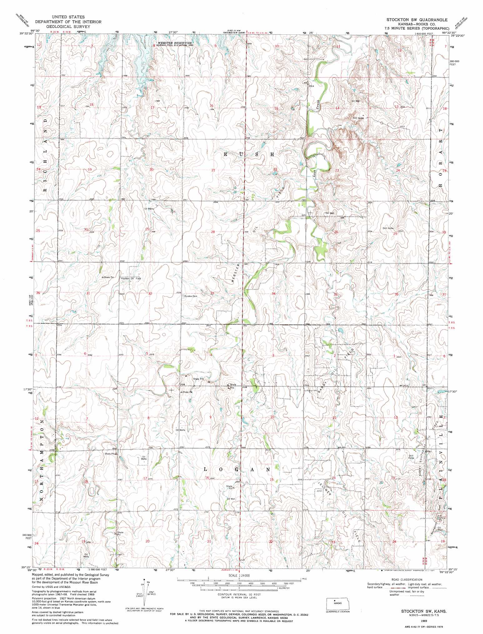
Stockton Sw Topo Map Kansas
To zoom in, hover over the map of Stockton Sw
USGS Topo Quad 39099c4 - 1:24,000 scale
| Topo Map Name: | Stockton Sw |
| USGS Topo Quad ID: | 39099c4 |
| Print Size: | ca. 21 1/4" wide x 27" high |
| Southeast Coordinates: | 39.25° N latitude / 99.375° W longitude |
| Map Center Coordinates: | 39.3125° N latitude / 99.4375° W longitude |
| U.S. State: | KS |
| Filename: | o39099c4.jpg |
| Download Map JPG Image: | Stockton Sw topo map 1:24,000 scale |
| Map Type: | Topographic |
| Topo Series: | 7.5´ |
| Map Scale: | 1:24,000 |
| Source of Map Images: | United States Geological Survey (USGS) |
| Alternate Map Versions: |
Stockton SW KS 1969, updated 1971 Download PDF Buy paper map Stockton SW KS 2010 Download PDF Buy paper map Stockton SW KS 2012 Download PDF Buy paper map Stockton SW KS 2016 Download PDF Buy paper map |
1:24,000 Topo Quads surrounding Stockton Sw
Logan Sw |
Logan Se |
Glade Sw |
Glade Se |
Kirwin Sw |
Bogue Nw |
Nicodemus |
Webster Dam |
Stockton |
Woodston Nw |
Bogue |
Palco |
Stockton Sw |
Stockton Se |
Twin Mound |
Hill City 4 Nw |
Wild Horse Creek |
Zurich |
Plainville |
Codell |
Hill City 4 Sw |
Hill City 4 Se |
Plainville Sw |
Plainville Se |
Turkville |
> Back to 39099a1 at 1:100,000 scale
> Back to 39098a1 at 1:250,000 scale
> Back to U.S. Topo Maps home
Stockton Sw topo map: Gazetteer
Stockton Sw: Oilfields
Barry Oil Field elevation 606m 1988′Barry Southeast Oil Field elevation 630m 2066′
Baumgarten Oil Field elevation 653m 2142′
Hayden Oil Field elevation 619m 2030′
Jelinek Oil Field elevation 628m 2060′
Webster Oil Field elevation 609m 1998′
Stockton Sw digital topo map on disk
Buy this Stockton Sw topo map showing relief, roads, GPS coordinates and other geographical features, as a high-resolution digital map file on DVD: