Bogue Topo Map Kansas
To zoom in, hover over the map of Bogue
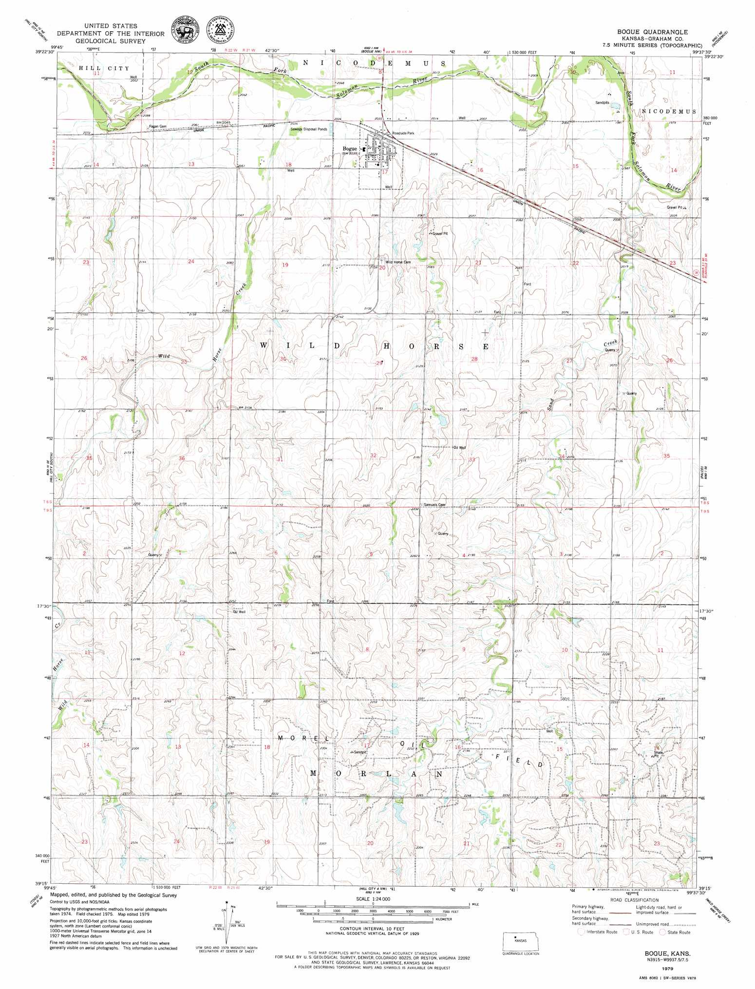
USGS Topo Quad 39099c6 - 1:24,000 scale
| Topo Map Name: | Bogue |
| USGS Topo Quad ID: | 39099c6 |
| Print Size: | ca. 21 1/4" wide x 27" high |
| Southeast Coordinates: | 39.25° N latitude / 99.625° W longitude |
| Map Center Coordinates: | 39.3125° N latitude / 99.6875° W longitude |
| U.S. State: | KS |
| Filename: | o39099c6.jpg |
| Download Map JPG Image: | Bogue topo map 1:24,000 scale |
| Map Type: | Topographic |
| Topo Series: | 7.5´ |
| Map Scale: | 1:24,000 |
| Source of Map Images: | United States Geological Survey (USGS) |
| Alternate Map Versions: |
Bogue KS 1979, updated 1979 Download PDF Buy paper map Bogue KS 2010 Download PDF Buy paper map Bogue KS 2012 Download PDF Buy paper map Bogue KS 2015 Download PDF Buy paper map |
1:24,000 Topo Quads surrounding Bogue
Lenora East |
Edmond Se |
Logan Sw |
Logan Se |
Glade Sw |
Hill City Nw |
Hill City North |
Bogue Nw |
Nicodemus |
Webster Dam |
Penokee |
Hill City South |
Bogue |
Palco |
Stockton Sw |
Hay Hollow |
Togo |
Hill City 4 Nw |
Wild Horse Creek |
Zurich |
Wa Keeney West |
Wa Keeney East |
Hill City 4 Sw |
Hill City 4 Se |
Plainville Sw |
> Back to 39099a1 at 1:100,000 scale
> Back to 39098a1 at 1:250,000 scale
> Back to U.S. Topo Maps home
Bogue topo map: Gazetteer
Bogue: Populated Places
Bogue elevation 621m 2037′Bogue: Streams
Sand Creek elevation 606m 1988′Wild Horse Creek elevation 616m 2020′
Bogue digital topo map on disk
Buy this Bogue topo map showing relief, roads, GPS coordinates and other geographical features, as a high-resolution digital map file on DVD: