Webster Dam Topo Map Kansas
To zoom in, hover over the map of Webster Dam
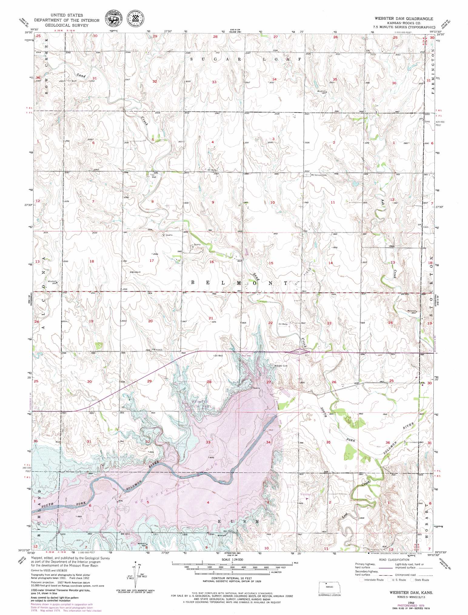
USGS Topo Quad 39099d4 - 1:24,000 scale
| Topo Map Name: | Webster Dam |
| USGS Topo Quad ID: | 39099d4 |
| Print Size: | ca. 21 1/4" wide x 27" high |
| Southeast Coordinates: | 39.375° N latitude / 99.375° W longitude |
| Map Center Coordinates: | 39.4375° N latitude / 99.4375° W longitude |
| U.S. State: | KS |
| Filename: | o39099d4.jpg |
| Download Map JPG Image: | Webster Dam topo map 1:24,000 scale |
| Map Type: | Topographic |
| Topo Series: | 7.5´ |
| Map Scale: | 1:24,000 |
| Source of Map Images: | United States Geological Survey (USGS) |
| Alternate Map Versions: |
Webster Dam KS 1952, updated 1955 Download PDF Buy paper map Webster Dam KS 1952, updated 1979 Download PDF Buy paper map Webster Dam KS 2010 Download PDF Buy paper map Webster Dam KS 2012 Download PDF Buy paper map Webster Dam KS 2015 Download PDF Buy paper map |
1:24,000 Topo Quads surrounding Webster Dam
Densmore |
Logan |
Speed |
Phillipsburg South |
Kirwin Reservoir |
Logan Sw |
Logan Se |
Glade Sw |
Glade Se |
Kirwin Sw |
Bogue Nw |
Nicodemus |
Webster Dam |
Stockton |
Woodston Nw |
Bogue |
Palco |
Stockton Sw |
Stockton Se |
Twin Mound |
Hill City 4 Nw |
Wild Horse Creek |
Zurich |
Plainville |
Codell |
> Back to 39099a1 at 1:100,000 scale
> Back to 39098a1 at 1:250,000 scale
> Back to U.S. Topo Maps home
Webster Dam topo map: Gazetteer
Webster Dam: Airports
Webster Reservoir Airstrip elevation 596m 1955′Webster Dam: Dams
Webster Dam elevation 577m 1893′Webster Dam: Parks
Webster State Park elevation 589m 1932′Webster Dam: Populated Places
Webster elevation 577m 1893′Webster Dam: Streams
Lost Creek elevation 558m 1830′Sand Creek elevation 558m 1830′
Webster Dam digital topo map on disk
Buy this Webster Dam topo map showing relief, roads, GPS coordinates and other geographical features, as a high-resolution digital map file on DVD: