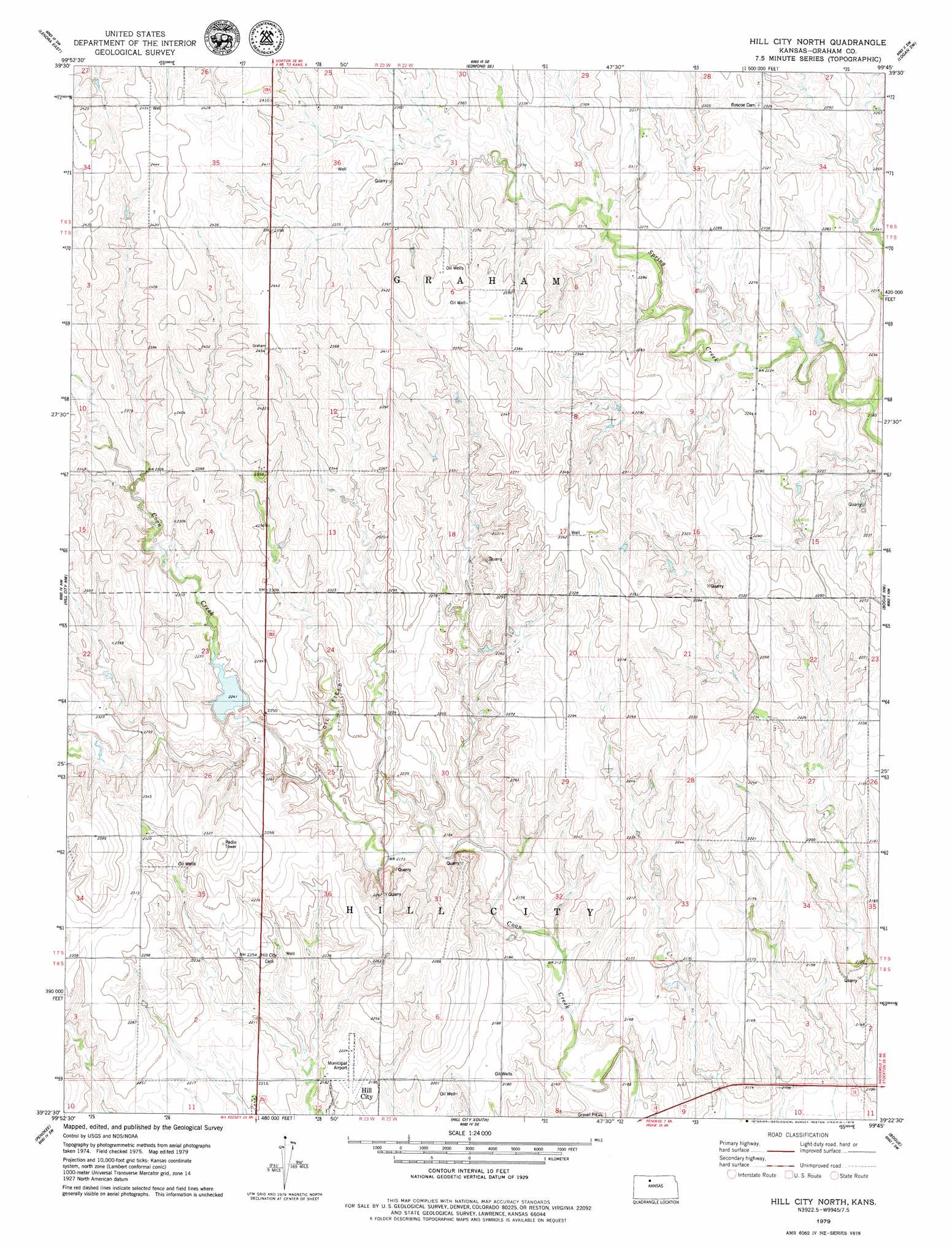
Hill City North Topo Map Kansas
To zoom in, hover over the map of Hill City North
USGS Topo Quad 39099d7 - 1:24,000 scale
| Topo Map Name: | Hill City North |
| USGS Topo Quad ID: | 39099d7 |
| Print Size: | ca. 21 1/4" wide x 27" high |
| Southeast Coordinates: | 39.375° N latitude / 99.75° W longitude |
| Map Center Coordinates: | 39.4375° N latitude / 99.8125° W longitude |
| U.S. State: | KS |
| Filename: | o39099d7.jpg |
| Download Map JPG Image: | Hill City North topo map 1:24,000 scale |
| Map Type: | Topographic |
| Topo Series: | 7.5´ |
| Map Scale: | 1:24,000 |
| Source of Map Images: | United States Geological Survey (USGS) |
| Alternate Map Versions: |
Hill City North KS 1979, updated 1979 Download PDF Buy paper map Hill City North KS 2009 Download PDF Buy paper map Hill City North KS 2012 Download PDF Buy paper map Hill City North KS 2015 Download PDF Buy paper map |
1:24,000 Topo Quads surrounding Hill City North
Clayton Ne |
Edmond Nw |
Edmond |
Densmore |
Logan |
Lenora West |
Lenora East |
Edmond Se |
Logan Sw |
Logan Se |
Morland Ne |
Hill City Nw |
Hill City North |
Bogue Nw |
Nicodemus |
Morland |
Penokee |
Hill City South |
Bogue |
Palco |
Saint Peter |
Hay Hollow |
Togo |
Hill City 4 Nw |
Wild Horse Creek |
> Back to 39099a1 at 1:100,000 scale
> Back to 39098a1 at 1:250,000 scale
> Back to U.S. Topo Maps home
Hill City North topo map: Gazetteer
Hill City North: Airports
Hill City Municipal Airport elevation 669m 2194′Hill City North: Populated Places
Roscoe elevation 702m 2303′Smithfield elevation 731m 2398′
Hill City North digital topo map on disk
Buy this Hill City North topo map showing relief, roads, GPS coordinates and other geographical features, as a high-resolution digital map file on DVD: