Morland Topo Map Kansas
To zoom in, hover over the map of Morland
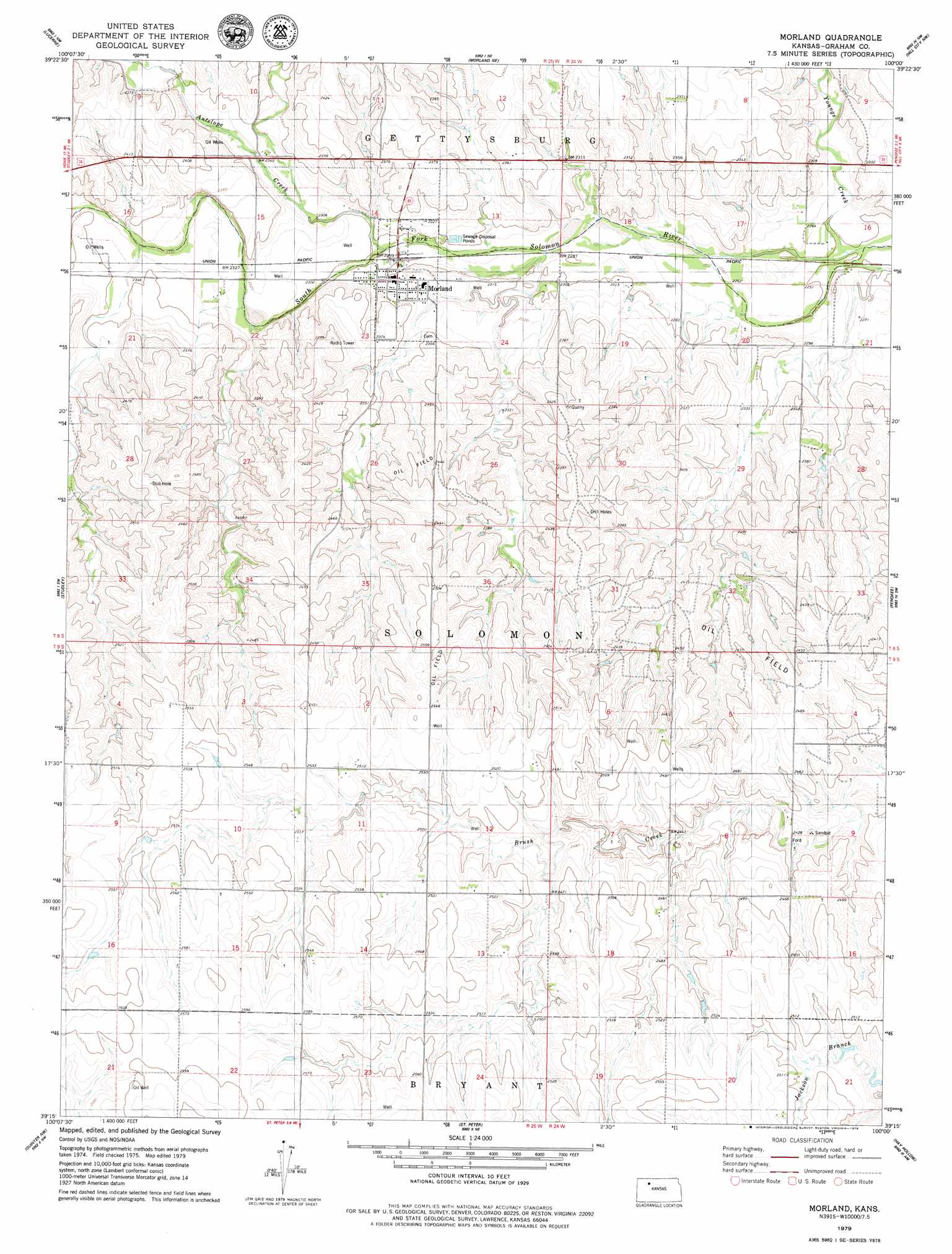
USGS Topo Quad 39100c1 - 1:24,000 scale
| Topo Map Name: | Morland |
| USGS Topo Quad ID: | 39100c1 |
| Print Size: | ca. 21 1/4" wide x 27" high |
| Southeast Coordinates: | 39.25° N latitude / 100° W longitude |
| Map Center Coordinates: | 39.3125° N latitude / 100.0625° W longitude |
| U.S. State: | KS |
| Filename: | o39100c1.jpg |
| Download Map JPG Image: | Morland topo map 1:24,000 scale |
| Map Type: | Topographic |
| Topo Series: | 7.5´ |
| Map Scale: | 1:24,000 |
| Source of Map Images: | United States Geological Survey (USGS) |
| Alternate Map Versions: |
Morland KS 1979, updated 1979 Download PDF Buy paper map Morland KS 2009 Download PDF Buy paper map Morland KS 2012 Download PDF Buy paper map Morland KS 2015 Download PDF Buy paper map |
1:24,000 Topo Quads surrounding Morland
Allison |
Clayton Sw |
Lenora West |
Lenora East |
Edmond Se |
Hoxie Ne |
Lucerne |
Morland Ne |
Hill City Nw |
Hill City North |
Tasco |
Studley |
Morland |
Penokee |
Hill City South |
Midway Draw East |
Quinter Nw |
Saint Peter |
Hay Hollow |
Togo |
Park |
Quinter |
Collyer |
Wa Keeney West |
Wa Keeney East |
> Back to 39100a1 at 1:100,000 scale
> Back to 39100a1 at 1:250,000 scale
> Back to U.S. Topo Maps home
Morland topo map: Gazetteer
Morland: Dams
Graham County Dam elevation 719m 2358′Morland: Parks
Antelope County Park elevation 718m 2355′Morland: Populated Places
Morland elevation 702m 2303′Morland: Reservoirs
Antelope Lake elevation 719m 2358′Morland: Streams
Antelope Creek elevation 699m 2293′Youngs Creek elevation 685m 2247′
Morland digital topo map on disk
Buy this Morland topo map showing relief, roads, GPS coordinates and other geographical features, as a high-resolution digital map file on DVD: