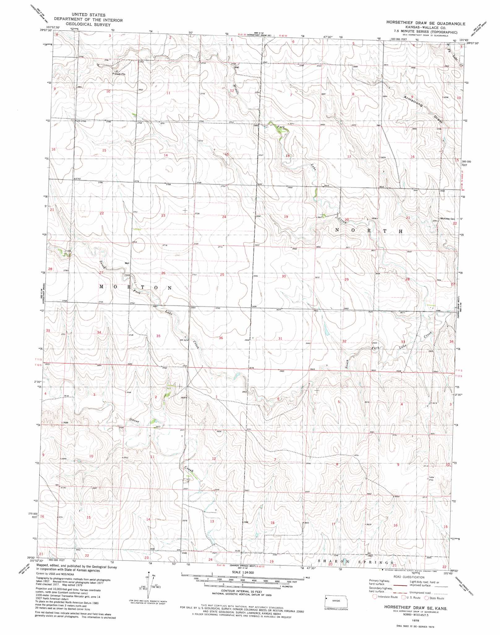
Horsethief Draw Se Topo Map Kansas
To zoom in, hover over the map of Horsethief Draw Se
USGS Topo Quad 39101a7 - 1:24,000 scale
| Topo Map Name: | Horsethief Draw Se |
| USGS Topo Quad ID: | 39101a7 |
| Print Size: | ca. 21 1/4" wide x 27" high |
| Southeast Coordinates: | 39° N latitude / 101.75° W longitude |
| Map Center Coordinates: | 39.0625° N latitude / 101.8125° W longitude |
| U.S. State: | KS |
| Filename: | o39101a7.jpg |
| Download Map JPG Image: | Horsethief Draw Se topo map 1:24,000 scale |
| Map Type: | Topographic |
| Topo Series: | 7.5´ |
| Map Scale: | 1:24,000 |
| Source of Map Images: | United States Geological Survey (USGS) |
| Alternate Map Versions: |
Horsethief Draw SE KS 1979, updated 1980 Download PDF Buy paper map Horsethief Draw SE KS 2009 Download PDF Buy paper map Horsethief Draw SE KS 2012 Download PDF Buy paper map Horsethief Draw SE KS 2015 Download PDF Buy paper map |
1:24,000 Topo Quads surrounding Horsethief Draw Se
Kanorado |
Ruleton |
Ruleton Se |
Goodland |
Edson |
Mount Sunflower Ne |
Horsethief Draw Nw |
Horsethief Draw Ne |
Wild Horse Draw |
Harris Draw Ne |
Mount Sunflower |
Horsethief Draw |
Horsethief Draw Se |
Harris Draw West |
Harris Draw East |
Arapahoe Ne |
Weskan Nw |
Sharon Springs West |
Sharon Springs East |
Wallace |
Arapahoe Se |
Weskan |
Spring Valley Ranch |
South Flats |
Harrison Flats |
> Back to 39101a1 at 1:100,000 scale
> Back to 39100a1 at 1:250,000 scale
> Back to U.S. Topo Maps home
Horsethief Draw Se topo map: Gazetteer
Horsethief Draw Se: Streams
Middle Fork Lake Creek elevation 1086m 3562′Horsethief Draw Se digital topo map on disk
Buy this Horsethief Draw Se topo map showing relief, roads, GPS coordinates and other geographical features, as a high-resolution digital map file on DVD: