Mount Sunflower Topo Map Colorado
To zoom in, hover over the map of Mount Sunflower
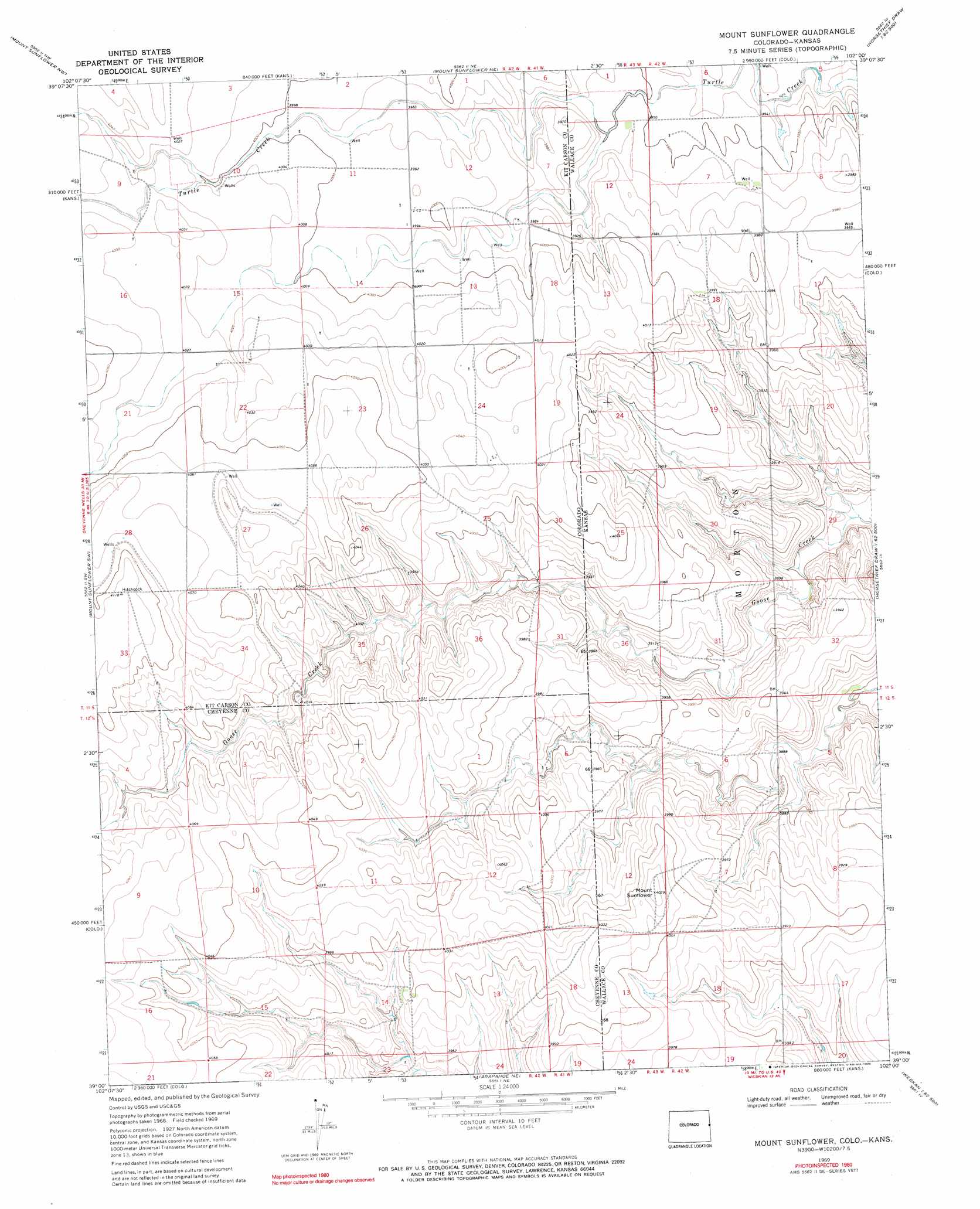
USGS Topo Quad 39102a1 - 1:24,000 scale
| Topo Map Name: | Mount Sunflower |
| USGS Topo Quad ID: | 39102a1 |
| Print Size: | ca. 21 1/4" wide x 27" high |
| Southeast Coordinates: | 39° N latitude / 102° W longitude |
| Map Center Coordinates: | 39.0625° N latitude / 102.0625° W longitude |
| U.S. States: | CO, KS |
| Filename: | o39102a1.jpg |
| Download Map JPG Image: | Mount Sunflower topo map 1:24,000 scale |
| Map Type: | Topographic |
| Topo Series: | 7.5´ |
| Map Scale: | 1:24,000 |
| Source of Map Images: | United States Geological Survey (USGS) |
| Alternate Map Versions: |
Mount Sunflower KS 1969, updated 1972 Download PDF Buy paper map Mount Sunflower KS 1969, updated 1990 Download PDF Buy paper map Mount Sunflower KS 2010 Download PDF Buy paper map Mount Sunflower KS 2012 Download PDF Buy paper map Mount Sunflower KS 2015 Download PDF Buy paper map |
1:24,000 Topo Quads surrounding Mount Sunflower
Burlington |
Peconic |
Kanorado |
Ruleton |
Ruleton Se |
Burlington 3 Ne |
Mount Sunflower Nw |
Mount Sunflower Ne |
Horsethief Draw Nw |
Horsethief Draw Ne |
Burlington 3 Se |
Mount Sunflower Sw |
Mount Sunflower |
Horsethief Draw |
Horsethief Draw Se |
Cheyenne Wells Ne |
Arapahoe Nw |
Arapahoe Ne |
Weskan Nw |
Sharon Springs West |
Cheyenne Wells |
Arapahoe |
Arapahoe Se |
Weskan |
Spring Valley Ranch |
> Back to 39102a1 at 1:100,000 scale
> Back to 39102a1 at 1:250,000 scale
> Back to U.S. Topo Maps home
Mount Sunflower topo map: Gazetteer
Mount Sunflower: Streams
Goose Creek elevation 1228m 4028′Little Beaver Creek elevation 1202m 3943′
Turtle Creek elevation 1207m 3959′
Mount Sunflower: Summits
Mount Sunflower elevation 1230m 4035′Mount Sunflower digital topo map on disk
Buy this Mount Sunflower topo map showing relief, roads, GPS coordinates and other geographical features, as a high-resolution digital map file on DVD: