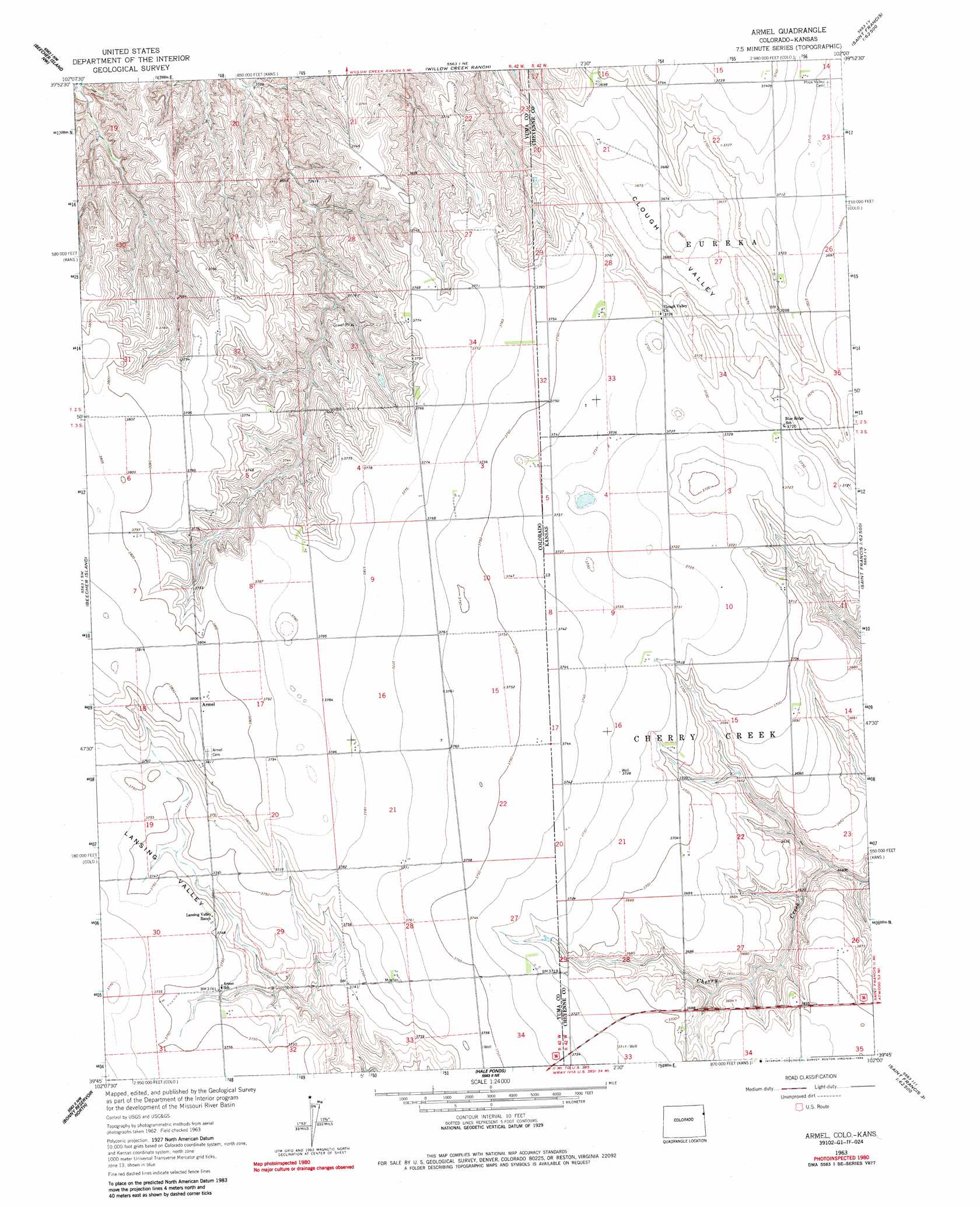
Armel Topo Map Colorado
To zoom in, hover over the map of Armel
USGS Topo Quad 39102g1 - 1:24,000 scale
| Topo Map Name: | Armel |
| USGS Topo Quad ID: | 39102g1 |
| Print Size: | ca. 21 1/4" wide x 27" high |
| Southeast Coordinates: | 39.75° N latitude / 102° W longitude |
| Map Center Coordinates: | 39.8125° N latitude / 102.0625° W longitude |
| U.S. States: | CO, KS |
| Filename: | o39102g1.jpg |
| Download Map JPG Image: | Armel topo map 1:24,000 scale |
| Map Type: | Topographic |
| Topo Series: | 7.5´ |
| Map Scale: | 1:24,000 |
| Source of Map Images: | United States Geological Survey (USGS) |
| Alternate Map Versions: |
Armel CO 1963, updated 1965 Download PDF Buy paper map Armel CO 1963, updated 1965 Download PDF Buy paper map Armel CO 1963, updated 1985 Download PDF Buy paper map Armel CO 2010 Download PDF Buy paper map Armel CO 2013 Download PDF Buy paper map Armel CO 2016 Download PDF Buy paper map |
1:24,000 Topo Quads surrounding Armel
Robb |
Wray |
Laird |
Haigler |
Rock Creek Lake |
Vernon |
Beecher Island Nw |
Willow Creek Ranch |
Saint Francis Nw |
White Canyon |
Wildcat Canyon |
Beecher Island |
Armel |
Saint Francis Sw |
Saint Francis |
Idalia |
Bonny Reservoir North |
Hale Ponds |
Crosby Creek |
Drury Creek |
Idalia Se |
Bonny Reservoir South |
Bonny Reservoir Se |
Saint Francis 3 Sw |
Saint Francis 3 Se |
> Back to 39102e1 at 1:100,000 scale
> Back to 39102a1 at 1:250,000 scale
> Back to U.S. Topo Maps home
Armel topo map: Gazetteer
Armel: Populated Places
Armel elevation 1161m 3809′Armel: Valleys
Clough Valley elevation 1125m 3690′Armel digital topo map on disk
Buy this Armel topo map showing relief, roads, GPS coordinates and other geographical features, as a high-resolution digital map file on DVD: