Beecher Island Nw Topo Map Colorado
To zoom in, hover over the map of Beecher Island Nw
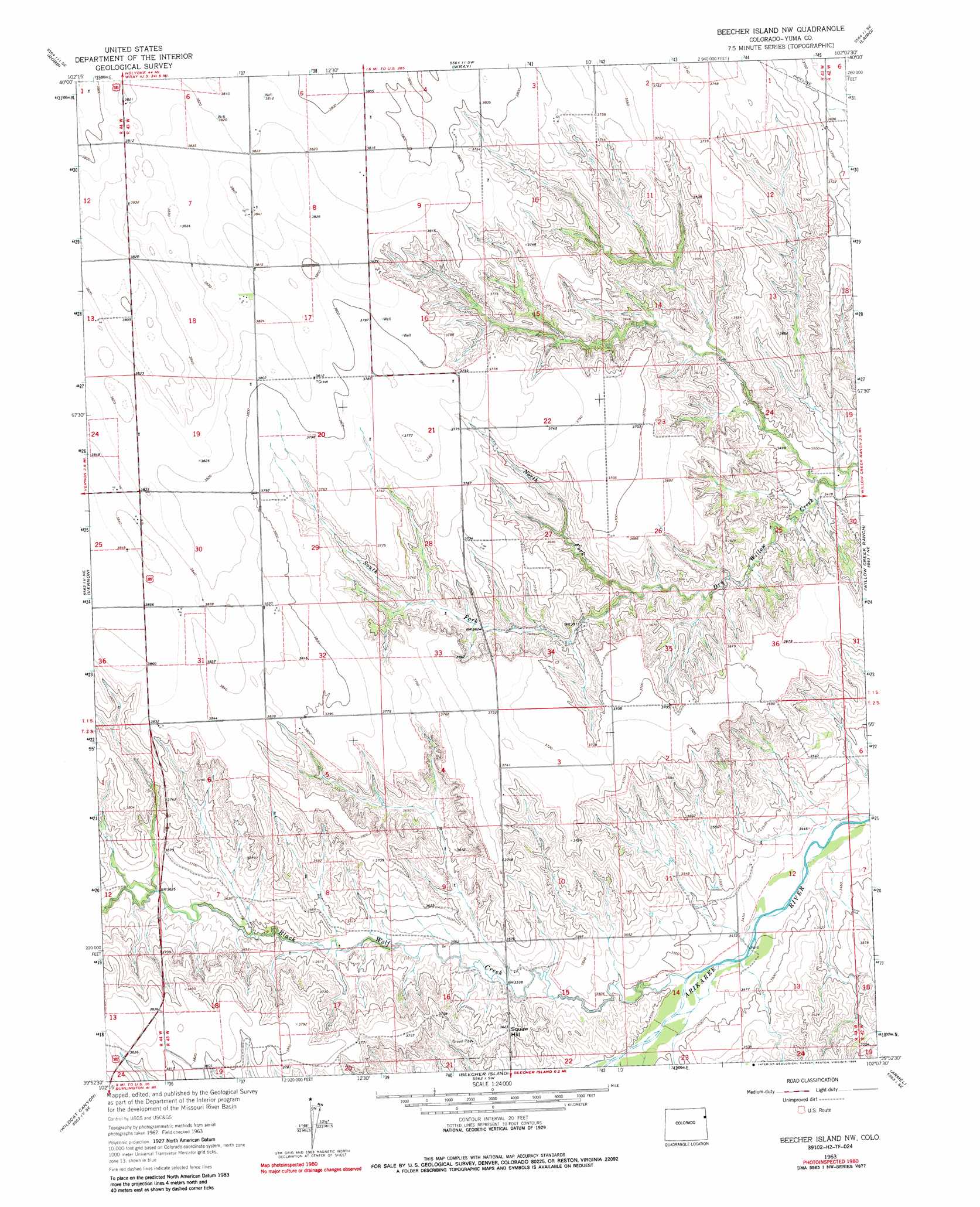
USGS Topo Quad 39102h2 - 1:24,000 scale
| Topo Map Name: | Beecher Island Nw |
| USGS Topo Quad ID: | 39102h2 |
| Print Size: | ca. 21 1/4" wide x 27" high |
| Southeast Coordinates: | 39.875° N latitude / 102.125° W longitude |
| Map Center Coordinates: | 39.9375° N latitude / 102.1875° W longitude |
| U.S. State: | CO |
| Filename: | o39102h2.jpg |
| Download Map JPG Image: | Beecher Island Nw topo map 1:24,000 scale |
| Map Type: | Topographic |
| Topo Series: | 7.5´ |
| Map Scale: | 1:24,000 |
| Source of Map Images: | United States Geological Survey (USGS) |
| Alternate Map Versions: |
Beecher Island NW CO 1963, updated 1965 Download PDF Buy paper map Beecher Island NW CO 1963, updated 1965 Download PDF Buy paper map Beecher Island Nw CO 1963, updated 1986 Download PDF Buy paper map Beecher Island NW CO 2010 Download PDF Buy paper map Beecher Island NW CO 2013 Download PDF Buy paper map Beecher Island NW CO 2016 Download PDF Buy paper map |
1:24,000 Topo Quads surrounding Beecher Island Nw
Eckley Nw |
Eckley Ne |
Wray Nw |
Wray Ne |
Haigler Nw |
Eckley |
Robb |
Wray |
Laird |
Haigler |
Vernon Nw |
Vernon |
Beecher Island Nw |
Willow Creek Ranch |
Saint Francis Nw |
Vernon Sw |
Wildcat Canyon |
Beecher Island |
Armel |
Saint Francis Sw |
Spring Canyon |
Idalia |
Bonny Reservoir North |
Hale Ponds |
Crosby Creek |
> Back to 39102e1 at 1:100,000 scale
> Back to 39102a1 at 1:250,000 scale
> Back to U.S. Topo Maps home
Beecher Island Nw topo map: Gazetteer
Beecher Island Nw: Streams
Black Wolf Creek elevation 1058m 3471′North Fork Dry Willow Creek elevation 1078m 3536′
South Fork Dry Willow Creek elevation 1078m 3536′
Beecher Island Nw: Summits
Squaw Hill elevation 1108m 3635′Beecher Island Nw digital topo map on disk
Buy this Beecher Island Nw topo map showing relief, roads, GPS coordinates and other geographical features, as a high-resolution digital map file on DVD: