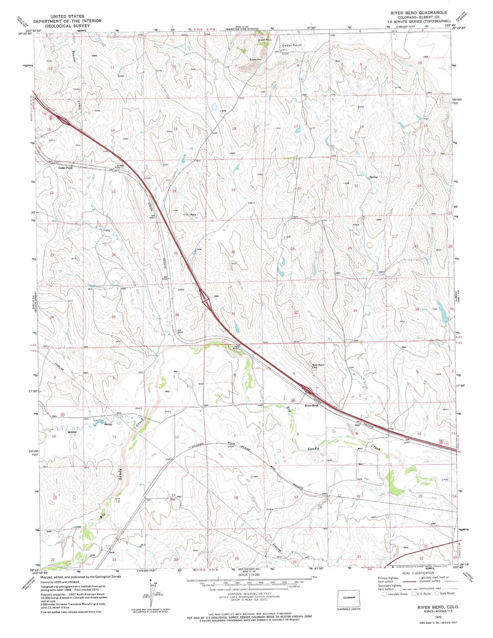
River Bend Topo Map Colorado
To zoom in, hover over the map of River Bend
USGS Topo Quad 39103c7 - 1:24,000 scale
| Topo Map Name: | River Bend |
| USGS Topo Quad ID: | 39103c7 |
| Print Size: | ca. 21 1/4" wide x 27" high |
| Southeast Coordinates: | 39.25° N latitude / 103.75° W longitude |
| Map Center Coordinates: | 39.3125° N latitude / 103.8125° W longitude |
| U.S. State: | CO |
| Filename: | o39103c7.jpg |
| Download Map JPG Image: | River Bend topo map 1:24,000 scale |
| Map Type: | Topographic |
| Topo Series: | 7.5´ |
| Map Scale: | 1:24,000 |
| Source of Map Images: | United States Geological Survey (USGS) |
| Alternate Map Versions: |
River Bend CO 1970, updated 1974 Download PDF Buy paper map River Bend CO 2010 Download PDF Buy paper map River Bend CO 2013 Download PDF Buy paper map River Bend CO 2016 Download PDF Buy paper map |
1:24,000 Topo Quads surrounding River Bend
Deer Trail |
Noonen Reservoir Sw |
Cottonwood Valley South |
Last Chance Sw |
Lusto Springs |
Cattle Gulch |
Agate |
Barking Dog Spring |
T Draw |
Walks Camp Park |
Kuhns Crossing |
Beuck Draw |
River Bend |
Limon |
Genoa West |
Simla |
Matheson |
Matheson Ne |
Lake |
Barron Creek |
Alta Vista |
Matheson Sw |
Matheson Se |
Long Creek |
Lake Se |
> Back to 39103a1 at 1:100,000 scale
> Back to 39102a1 at 1:250,000 scale
> Back to U.S. Topo Maps home
River Bend topo map: Gazetteer
River Bend: Populated Places
Cedar Point elevation 1741m 5711′River Bend: Summits
Cedar Point elevation 1825m 5987′River Bend: Valleys
Willow Gulch elevation 1696m 5564′River Bend digital topo map on disk
Buy this River Bend topo map showing relief, roads, GPS coordinates and other geographical features, as a high-resolution digital map file on DVD: