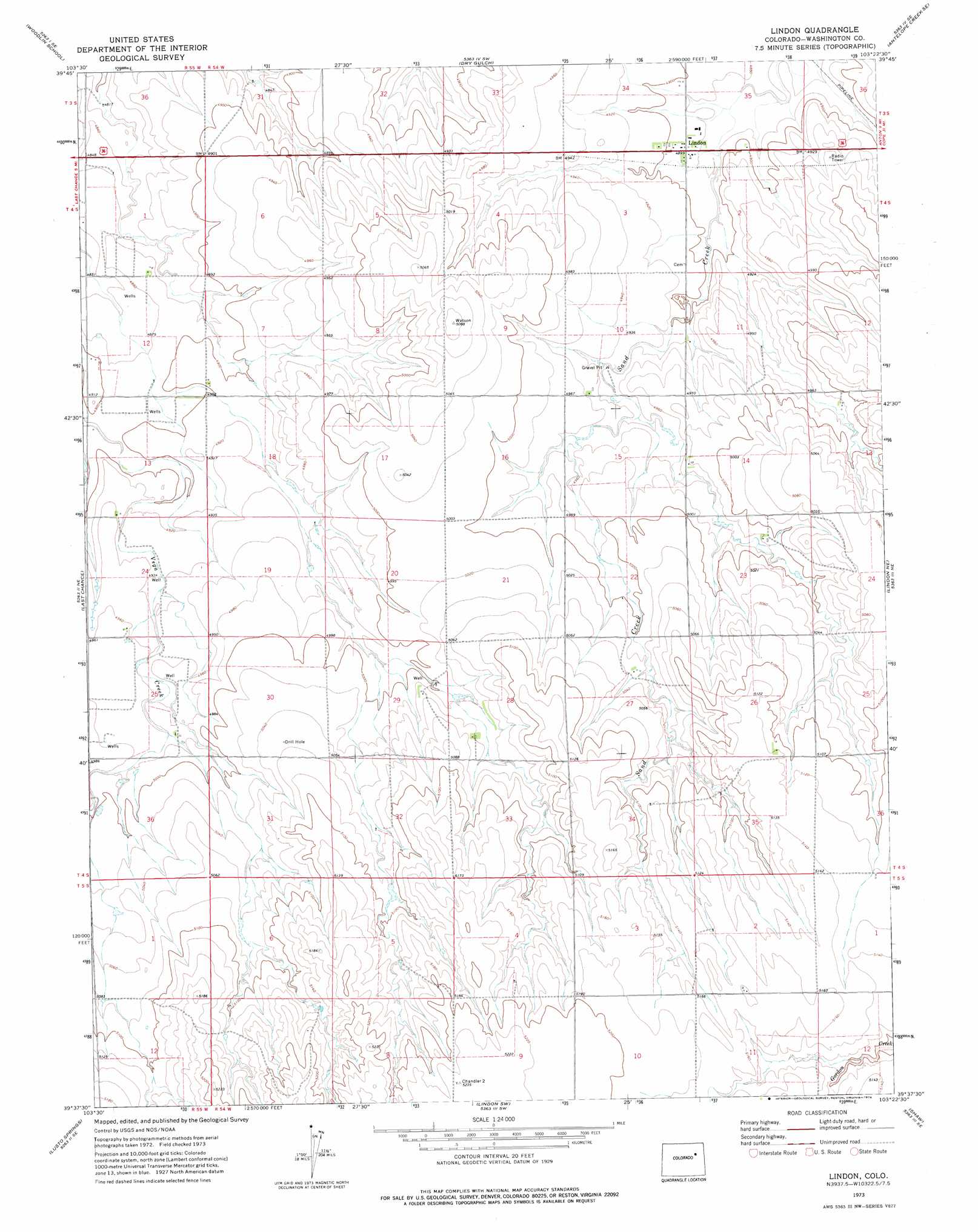
Lindon Topo Map Colorado
To zoom in, hover over the map of Lindon
USGS Topo Quad 39103f4 - 1:24,000 scale
| Topo Map Name: | Lindon |
| USGS Topo Quad ID: | 39103f4 |
| Print Size: | ca. 21 1/4" wide x 27" high |
| Southeast Coordinates: | 39.625° N latitude / 103.375° W longitude |
| Map Center Coordinates: | 39.6875° N latitude / 103.4375° W longitude |
| U.S. State: | CO |
| Filename: | o39103f4.jpg |
| Download Map JPG Image: | Lindon topo map 1:24,000 scale |
| Map Type: | Topographic |
| Topo Series: | 7.5´ |
| Map Scale: | 1:24,000 |
| Source of Map Images: | United States Geological Survey (USGS) |
| Alternate Map Versions: |
Lindon CO 1973, updated 1976 Download PDF Buy paper map Lindon CO 2010 Download PDF Buy paper map Lindon CO 2013 Download PDF Buy paper map Lindon CO 2016 Download PDF Buy paper map |
1:24,000 Topo Quads surrounding Lindon
Woodrow Nw |
Woodrow |
Antelope Creek West |
Antelope Creek East |
Elba |
Wetzel Creek |
Woodlin School |
Dry Gulch |
Antelope Creek Se |
Elba Sw |
Last Chance Nw |
Last Chance |
Lindon |
Lindon Ne |
Anton |
Last Chance Sw |
Lusto Springs |
Lindon Sw |
Shaw |
Thurman |
T Draw |
Walks Camp Park |
Arriba Nw |
Arriba Ne |
Flagler Nw |
> Back to 39103e1 at 1:100,000 scale
> Back to 39102a1 at 1:250,000 scale
> Back to U.S. Topo Maps home
Lindon digital topo map on disk
Buy this Lindon topo map showing relief, roads, GPS coordinates and other geographical features, as a high-resolution digital map file on DVD: