Fondis Topo Map Colorado
To zoom in, hover over the map of Fondis
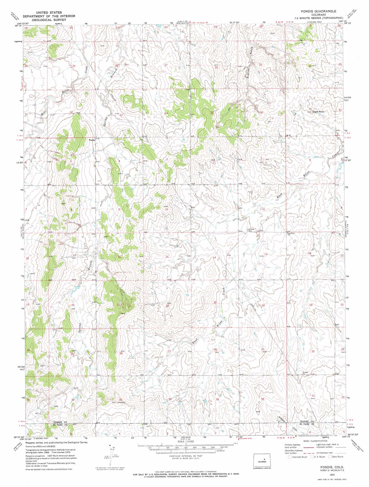
USGS Topo Quad 39104b3 - 1:24,000 scale
| Topo Map Name: | Fondis |
| USGS Topo Quad ID: | 39104b3 |
| Print Size: | ca. 21 1/4" wide x 27" high |
| Southeast Coordinates: | 39.125° N latitude / 104.25° W longitude |
| Map Center Coordinates: | 39.1875° N latitude / 104.3125° W longitude |
| U.S. State: | CO |
| Filename: | o39104b3.jpg |
| Download Map JPG Image: | Fondis topo map 1:24,000 scale |
| Map Type: | Topographic |
| Topo Series: | 7.5´ |
| Map Scale: | 1:24,000 |
| Source of Map Images: | United States Geological Survey (USGS) |
| Alternate Map Versions: |
Fondis CO 1970, updated 1973 Download PDF Buy paper map Fondis CO 2010 Download PDF Buy paper map Fondis CO 2013 Download PDF Buy paper map Fondis CO 2016 Download PDF Buy paper map |
1:24,000 Topo Quads surrounding Fondis
Cabin Gulch |
Kiowa Nw |
Kiowa Ne |
Bijou |
Cattle Gulch |
Elizabeth |
Kiowa |
Big Gulch |
Bijou Sw |
Kuhns Crossing |
Elbert |
Bijou Basin |
Fondis |
Ramah North |
Simla |
Eastonville |
Peyton |
Calhan |
Ramah South |
Alta Vista |
Falcon |
Haegler Ranch |
Holcolm Hills |
Rush Nw |
Holtwold Store |
> Back to 39104a1 at 1:100,000 scale
> Back to 39104a1 at 1:250,000 scale
> Back to U.S. Topo Maps home
Fondis topo map: Gazetteer
Fondis: Dams
Ed Hertneky Dam elevation 1875m 6151′George Mason Dam elevation 1910m 6266′
Ramsey Dam elevation 1880m 6167′
Saran Erosion Control and Recreation Dam Number 1 elevation 1943m 6374′
Trojanovich Dam elevation 1945m 6381′
Fondis: Populated Places
Fondis elevation 1882m 6174′Fondis: Reservoirs
George Mason Reservoir elevation 1910m 6266′Hertneky Reservoir elevation 1875m 6151′
Ramsey Reservoir elevation 1880m 6167′
Trojanovich Reservoir elevation 1945m 6381′
Fondis: Summits
Eagle Rock elevation 1898m 6227′Fondis digital topo map on disk
Buy this Fondis topo map showing relief, roads, GPS coordinates and other geographical features, as a high-resolution digital map file on DVD: