Kuhns Crossing Topo Map Colorado
To zoom in, hover over the map of Kuhns Crossing
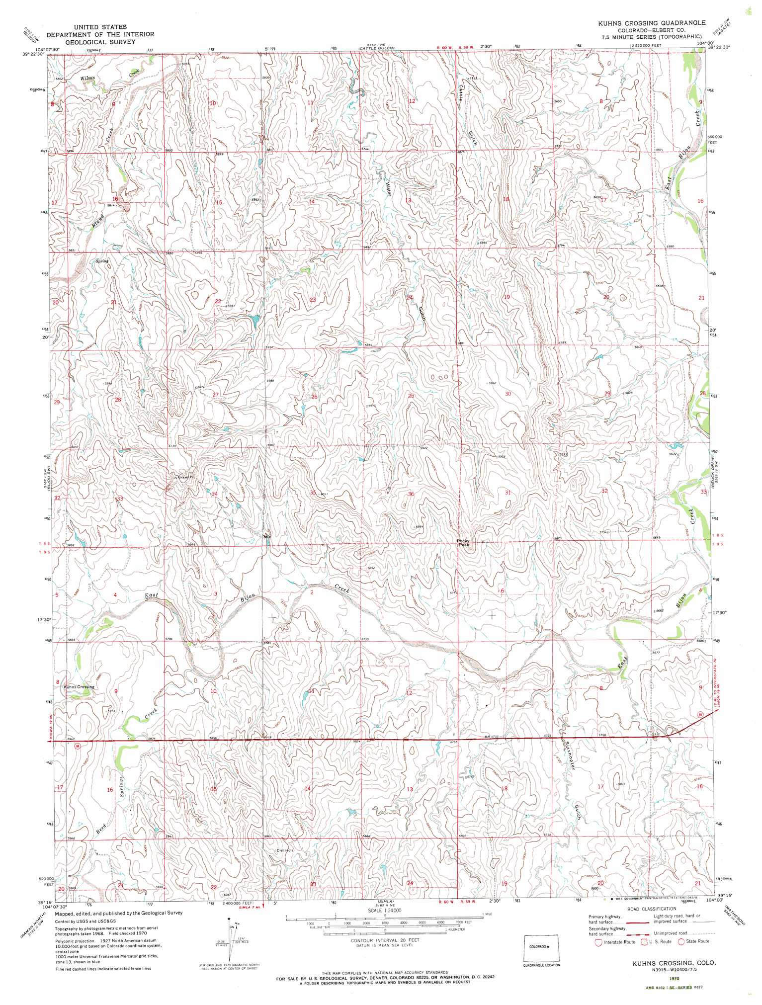
USGS Topo Quad 39104c1 - 1:24,000 scale
| Topo Map Name: | Kuhns Crossing |
| USGS Topo Quad ID: | 39104c1 |
| Print Size: | ca. 21 1/4" wide x 27" high |
| Southeast Coordinates: | 39.25° N latitude / 104° W longitude |
| Map Center Coordinates: | 39.3125° N latitude / 104.0625° W longitude |
| U.S. State: | CO |
| Filename: | o39104c1.jpg |
| Download Map JPG Image: | Kuhns Crossing topo map 1:24,000 scale |
| Map Type: | Topographic |
| Topo Series: | 7.5´ |
| Map Scale: | 1:24,000 |
| Source of Map Images: | United States Geological Survey (USGS) |
| Alternate Map Versions: |
Kuhns Crossing CO 1970, updated 1973 Download PDF Buy paper map Kuhns Crossing CO 2010 Download PDF Buy paper map Kuhns Crossing CO 2013 Download PDF Buy paper map Kuhns Crossing CO 2016 Download PDF Buy paper map |
1:24,000 Topo Quads surrounding Kuhns Crossing
Strasburg Se |
Byers Sw |
Deer Trail |
Noonen Reservoir Sw |
Cottonwood Valley South |
Kiowa Ne |
Bijou |
Cattle Gulch |
Agate |
Barking Dog Spring |
Big Gulch |
Bijou Sw |
Kuhns Crossing |
Beuck Draw |
River Bend |
Fondis |
Ramah North |
Simla |
Matheson |
Matheson Ne |
Calhan |
Ramah South |
Alta Vista |
Matheson Sw |
Matheson Se |
> Back to 39104a1 at 1:100,000 scale
> Back to 39104a1 at 1:250,000 scale
> Back to U.S. Topo Maps home
Kuhns Crossing topo map: Gazetteer
Kuhns Crossing: Dams
Verhoeffs Big Dam elevation 1803m 5915′Kuhns Crossing: Streams
Reed Springs Creek elevation 1763m 5784′Kuhns Crossing: Summits
Rocky Peak elevation 1825m 5987′Kuhns Crossing: Valleys
Beuck Draw elevation 1698m 5570′Sixshooter Gulch elevation 1732m 5682′
Kuhns Crossing digital topo map on disk
Buy this Kuhns Crossing topo map showing relief, roads, GPS coordinates and other geographical features, as a high-resolution digital map file on DVD: