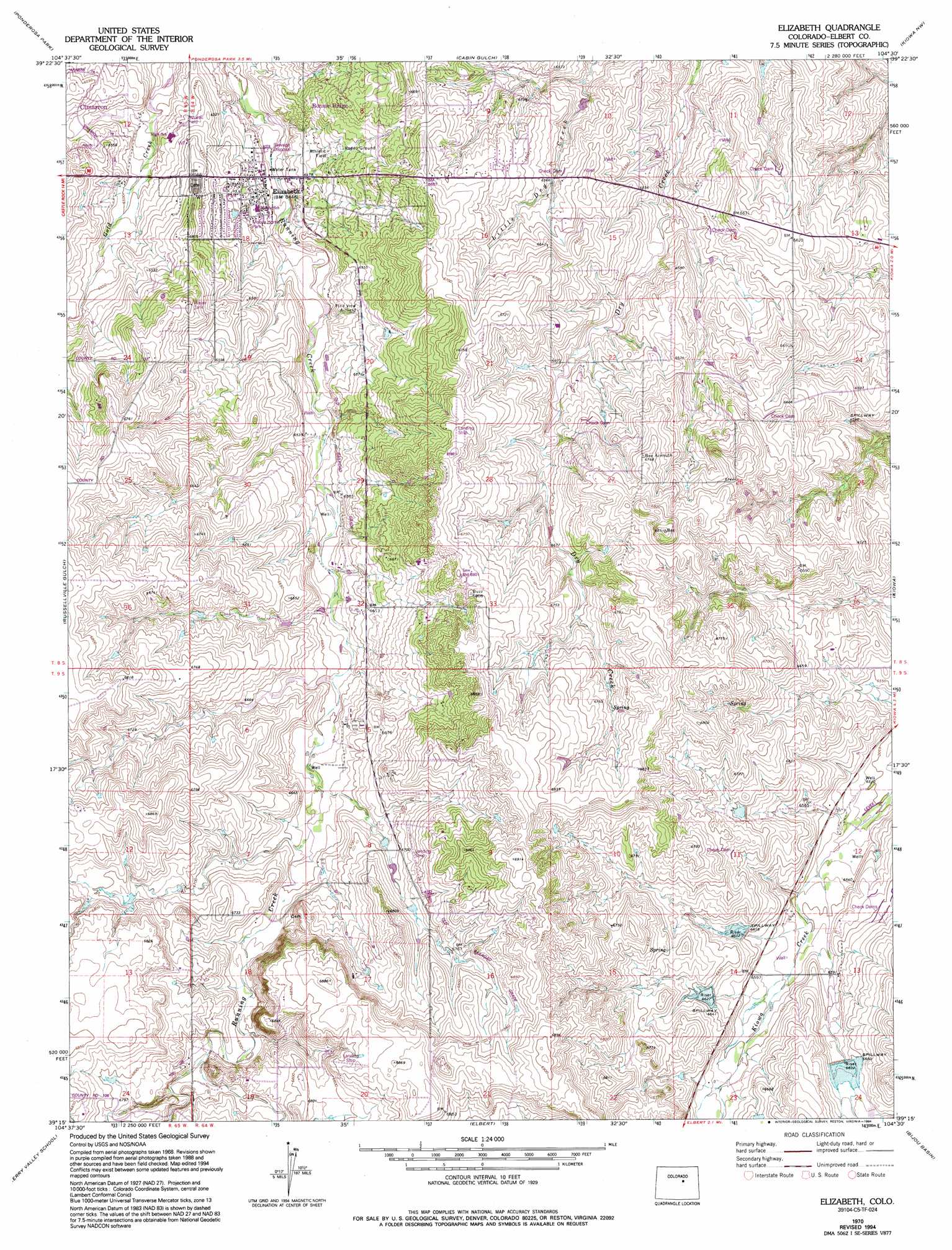
Elizabeth Topo Map Colorado
To zoom in, hover over the map of Elizabeth
USGS Topo Quad 39104c5 - 1:24,000 scale
| Topo Map Name: | Elizabeth |
| USGS Topo Quad ID: | 39104c5 |
| Print Size: | ca. 21 1/4" wide x 27" high |
| Southeast Coordinates: | 39.25° N latitude / 104.5° W longitude |
| Map Center Coordinates: | 39.3125° N latitude / 104.5625° W longitude |
| U.S. State: | CO |
| Filename: | o39104c5.jpg |
| Download Map JPG Image: | Elizabeth topo map 1:24,000 scale |
| Map Type: | Topographic |
| Topo Series: | 7.5´ |
| Map Scale: | 1:24,000 |
| Source of Map Images: | United States Geological Survey (USGS) |
| Alternate Map Versions: |
Elizabeth CO 1970, updated 1973 Download PDF Buy paper map Elizabeth CO 1970, updated 1973 Download PDF Buy paper map Elizabeth CO 1970, updated 1979 Download PDF Buy paper map Elizabeth CO 1970, updated 1994 Download PDF Buy paper map Elizabeth CO 2010 Download PDF Buy paper map Elizabeth CO 2013 Download PDF Buy paper map Elizabeth CO 2016 Download PDF Buy paper map |
1:24,000 Topo Quads surrounding Elizabeth
Parker |
Piney Creek |
Watkins Se |
Strasburg Sw |
Strasburg Se |
Castle Rock North |
Ponderosa Park |
Cabin Gulch |
Kiowa Nw |
Kiowa Ne |
Castle Rock South |
Russellville Gulch |
Elizabeth |
Kiowa |
Big Gulch |
Greenland |
Cherry Valley School |
Elbert |
Bijou Basin |
Fondis |
Monument |
Black Forest |
Eastonville |
Peyton |
Calhan |
> Back to 39104a1 at 1:100,000 scale
> Back to 39104a1 at 1:250,000 scale
> Back to U.S. Topo Maps home
Elizabeth topo map: Gazetteer
Elizabeth: Airports
Circle 8 Ranch Airport elevation 2022m 6633′Dead Stick Ranch Airport elevation 2021m 6630′
Elizabeth Emergency Heliport elevation 1986m 6515′
Pine View Airport elevation 1998m 6555′
Plane View Airfield elevation 2004m 6574′
Elizabeth: Dams
C G Cozart Erosion Control Number 1 Dam elevation 2038m 6686′Kiowa Creek Watershed 2-B-30 Dam elevation 2009m 6591′
Kiowa Creek Watershed 2-D-20 Dam elevation 2028m 6653′
Kiowa Creek Watershed 2-E-10 Dam elevation 2014m 6607′
Kiowa Creek Watershed 2-F-20 Dam elevation 2018m 6620′
Kiowa Creek Watershed 2-G-10 Dam elevation 2029m 6656′
Kiowa Creek Watershed 3-D-10 Dam elevation 2028m 6653′
Richard Warne Flood Retention Dam elevation 2049m 6722′
Russell Number 1 Dam elevation 1996m 6548′
Elizabeth: Populated Places
Elizabeth elevation 1974m 6476′Elizabeth: Reservoirs
C G Cozart Erosion Control Reservoir Number 1 elevation 2038m 6686′Kiowa Creek Watershed 2-B-30 Reservoir elevation 2009m 6591′
Kiowa Creek Watershed 2-D-20 Reservoir elevation 2028m 6653′
Kiowa Creek Watershed 2-E-10 Reservoir elevation 2014m 6607′
Kiowa Creek Watershed 2-F-20 Reservoir elevation 2018m 6620′
Kiowa Creek Watershed 2-G-10 Reservoir elevation 2029m 6656′
Kiowa Creek Watershed 3-D-10 Reservoir elevation 2028m 6653′
Richard Warne Flood Retention Reservoir elevation 2049m 6722′
Russell Number 1 Reservoir elevation 1996m 6548′
Elizabeth digital topo map on disk
Buy this Elizabeth topo map showing relief, roads, GPS coordinates and other geographical features, as a high-resolution digital map file on DVD: