Piney Creek Topo Map Colorado
To zoom in, hover over the map of Piney Creek
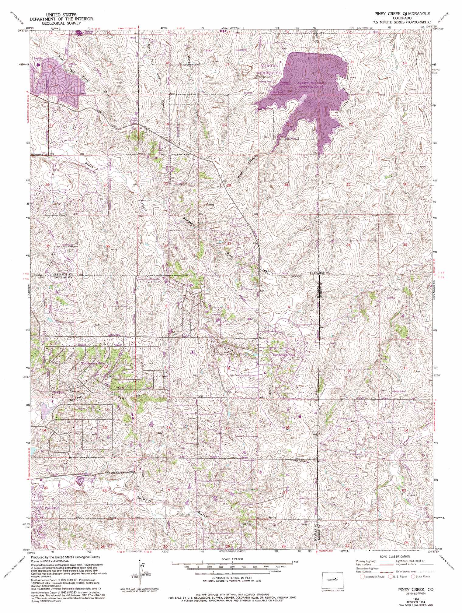
USGS Topo Quad 39104e6 - 1:24,000 scale
| Topo Map Name: | Piney Creek |
| USGS Topo Quad ID: | 39104e6 |
| Print Size: | ca. 21 1/4" wide x 27" high |
| Southeast Coordinates: | 39.5° N latitude / 104.625° W longitude |
| Map Center Coordinates: | 39.5625° N latitude / 104.6875° W longitude |
| U.S. State: | CO |
| Filename: | o39104e6.jpg |
| Download Map JPG Image: | Piney Creek topo map 1:24,000 scale |
| Map Type: | Topographic |
| Topo Series: | 7.5´ |
| Map Scale: | 1:24,000 |
| Source of Map Images: | United States Geological Survey (USGS) |
| Alternate Map Versions: |
Piney Creek CO 1940 Download PDF Buy paper map Piney Creek CO 1957, updated 1958 Download PDF Buy paper map Piney Creek CO 1957, updated 1963 Download PDF Buy paper map Piney Creek CO 1957, updated 1963 Download PDF Buy paper map Piney Creek CO 1966, updated 1967 Download PDF Buy paper map Piney Creek CO 1966, updated 1967 Download PDF Buy paper map Piney Creek CO 1966, updated 1973 Download PDF Buy paper map Piney Creek CO 1966, updated 1973 Download PDF Buy paper map Piney Creek CO 1966, updated 1979 Download PDF Buy paper map Piney Creek CO 1966, updated 1994 Download PDF Buy paper map Piney Creek CO 2010 Download PDF Buy paper map Piney Creek CO 2013 Download PDF Buy paper map Piney Creek CO 2016 Download PDF Buy paper map |
1:24,000 Topo Quads surrounding Piney Creek
Commerce City |
Sable |
Box Elder School |
Manila |
Bennett |
Englewood |
Fitzsimons |
Coal Creek |
Watkins |
Strasburg Nw |
Highlands Ranch |
Parker |
Piney Creek |
Watkins Se |
Strasburg Sw |
Sedalia |
Castle Rock North |
Ponderosa Park |
Cabin Gulch |
Kiowa Nw |
Dawson Butte |
Castle Rock South |
Russellville Gulch |
Elizabeth |
Kiowa |
> Back to 39104e1 at 1:100,000 scale
> Back to 39104a1 at 1:250,000 scale
> Back to U.S. Topo Maps home
Piney Creek topo map: Gazetteer
Piney Creek: Airports
Everitt Airport elevation 1921m 6302′Piney Creek: Parks
Pioneer Park elevation 1782m 5846′Piney Creek: Populated Places
Dove Hill elevation 1808m 5931′Homestead Hills elevation 1880m 6167′
Park View elevation 1799m 5902′
Parkborough elevation 1796m 5892′
Pine Valley elevation 1842m 6043′
Ponderosa East elevation 1909m 6263′
Ponderosa Hills elevation 1867m 6125′
Saddlebrook elevation 1816m 5958′
Travois elevation 1870m 6135′
Piney Creek: Reservoirs
Aurora Reservoir elevation 1811m 5941′Piney Creek: Streams
Cool Creek elevation 1865m 6118′Piney Creek: Valleys
Sampson Gulch elevation 1799m 5902′Piney Creek digital topo map on disk
Buy this Piney Creek topo map showing relief, roads, GPS coordinates and other geographical features, as a high-resolution digital map file on DVD: