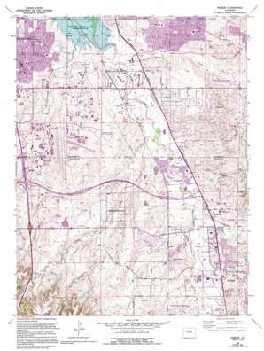
Parker Topo Map Colorado
To zoom in, hover over the map of Parker
USGS Topo Quad 39104e7 - 1:24,000 scale
| Topo Map Name: | Parker |
| USGS Topo Quad ID: | 39104e7 |
| Print Size: | ca. 21 1/4" wide x 27" high |
| Southeast Coordinates: | 39.5° N latitude / 104.75° W longitude |
| Map Center Coordinates: | 39.5625° N latitude / 104.8125° W longitude |
| U.S. State: | CO |
| Filename: | o39104e7.jpg |
| Download Map JPG Image: | Parker topo map 1:24,000 scale |
| Map Type: | Topographic |
| Topo Series: | 7.5´ |
| Map Scale: | 1:24,000 |
| Source of Map Images: | United States Geological Survey (USGS) |
| Alternate Map Versions: |
Parker CO 1949 Download PDF Buy paper map Parker CO 1957, updated 1958 Download PDF Buy paper map Parker CO 1957, updated 1961 Download PDF Buy paper map Parker CO 1965, updated 1967 Download PDF Buy paper map Parker CO 1965, updated 1973 Download PDF Buy paper map Parker CO 1965, updated 1973 Download PDF Buy paper map Parker CO 1965, updated 1980 Download PDF Buy paper map Parker CO 1965, updated 1986 Download PDF Buy paper map Parker CO 1965, updated 1994 Download PDF Buy paper map Parker CO 1965, updated 1994 Download PDF Buy paper map Parker CO 2010 Download PDF Buy paper map Parker CO 2013 Download PDF Buy paper map Parker CO 2016 Download PDF Buy paper map |
1:24,000 Topo Quads surrounding Parker
> Back to 39104e1 at 1:100,000 scale
> Back to 39104a1 at 1:250,000 scale
> Back to U.S. Topo Maps home
Parker topo map: Gazetteer
Parker: Airports
Arapahoe County Airport elevation 1789m 5869′Centennial Airport elevation 1780m 5839′
Centennial Healthcare Plaza Heliport elevation 1731m 5679′
Pavilion Heliport elevation 1861m 6105′
Parker: Crossings
Exit 193 elevation 1821m 5974′Exit 194 elevation 1792m 5879′
Exit 195 elevation 1787m 5862′
Parker: Dams
Arapahoe Lake Dam elevation 1734m 5688′Franktown Parker FPB-1 Dam elevation 1815m 5954′
Franktown Parker FPP-1 Dam elevation 1805m 5921′
Inverness Dam elevation 1761m 5777′
Parker: Mines
Madis Mine elevation 1776m 5826′Parker: Oilfields
Aurora Water Well Field elevation 1720m 5643′Parker: Parks
Arapahoe County Community Park elevation 1754m 5754′Bar Triple C Park elevation 1778m 5833′
Challenger Regional Park elevation 1772m 5813′
Cottonwood Park East elevation 1745m 5725′
Cottonwood Park West elevation 1742m 5715′
Hutchison Memorial Park elevation 1722m 5649′
O'Brien Memorial Park elevation 1787m 5862′
Parker: Populated Places
Algonquin Acres elevation 1727m 5666′Chapparal elevation 1816m 5958′
Cherry Creek East elevation 1737m 5698′
Cherry Creek Highlands elevation 1804m 5918′
Clarke Farms elevation 1784m 5853′
Cottonwood elevation 1753m 5751′
Foxfield elevation 1754m 5754′
Grand View Estates elevation 1772m 5813′
Inverness elevation 1769m 5803′
Lone Tree elevation 1829m 6000′
Meridian elevation 1795m 5889′
Parker elevation 1789m 5869′
Piney Creek elevation 1756m 5761′
Piney Creek Ranches elevation 1757m 5764′
Southfield Park elevation 1734m 5688′
Stonegate elevation 1791m 5875′
Vista Pointe elevation 1805m 5921′
Parker: Reservoirs
Arapahoe Lake Reservoir elevation 1734m 5688′Franktown Parker FPB-1 Reservoir elevation 1815m 5954′
Franktown Parker FPP-1 Reservoir elevation 1805m 5921′
Inverness Reservoir elevation 1761m 5777′
Parker: Streams
Happy Canyon Creek elevation 1727m 5666′Lone Tree Creek elevation 1702m 5583′
Piney Creek elevation 1713m 5620′
Parker: Valleys
Badger Gulch elevation 1780m 5839′Baldwin Gulch elevation 1754m 5754′
Newlin Gulch elevation 1760m 5774′
Sulphur Gulch elevation 1772m 5813′
Tallman Gulch elevation 1797m 5895′
Parker digital topo map on disk
Buy this Parker topo map showing relief, roads, GPS coordinates and other geographical features, as a high-resolution digital map file on DVD:


