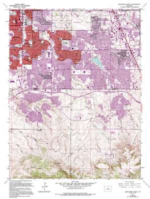
Highlands Ranch Topo Map Colorado
To zoom in, hover over the map of Highlands Ranch
USGS Topo Quad 39104e8 - 1:24,000 scale
| Topo Map Name: | Highlands Ranch |
| USGS Topo Quad ID: | 39104e8 |
| Print Size: | ca. 21 1/4" wide x 27" high |
| Southeast Coordinates: | 39.5° N latitude / 104.875° W longitude |
| Map Center Coordinates: | 39.5625° N latitude / 104.9375° W longitude |
| U.S. State: | CO |
| Filename: | o39104e8.jpg |
| Download Map JPG Image: | Highlands Ranch topo map 1:24,000 scale |
| Map Type: | Topographic |
| Topo Series: | 7.5´ |
| Map Scale: | 1:24,000 |
| Source of Map Images: | United States Geological Survey (USGS) |
| Alternate Map Versions: |
Highland Ranch CO 1949 Download PDF Buy paper map Highlands Ranch CO 1949 Download PDF Buy paper map Highlands Ranch CO 1957, updated 1958 Download PDF Buy paper map Highlands Ranch CO 1957, updated 1961 Download PDF Buy paper map Highlands Ranch CO 1965, updated 1967 Download PDF Buy paper map Highlands Ranch CO 1965, updated 1967 Download PDF Buy paper map Highlands Ranch CO 1965, updated 1973 Download PDF Buy paper map Highlands Ranch CO 1965, updated 1973 Download PDF Buy paper map Highlands Ranch CO 1965, updated 1980 Download PDF Buy paper map Highlands Ranch CO 1965, updated 1984 Download PDF Buy paper map Highlands Ranch CO 1965, updated 1994 Download PDF Buy paper map Highlands Ranch CO 1965, updated 1994 Download PDF Buy paper map Highlands Ranch CO 2010 Download PDF Buy paper map Highlands Ranch CO 2013 Download PDF Buy paper map Highlands Ranch CO 2016 Download PDF Buy paper map |
1:24,000 Topo Quads surrounding Highlands Ranch
> Back to 39104e1 at 1:100,000 scale
> Back to 39104a1 at 1:250,000 scale
> Back to U.S. Topo Maps home
Highlands Ranch topo map: Gazetteer
Highlands Ranch: Airports
Arapahoe Medical Park-Littleton Hospital Heliport elevation 1700m 5577′Yankee Port Heliport elevation 1787m 5862′
Highlands Ranch: Canals
Highline Canal elevation 1684m 5524′Highlands Ranch: Crossings
Exit 196 elevation 1782m 5846′Exit 197 elevation 1764m 5787′
Exit 198 elevation 1736m 5695′
Highlands Ranch: Dams
Englewood Dam elevation 1709m 5606′Holly Dam elevation 1691m 5547′
Highlands Ranch: Lakes
Ketring Lake elevation 1664m 5459′Highlands Ranch: Mines
Big Dry Creek Placers elevation 1695m 5561′Cherry Creek Mine elevation 1722m 5649′
Little Dry Creek Placers elevation 1774m 5820′
Highlands Ranch: Parks
Abbott Park elevation 1734m 5688′Altair Park elevation 1772m 5813′
Arapahoe Park elevation 1722m 5649′
Brookridge Park elevation 1648m 5406′
Carbone Park elevation 1667m 5469′
Cheese Ranch Park elevation 1771m 5810′
Cherry Hill Park elevation 1712m 5616′
Cherry Knolls Park elevation 1692m 5551′
Clarkson Park elevation 1705m 5593′
Cook Creek Park elevation 1780m 5839′
DeKoevend Park elevation 1675m 5495′
Eastridge Park elevation 1809m 5935′
Falcon Park elevation 1789m 5869′
Foxhill Park elevation 1747m 5731′
Heritage Village Park elevation 1677m 5501′
Highland Heritage Regional Park elevation 1782m 5846′
Holly Park elevation 1697m 5567′
Horsemans Park elevation 1659m 5442′
Horseshoe Park elevation 1676m 5498′
Hunters Hill Park elevation 1755m 5757′
Ketring Park elevation 1661m 5449′
Linksview Park elevation 1731m 5679′
Little Dry Creek Park elevation 1699m 5574′
Littles Creek Park elevation 1664m 5459′
Lonesome Pine Park elevation 1779m 5836′
Madema Park elevation 1727m 5666′
McArthur Ranch Park elevation 1857m 6092′
Northridge Park elevation 1708m 5603′
Palos Verdes Park elevation 1700m 5577′
Palos Verdes Park West elevation 1709m 5606′
Powers Park elevation 1650m 5413′
Progress Park elevation 1632m 5354′
Puma Park elevation 1702m 5583′
Sand Creek Park elevation 1743m 5718′
Southwood Park elevation 1676m 5498′
Springer Park elevation 1753m 5751′
Sunset Park elevation 1714m 5623′
Sweetwater Park elevation 1773m 5816′
Walnut Hills Park elevation 1736m 5695′
William McKinley Carson Park elevation 1710m 5610′
Willow Creek Park elevation 1733m 5685′
Woody Hollow Park elevation 1650m 5413′
Highlands Ranch: Populated Places
Acres Green elevation 1778m 5833′Broadway Estates elevation 1682m 5518′
Carriage Club elevation 1833m 6013′
Castlewood elevation 1746m 5728′
Centennial elevation 1777m 5830′
Cherry Knolls elevation 1708m 5603′
Dream House Acres elevation 1691m 5547′
Gateway elevation 1806m 5925′
Greenwood Village elevation 1666m 5465′
Heritage Hills elevation 1806m 5925′
Highlands Ranch elevation 1732m 5682′
Kistler Park elevation 1749m 5738′
McArthur Ranch elevation 1845m 6053′
Palos Verdes elevation 1712m 5616′
Park Meadows elevation 1780m 5839′
Southglenn elevation 1705m 5593′
Willow Creek elevation 1746m 5728′
Highlands Ranch: Post Offices
Centennial Post Office elevation 1693m 5554′Highlands Ranch: Reservoirs
Englewood Reservoir elevation 1697m 5567′Gallup Reservoir elevation 1664m 5459′
Holly Reservoir elevation 1691m 5547′
Highlands Ranch: Streams
Cook Creek elevation 1769m 5803′Willow Creek elevation 1685m 5528′
Highlands Ranch: Summits
Highlands Point elevation 1925m 6315′Highlands Ranch digital topo map on disk
Buy this Highlands Ranch topo map showing relief, roads, GPS coordinates and other geographical features, as a high-resolution digital map file on DVD:


