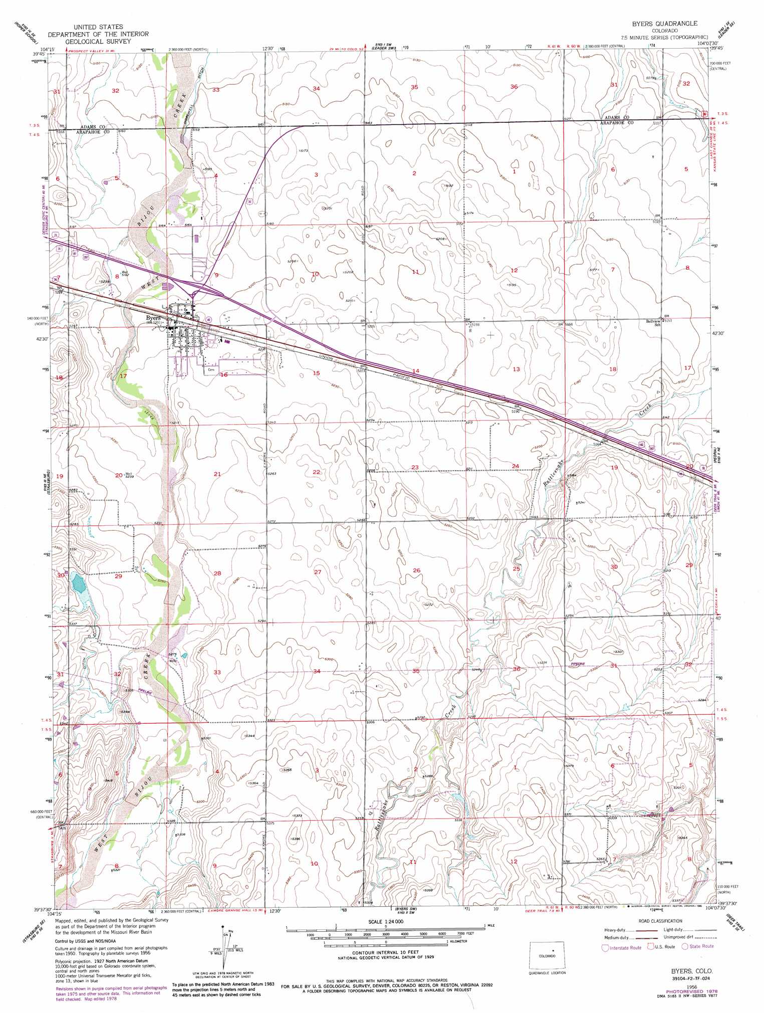
Byers Topo Map Colorado
To zoom in, hover over the map of Byers
USGS Topo Quad 39104f2 - 1:24,000 scale
| Topo Map Name: | Byers |
| USGS Topo Quad ID: | 39104f2 |
| Print Size: | ca. 21 1/4" wide x 27" high |
| Southeast Coordinates: | 39.625° N latitude / 104.125° W longitude |
| Map Center Coordinates: | 39.6875° N latitude / 104.1875° W longitude |
| U.S. State: | CO |
| Filename: | o39104f2.jpg |
| Download Map JPG Image: | Byers topo map 1:24,000 scale |
| Map Type: | Topographic |
| Topo Series: | 7.5´ |
| Map Scale: | 1:24,000 |
| Source of Map Images: | United States Geological Survey (USGS) |
| Alternate Map Versions: |
Byers CO 1956, updated 1958 Download PDF Buy paper map Byers CO 1956, updated 1958 Download PDF Buy paper map Byers CO 1956, updated 1972 Download PDF Buy paper map Byers CO 1956, updated 1985 Download PDF Buy paper map Byers CO 2010 Download PDF Buy paper map Byers CO 2013 Download PDF Buy paper map Byers CO 2016 Download PDF Buy paper map |
1:24,000 Topo Quads surrounding Byers
Sunnydale |
Living Springs |
Leader Nw |
Leader |
Potty Brown Creek |
Bennett |
Roper School |
Leader Sw |
Leader Se |
Poison Springs |
Strasburg Nw |
Strasburg |
Byers |
Peoria |
Noonen Reservoir |
Strasburg Sw |
Strasburg Se |
Byers Sw |
Deer Trail |
Noonen Reservoir Sw |
Kiowa Nw |
Kiowa Ne |
Bijou |
Cattle Gulch |
Agate |
> Back to 39104e1 at 1:100,000 scale
> Back to 39104a1 at 1:250,000 scale
> Back to U.S. Topo Maps home
Byers topo map: Gazetteer
Byers: Airports
Sky Haven Airport elevation 1588m 5209′Byers: Populated Places
Byers elevation 1586m 5203′Byers: Springs
Sheep Spring elevation 1607m 5272′Byers digital topo map on disk
Buy this Byers topo map showing relief, roads, GPS coordinates and other geographical features, as a high-resolution digital map file on DVD: