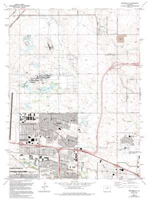
Sable Topo Map Colorado
To zoom in, hover over the map of Sable
USGS Topo Quad 39104g7 - 1:24,000 scale
| Topo Map Name: | Sable |
| USGS Topo Quad ID: | 39104g7 |
| Print Size: | ca. 21 1/4" wide x 27" high |
| Southeast Coordinates: | 39.75° N latitude / 104.75° W longitude |
| Map Center Coordinates: | 39.8125° N latitude / 104.8125° W longitude |
| U.S. State: | CO |
| Filename: | o39104g7.jpg |
| Download Map JPG Image: | Sable topo map 1:24,000 scale |
| Map Type: | Topographic |
| Topo Series: | 7.5´ |
| Map Scale: | 1:24,000 |
| Source of Map Images: | United States Geological Survey (USGS) |
| Alternate Map Versions: |
Long Branch CO 1938, updated 1957 Download PDF Buy paper map Sable CO 1957, updated 1958 Download PDF Buy paper map Sable CO 1957, updated 1958 Download PDF Buy paper map Sable CO 1965, updated 1966 Download PDF Buy paper map Sable CO 1965, updated 1973 Download PDF Buy paper map Sable CO 1965, updated 1973 Download PDF Buy paper map Sable CO 1965, updated 1980 Download PDF Buy paper map Sable CO 1965, updated 1986 Download PDF Buy paper map Montbello CO 1965, updated 1994 Download PDF Buy paper map Montbello CO 1965, updated 1994 Download PDF Buy paper map Long Branch CO 1972 Download PDF Buy paper map Montbello CO 2010 Download PDF Buy paper map Montbello CO 2013 Download PDF Buy paper map Montbello CO 2016 Download PDF Buy paper map |
1:24,000 Topo Quads surrounding Sable
> Back to 39104e1 at 1:100,000 scale
> Back to 39104a1 at 1:250,000 scale
> Back to U.S. Topo Maps home
Sable topo map: Gazetteer
Sable: Basins
Basin F elevation 1587m 5206′Sable: Canals
East Branch Highline Canal elevation 1657m 5436′Highline Lateral elevation 1624m 5328′
Lone Tree Ditch elevation 1584m 5196′
Sand Creek Lateral elevation 1594m 5229′
Sable: Crossings
Exit 12 elevation 1630m 5347′Exit 280 elevation 1617m 5305′
Exit 281 elevation 1624m 5328′
Exit 282 elevation 1633m 5357′
Exit 283 elevation 1635m 5364′
Exit 285 elevation 1650m 5413′
Exit 286 elevation 1651m 5416′
Sable: Dams
Cheyenne Lake Dam elevation 1586m 5203′Derby Dam elevation 1602m 5255′
Ladora Lake Dam elevation 1595m 5232′
Lower Derby Lake Dam elevation 1602m 5255′
Reservoir C Dam elevation 1589m 5213′
Reservoir D Dam elevation 1579m 5180′
Reservoir E Dam elevation 1586m 5203′
Reservoir F Dam elevation 1585m 5200′
Upper Derby Lake Dam elevation 1608m 5275′
Sable: Lakes
Bluff Lake elevation 1611m 5285′Sable: Parks
Cottonwood Park elevation 1629m 5344′Elmendorf Park elevation 1619m 5311′
Fairplay Park elevation 1648m 5406′
Falcon Park elevation 1615m 5298′
Ford Park elevation 1622m 5321′
Idalia Park elevation 1624m 5328′
Mel Silverman Park elevation 1623m 5324′
Montbello Civic Center Park elevation 1626m 5334′
Montbello State Central Park elevation 1626m 5334′
Moorhead Park elevation 1624m 5328′
Park Lane Park elevation 1625m 5331′
Sand Creek Park elevation 1621m 5318′
Village Place Park elevation 1627m 5337′
West Park elevation 1644m 5393′
Sable: Populated Places
Montbello elevation 1620m 5314′Sable elevation 1627m 5337′
Sable: Post Offices
Montbello Station Denver Post Office elevation 1614m 5295′Sable: Reservoirs
Derby Lake elevation 1602m 5255′Lake Mary elevation 1587m 5206′
Landora Lake elevation 1592m 5223′
Reservoir C elevation 1589m 5213′
Reservoir D elevation 1579m 5180′
Reservoir E elevation 1586m 5203′
Reservoir F elevation 1586m 5203′
Upper Derby Lake elevation 1607m 5272′
Sable: Streams
Toll Gate Creek elevation 1621m 5318′Sable digital topo map on disk
Buy this Sable topo map showing relief, roads, GPS coordinates and other geographical features, as a high-resolution digital map file on DVD:


