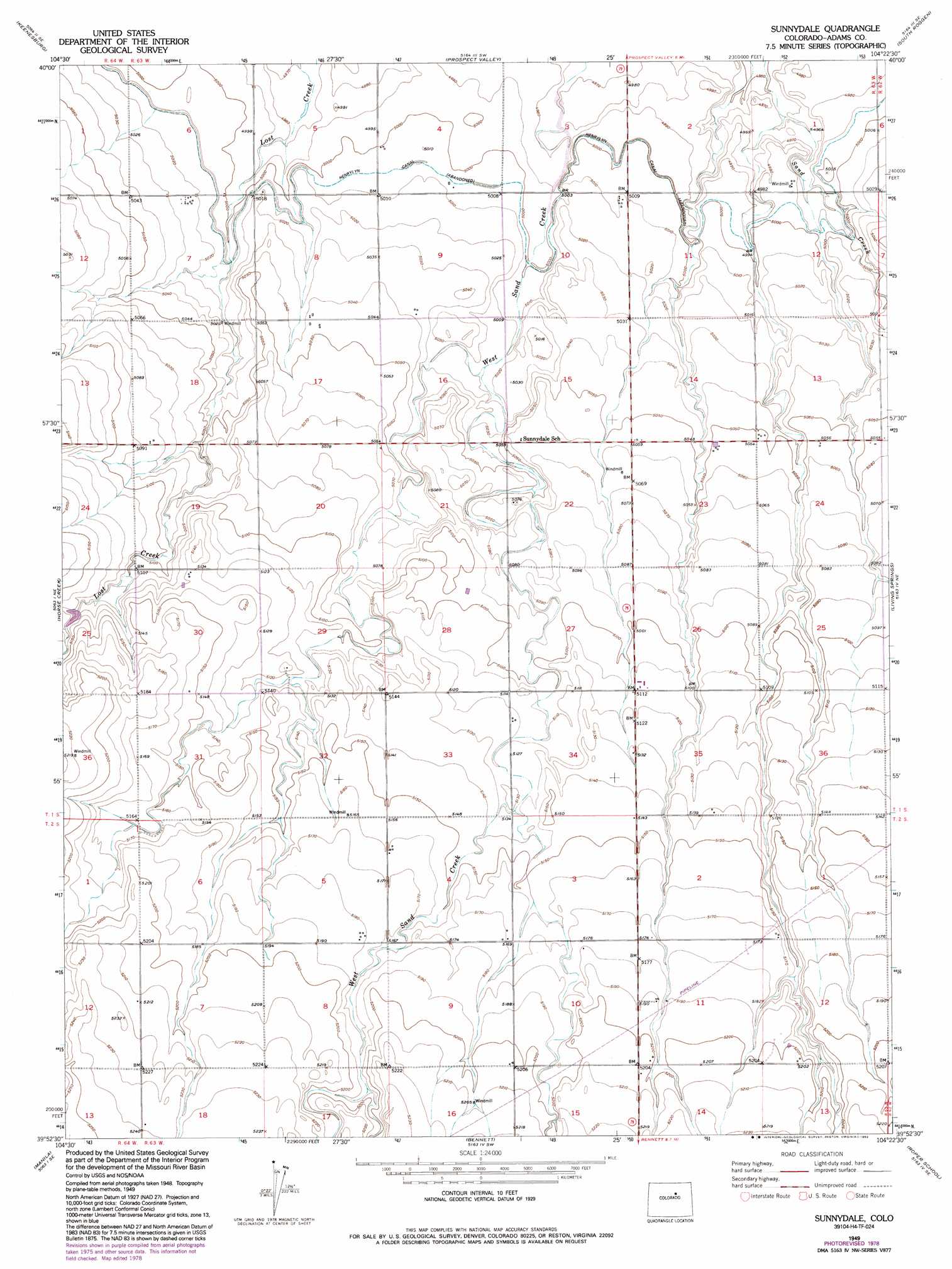
Sunnydale Topo Map Colorado
To zoom in, hover over the map of Sunnydale
USGS Topo Quad 39104h4 - 1:24,000 scale
| Topo Map Name: | Sunnydale |
| USGS Topo Quad ID: | 39104h4 |
| Print Size: | ca. 21 1/4" wide x 27" high |
| Southeast Coordinates: | 39.875° N latitude / 104.375° W longitude |
| Map Center Coordinates: | 39.9375° N latitude / 104.4375° W longitude |
| U.S. State: | CO |
| Filename: | o39104h4.jpg |
| Download Map JPG Image: | Sunnydale topo map 1:24,000 scale |
| Map Type: | Topographic |
| Topo Series: | 7.5´ |
| Map Scale: | 1:24,000 |
| Source of Map Images: | United States Geological Survey (USGS) |
| Alternate Map Versions: |
Sunnydale CO 1949 Download PDF Buy paper map Sunnydale CO 1949, updated 1972 Download PDF Buy paper map Sunnydale CO 1949, updated 1992 Download PDF Buy paper map Sunnydale CO 2010 Download PDF Buy paper map Sunnydale CO 2013 Download PDF Buy paper map Sunnydale CO 2016 Download PDF Buy paper map |
1:24,000 Topo Quads surrounding Sunnydale
Milton Reservoir |
Klug Ranch |
Tampa |
Roggen |
Omar |
Hudson |
Keenesburg |
Prospect Valley |
South Roggen |
Wiggins Sw |
Mile High Lakes |
Horse Creek |
Sunnydale |
Living Springs |
Leader Nw |
Box Elder School |
Manila |
Bennett |
Roper School |
Leader Sw |
Coal Creek |
Watkins |
Strasburg Nw |
Strasburg |
Byers |
> Back to 39104e1 at 1:100,000 scale
> Back to 39104a1 at 1:250,000 scale
> Back to U.S. Topo Maps home
Sunnydale topo map: Gazetteer
Sunnydale: Airports
JJS Airport elevation 1542m 5059′Sunnydale: Canals
Henrylyn Canal elevation 1527m 5009′Sunnydale digital topo map on disk
Buy this Sunnydale topo map showing relief, roads, GPS coordinates and other geographical features, as a high-resolution digital map file on DVD: