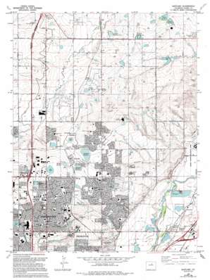
Eastlake Topo Map Colorado
To zoom in, hover over the map of Eastlake
USGS Topo Quad 39104h8 - 1:24,000 scale
| Topo Map Name: | Eastlake |
| USGS Topo Quad ID: | 39104h8 |
| Print Size: | ca. 21 1/4" wide x 27" high |
| Southeast Coordinates: | 39.875° N latitude / 104.875° W longitude |
| Map Center Coordinates: | 39.9375° N latitude / 104.9375° W longitude |
| U.S. State: | CO |
| Filename: | o39104h8.jpg |
| Download Map JPG Image: | Eastlake topo map 1:24,000 scale |
| Map Type: | Topographic |
| Topo Series: | 7.5´ |
| Map Scale: | 1:24,000 |
| Source of Map Images: | United States Geological Survey (USGS) |
| Alternate Map Versions: |
Eastlake CO 1957, updated 1958 Download PDF Buy paper map Eastlake CO 1965, updated 1967 Download PDF Buy paper map Eastlake CO 1965, updated 1967 Download PDF Buy paper map Eastlake CO 1965, updated 1973 Download PDF Buy paper map Eastlake CO 1965, updated 1973 Download PDF Buy paper map Eastlake CO 1965, updated 1980 Download PDF Buy paper map Eastlake CO 1965, updated 1983 Download PDF Buy paper map Eastlake CO 1965, updated 1994 Download PDF Buy paper map Eastlake CO 1965, updated 1994 Download PDF Buy paper map Eastlake CO 2010 Download PDF Buy paper map Eastlake CO 2013 Download PDF Buy paper map Eastlake CO 2016 Download PDF Buy paper map |
1:24,000 Topo Quads surrounding Eastlake
> Back to 39104e1 at 1:100,000 scale
> Back to 39104a1 at 1:250,000 scale
> Back to U.S. Topo Maps home
Eastlake topo map: Gazetteer
Eastlake: Canals
Bull Canal elevation 1579m 5180′German Ditch elevation 1563m 5127′
Lee Lateral elevation 1600m 5249′
Lower Clear Creek Canal elevation 1616m 5301′
Signal Ditch elevation 1585m 5200′
Tuck Lateral elevation 1648m 5406′
Eastlake: Crossings
Exit 12 elevation 1547m 5075′Exit 221 elevation 1637m 5370′
Exit 223 elevation 1633m 5357′
Eastlake: Dams
A-20 Dam elevation 1570m 5150′Brewer Dam elevation 1570m 5150′
Cole Dam elevation 1583m 5193′
Croke Number 7 Dam elevation 1649m 5410′
East Lake Number 1 Dam elevation 1612m 5288′
East Lake Number 2 Dam elevation 1604m 5262′
East Lake Number 3 Dam elevation 1592m 5223′
German Number 1 Dam elevation 1556m 5104′
German Number 2 Dam elevation 1553m 5095′
Ginther Number 1 Dam elevation 1581m 5187′
Hartley Dam elevation 1598m 5242′
Johnson Dam elevation 1556m 5104′
Koleski Number 2 Dam elevation 1613m 5291′
Marshall Dam elevation 1579m 5180′
Metzger Dam elevation 1571m 5154′
Ohio Lake Dam elevation 1623m 5324′
Poitz Dam elevation 1598m 5242′
Rampart Dam elevation 1552m 5091′
Richards Dam elevation 1593m 5226′
Signal Number 1 Dam elevation 1567m 5141′
Signal Number 2 Dam elevation 1574m 5164′
Smith Irrigation Dam elevation 1554m 5098′
Sunny Acres Dam elevation 1610m 5282′
Talbott Irrigation Dam elevation 1588m 5209′
Wadley Number 1 Dam elevation 1592m 5223′
Wadley Number 2 Dam elevation 1583m 5193′
Wadley Number 3 Dam elevation 1576m 5170′
Webster Lake East Dam elevation 1644m 5393′
Eastlake: Mines
Adams County Pit elevation 1540m 5052′Brannan Sand and Gravel Company Pit elevation 1652m 5419′
Colorado Consolidated Rock Pit elevation 1537m 5042′
Platte Valley Sand and Gravel Pit elevation 1540m 5052′
Suburban Sand and Gravel Company Pit elevation 1535m 5036′
Western Paving Company Pit elevation 1538m 5045′
Eastlake: Parks
Adams County Regional Park elevation 1532m 5026′Briar Ridge Park elevation 1601m 5252′
Charles Winburn Park elevation 1650m 5413′
Cherry Park elevation 1591m 5219′
E B Rains Junior Memorial Park elevation 1644m 5393′
Eagleview Park elevation 1620m 5314′
Glencoe Park elevation 1573m 5160′
Grange Creek Park elevation 1579m 5180′
Grant Park elevation 1625m 5331′
Holly Park elevation 1565m 5134′
Hunters Glen Lake Park elevation 1601m 5252′
Jaycee Park elevation 1590m 5216′
Lake Village Park elevation 1600m 5249′
Loma Linda Park elevation 1630m 5347′
Norse Glenn Park elevation 1661m 5449′
Northern Lights Ball Fields elevation 1582m 5190′
Park Village Park elevation 1617m 5305′
Playway Park elevation 1597m 5239′
Riverdale Park elevation 1559m 5114′
Shadow Ridge Park elevation 1623m 5324′
Sherwood Hills Park elevation 1607m 5272′
Steele Park elevation 1587m 5206′
Stonehocker Park elevation 1579m 5180′
Thomas Park elevation 1597m 5239′
Woodglen Meadows Park elevation 1587m 5206′
Woodglen Park elevation 1607m 5272′
Woodhaven Park elevation 1599m 5246′
Wyco Park elevation 1620m 5314′
Eastlake: Populated Places
Eastlake elevation 1606m 5269′Hazeltine elevation 1540m 5052′
Hazeltine Heights elevation 1549m 5082′
Hi-Land Acres elevation 1567m 5141′
Northglenn elevation 1639m 5377′
Eastlake: Reservoirs
A-20 Reservoir elevation 1570m 5150′Ashwood Reservoir elevation 1578m 5177′
Brewer Reservoir elevation 1570m 5150′
Cole Reservoir elevation 1583m 5193′
Croke Reservoir elevation 1648m 5406′
Croke Reservoir Number 7 elevation 1649m 5410′
Eagle Lake elevation 1617m 5305′
East Lake Number 1 elevation 1612m 5288′
East Lake Number 2 elevation 1604m 5262′
East Lake Number 3 elevation 1592m 5223′
East Webster Lake elevation 1644m 5393′
Eastlake Reservoir Number 1 elevation 1611m 5285′
Eastlake Reservoir Number 3 elevation 1592m 5223′
German Reservoir Number 1 elevation 1556m 5104′
German Reservoir Number 2 elevation 1553m 5095′
Ginther Reservoir Number 1 elevation 1581m 5187′
Hartley Reservoir elevation 1598m 5242′
Hunters Glen Lake elevation 1601m 5252′
Koleski Reservoir Number 1 elevation 1613m 5291′
Lake Erie elevation 1599m 5246′
Lutz Reservoir elevation 1556m 5104′
Marshall Reservoir elevation 1579m 5180′
Metzger Reservoir elevation 1571m 5154′
Nott Lake elevation 1598m 5242′
Ohio Lake Reservoir elevation 1623m 5324′
Poitz Reservoir elevation 1598m 5242′
Richards Reservoir elevation 1593m 5226′
Signal Reservoir Number 1 elevation 1567m 5141′
Signal Reservoir Number 2 elevation 1574m 5164′
Smith Irrigation Reservoir elevation 1554m 5098′
Smith Reservoir elevation 1555m 5101′
Sunny Acres Reservoir elevation 1610m 5282′
Talbott Irrigation Reservoir elevation 1588m 5209′
Todd Reservoir elevation 1545m 5068′
Wadley Reservoir Number 1 elevation 1592m 5223′
Wadley Reservoir Number 2 elevation 1573m 5160′
Wadley Reservoir Number 3 elevation 1576m 5170′
Webster Lake elevation 1645m 5396′
Eastlake: Valleys
Branther Gulch elevation 1538m 5045′Eastlake digital topo map on disk
Buy this Eastlake topo map showing relief, roads, GPS coordinates and other geographical features, as a high-resolution digital map file on DVD:


