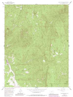
Dakan Mountain Topo Map Colorado
To zoom in, hover over the map of Dakan Mountain
USGS Topo Quad 39105b1 - 1:24,000 scale
| Topo Map Name: | Dakan Mountain |
| USGS Topo Quad ID: | 39105b1 |
| Print Size: | ca. 21 1/4" wide x 27" high |
| Southeast Coordinates: | 39.125° N latitude / 105° W longitude |
| Map Center Coordinates: | 39.1875° N latitude / 105.0625° W longitude |
| U.S. State: | CO |
| Filename: | o39105b1.jpg |
| Download Map JPG Image: | Dakan Mountain topo map 1:24,000 scale |
| Map Type: | Topographic |
| Topo Series: | 7.5´ |
| Map Scale: | 1:24,000 |
| Source of Map Images: | United States Geological Survey (USGS) |
| Alternate Map Versions: |
Dakan Mountain CO 1956, updated 1957 Download PDF Buy paper map Dakan Mountain CO 1956, updated 1957 Download PDF Buy paper map Dakan Mountain CO 1956, updated 1963 Download PDF Buy paper map Dakan Mountain CO 1956, updated 1971 Download PDF Buy paper map Dakan Mountain CO 1956, updated 1971 Download PDF Buy paper map Dakan Mountain CO 1956, updated 1980 Download PDF Buy paper map Dakan Mountain CO 1956, updated 1985 Download PDF Buy paper map Dakan Mountain CO 1994, updated 1998 Download PDF Buy paper map Dakan Mountain CO 2011 Download PDF Buy paper map Dakan Mountain CO 2013 Download PDF Buy paper map Dakan Mountain CO 2016 Download PDF Buy paper map |
| FStopo: | US Forest Service topo Dakan Mountain is available: Download FStopo PDF Download FStopo TIF |
1:24,000 Topo Quads surrounding Dakan Mountain
> Back to 39105a1 at 1:100,000 scale
> Back to 39104a1 at 1:250,000 scale
> Back to U.S. Topo Maps home
Dakan Mountain topo map: Gazetteer
Dakan Mountain: Flats
Rainbow Falls Park elevation 2309m 7575′Dakan Mountain: Mines
Baldwin Pegmatite Mine elevation 2732m 8963′C and S Mine elevation 2567m 8421′
Denver Pegmatite Mine elevation 2645m 8677′
Fern Creek Mine elevation 2517m 8257′
Glen Spielman Mine elevation 2534m 8313′
Little Anna Mine elevation 2706m 8877′
Little Eagle Mine elevation 2678m 8786′
Little Eddy Mine elevation 2713m 8900′
Little Joe Mine elevation 2733m 8966′
Lone Pine Mine elevation 2649m 8690′
Lost Dutchman Mine elevation 2566m 8418′
Rusty Pick Mine elevation 2685m 8809′
Skeleton Number Two Mine elevation 2722m 8930′
Spielman Mine elevation 2729m 8953′
Watson Park Mine elevation 2648m 8687′
Dakan Mountain: Streams
Fern Creek elevation 2283m 7490′Dakan Mountain: Summits
Chimney Peak elevation 2763m 9064′Dakan Mountain elevation 2797m 9176′
Storm Peak elevation 2783m 9130′
Turtle Mountain elevation 2710m 8891′
Dakan Mountain: Trails
Long Hollow Trail elevation 2649m 8690′Missouri Gulch Trail elevation 2631m 8631′
South Manitou Park Trail elevation 2451m 8041′
Dakan Mountain: Valleys
Illinois Gulch elevation 2301m 7549′Missouri Gulch elevation 2317m 7601′
South Fork Missouri Gulch elevation 2710m 8891′
White Spruce Gulch elevation 2315m 7595′
Dakan Mountain digital topo map on disk
Buy this Dakan Mountain topo map showing relief, roads, GPS coordinates and other geographical features, as a high-resolution digital map file on DVD:


