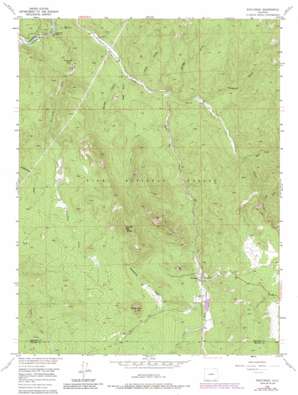
Westcreek Topo Map Colorado
To zoom in, hover over the map of Westcreek
USGS Topo Quad 39105b2 - 1:24,000 scale
| Topo Map Name: | Westcreek |
| USGS Topo Quad ID: | 39105b2 |
| Print Size: | ca. 21 1/4" wide x 27" high |
| Southeast Coordinates: | 39.125° N latitude / 105.125° W longitude |
| Map Center Coordinates: | 39.1875° N latitude / 105.1875° W longitude |
| U.S. State: | CO |
| Filename: | o39105b2.jpg |
| Download Map JPG Image: | Westcreek topo map 1:24,000 scale |
| Map Type: | Topographic |
| Topo Series: | 7.5´ |
| Map Scale: | 1:24,000 |
| Source of Map Images: | United States Geological Survey (USGS) |
| Alternate Map Versions: |
Westcreek CO 1956, updated 1958 Download PDF Buy paper map Westcreek CO 1956, updated 1962 Download PDF Buy paper map Westcreek CO 1956, updated 1966 Download PDF Buy paper map Westcreek CO 1956, updated 1966 Download PDF Buy paper map Westcreek CO 1956, updated 1985 Download PDF Buy paper map Westcreek CO 1994, updated 1998 Download PDF Buy paper map Westcreek CO 2011 Download PDF Buy paper map Westcreek CO 2013 Download PDF Buy paper map Westcreek CO 2016 Download PDF Buy paper map |
| FStopo: | US Forest Service topo Westcreek is available: Download FStopo PDF Download FStopo TIF |
1:24,000 Topo Quads surrounding Westcreek
> Back to 39105a1 at 1:100,000 scale
> Back to 39104a1 at 1:250,000 scale
> Back to U.S. Topo Maps home
Westcreek topo map: Gazetteer
Westcreek: Dams
J O Hill Dam elevation 2292m 7519′West Creek Dam elevation 2262m 7421′
Westcreek: Populated Places
Westcreek elevation 2281m 7483′Westcreek: Reservoirs
J O Hill Reservoir elevation 2292m 7519′Westcreek Lake (historical) elevation 2262m 7421′
Westcreek: Streams
Camp Creek elevation 2061m 6761′Eagle Creek elevation 2086m 6843′
Fourmile Creek elevation 1964m 6443′
Trail Creek elevation 2300m 7545′
Trout Creek elevation 2022m 6633′
West Creek elevation 2022m 6633′
Westcreek: Summits
Bell Rock elevation 2472m 8110′Sheep Nose elevation 2692m 8832′
Thunder Butte elevation 2991m 9812′
Westcreek: Valleys
Bridge Gulch elevation 2025m 6643′Long Hollow elevation 2156m 7073′
Polhemus Gulch elevation 2047m 6715′
Ruby Gulch elevation 2010m 6594′
Shrewsbury Gulch elevation 2305m 7562′
Spring Gulch elevation 2000m 6561′
Wren Gulch elevation 2013m 6604′
Westcreek digital topo map on disk
Buy this Westcreek topo map showing relief, roads, GPS coordinates and other geographical features, as a high-resolution digital map file on DVD:


