Fairplay East Topo Map Colorado
To zoom in, hover over the map of Fairplay East
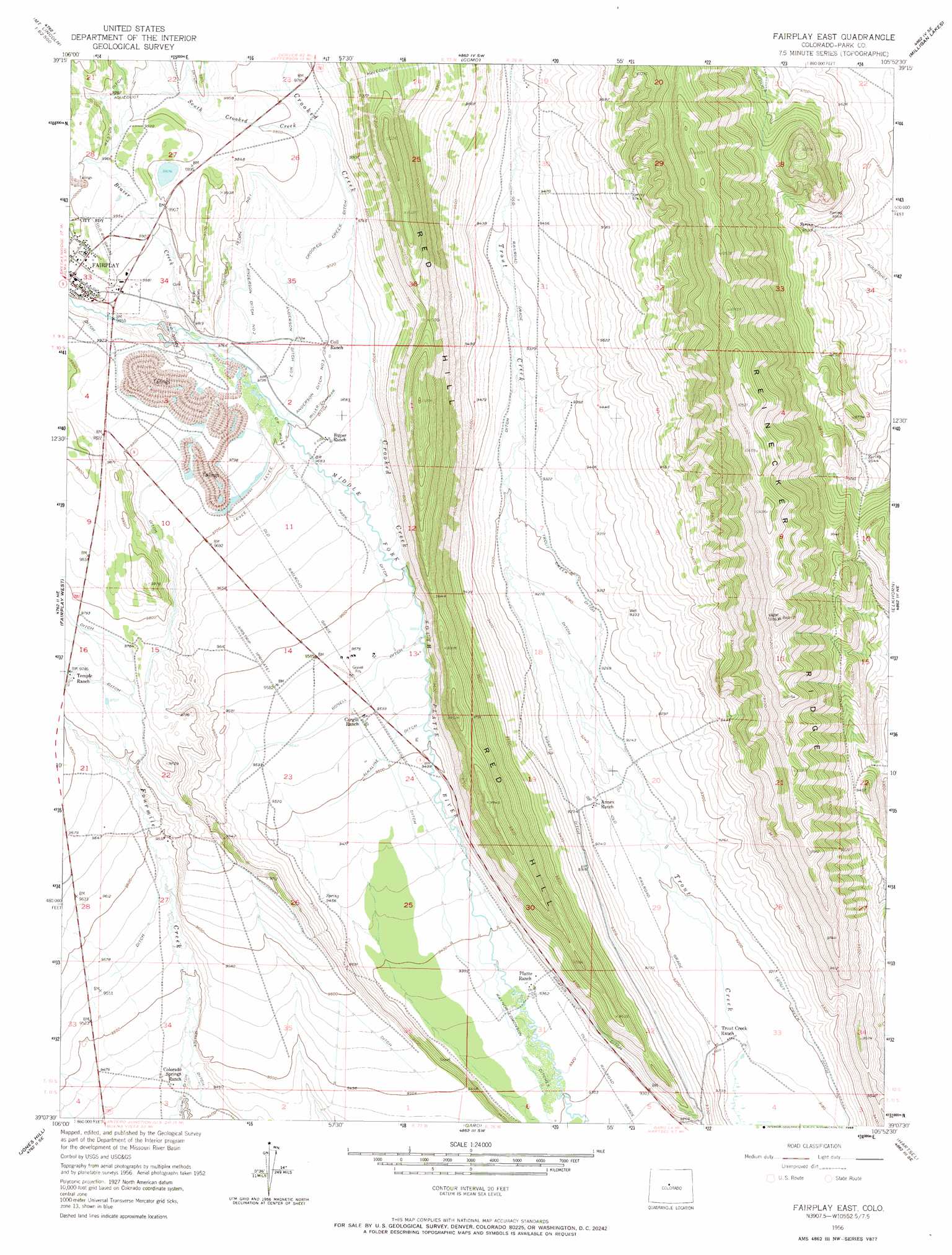
USGS Topo Quad 39105b8 - 1:24,000 scale
| Topo Map Name: | Fairplay East |
| USGS Topo Quad ID: | 39105b8 |
| Print Size: | ca. 21 1/4" wide x 27" high |
| Southeast Coordinates: | 39.125° N latitude / 105.875° W longitude |
| Map Center Coordinates: | 39.1875° N latitude / 105.9375° W longitude |
| U.S. State: | CO |
| Filename: | o39105b8.jpg |
| Download Map JPG Image: | Fairplay East topo map 1:24,000 scale |
| Map Type: | Topographic |
| Topo Series: | 7.5´ |
| Map Scale: | 1:24,000 |
| Source of Map Images: | United States Geological Survey (USGS) |
| Alternate Map Versions: |
Fairplay East CO 1956, updated 1957 Download PDF Buy paper map Fairplay East CO 1956, updated 1957 Download PDF Buy paper map Fairplay East CO 1956, updated 1968 Download PDF Buy paper map Fairplay East CO 2010 Download PDF Buy paper map Fairplay East CO 2013 Download PDF Buy paper map Fairplay East CO 2016 Download PDF Buy paper map |
1:24,000 Topo Quads surrounding Fairplay East
Copper Mountain |
Breckenridge |
Boreas Pass |
Jefferson |
Mount Logan |
Climax |
Alma |
Como |
Milligan Lakes |
Observatory Rock |
Mount Sherman |
Fairplay West |
Fairplay East |
Elkhorn |
Eagle Rock |
South Peak |
Jones Hill |
Garo |
Hartsel |
Sulphur Mountain |
Harvard Lakes |
Marmot Peak |
Antero Reservoir |
Antero Reservoir Ne |
Guffey Nw |
> Back to 39105a1 at 1:100,000 scale
> Back to 39104a1 at 1:250,000 scale
> Back to U.S. Topo Maps home
Fairplay East topo map: Gazetteer
Fairplay East: Canals
Alkaline Ditch elevation 2899m 9511′Anderson Ditch Number 1 elevation 2976m 9763′
Anderson Ditch Number 2 elevation 2976m 9763′
Anderson Ditch Number 3 elevation 2960m 9711′
Bonell Ditch elevation 2911m 9550′
Crooked Creek Ditch elevation 2969m 9740′
D F Miller Ditch elevation 2958m 9704′
Malice Ditch elevation 2881m 9452′
Miller-Chapman Ditch elevation 2958m 9704′
Park Ditch elevation 2939m 9642′
Raynor-Edmonson Ditches elevation 2858m 9376′
Sigafus Ditch elevation 2856m 9370′
Trout Creek Ditch elevation 2812m 9225′
Fairplay East: Ridges
Red Hill elevation 3000m 9842′Reinecker Ridge elevation 3208m 10524′
Fairplay East: Streams
Beaver Creek elevation 2982m 9783′Crooked Creek elevation 2924m 9593′
Fairplay East digital topo map on disk
Buy this Fairplay East topo map showing relief, roads, GPS coordinates and other geographical features, as a high-resolution digital map file on DVD: