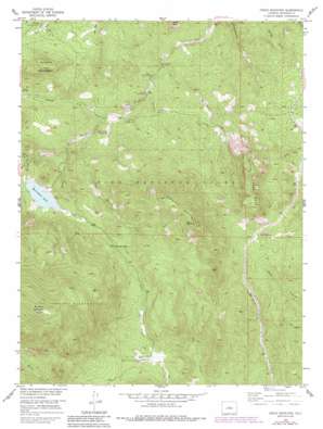
Green Mountain Topo Map Colorado
To zoom in, hover over the map of Green Mountain
USGS Topo Quad 39105c3 - 1:24,000 scale
| Topo Map Name: | Green Mountain |
| USGS Topo Quad ID: | 39105c3 |
| Print Size: | ca. 21 1/4" wide x 27" high |
| Southeast Coordinates: | 39.25° N latitude / 105.25° W longitude |
| Map Center Coordinates: | 39.3125° N latitude / 105.3125° W longitude |
| U.S. State: | CO |
| Filename: | o39105c3.jpg |
| Download Map JPG Image: | Green Mountain topo map 1:24,000 scale |
| Map Type: | Topographic |
| Topo Series: | 7.5´ |
| Map Scale: | 1:24,000 |
| Source of Map Images: | United States Geological Survey (USGS) |
| Alternate Map Versions: |
Green Mountain CO 1948 Download PDF Buy paper map Green Mountain CO 1948 Download PDF Buy paper map Green Mountain CO 1954, updated 1955 Download PDF Buy paper map Green Mountain CO 1954, updated 1955 Download PDF Buy paper map Green Mountain CO 1954, updated 1962 Download PDF Buy paper map Green Mountain CO 1954, updated 1962 Download PDF Buy paper map Green Mountain CO 1954, updated 1962 Download PDF Buy paper map Green Mountain CO 1954, updated 1970 Download PDF Buy paper map Green Mountain CO 1954, updated 1970 Download PDF Buy paper map Green Mountain CO 1954, updated 1979 Download PDF Buy paper map Green Mountain CO 1954, updated 1985 Download PDF Buy paper map Green Mountain CO 1954, updated 1985 Download PDF Buy paper map Green Mountain CO 1994, updated 2001 Download PDF Buy paper map Green Mountain CO 1994, updated 2001 Download PDF Buy paper map Green Mountain CO 2011 Download PDF Buy paper map Green Mountain CO 2013 Download PDF Buy paper map Green Mountain CO 2016 Download PDF Buy paper map |
| FStopo: | US Forest Service topo Green Mountain is available: Download FStopo PDF Download FStopo TIF |
1:24,000 Topo Quads surrounding Green Mountain
> Back to 39105a1 at 1:100,000 scale
> Back to 39104a1 at 1:250,000 scale
> Back to U.S. Topo Maps home
Green Mountain topo map: Gazetteer
Green Mountain: Dams
Wellington Dam elevation 2442m 8011′Green Mountain: Flats
Webster Park elevation 2403m 7883′Green Mountain: Mines
Orthite Number One Mine elevation 2391m 7844′Sunset Group Mine elevation 2391m 7844′
Green Mountain: Reservoirs
Wellington Lake elevation 2442m 8011′Green Mountain: Streams
Freeman Creek elevation 2384m 7821′Green Mountain Creek elevation 2277m 7470′
Morrison Creek elevation 2157m 7076′
Redskin Creek elevation 2242m 7355′
Rolling Creek elevation 2384m 7821′
Shinglemill Creek elevation 2067m 6781′
South Fork Buffalo Creek elevation 2303m 7555′
Tramway Creek elevation 2189m 7181′
Green Mountain: Summits
Baldy Peak elevation 2388m 7834′Buffalo Peak elevation 3526m 11568′
Green Mountain elevation 3174m 10413′
Little Scraggy Peak elevation 2798m 9179′
Redskin Mountain elevation 2670m 8759′
Green Mountain digital topo map on disk
Buy this Green Mountain topo map showing relief, roads, GPS coordinates and other geographical features, as a high-resolution digital map file on DVD:


