Windy Peak Topo Map Colorado
To zoom in, hover over the map of Windy Peak
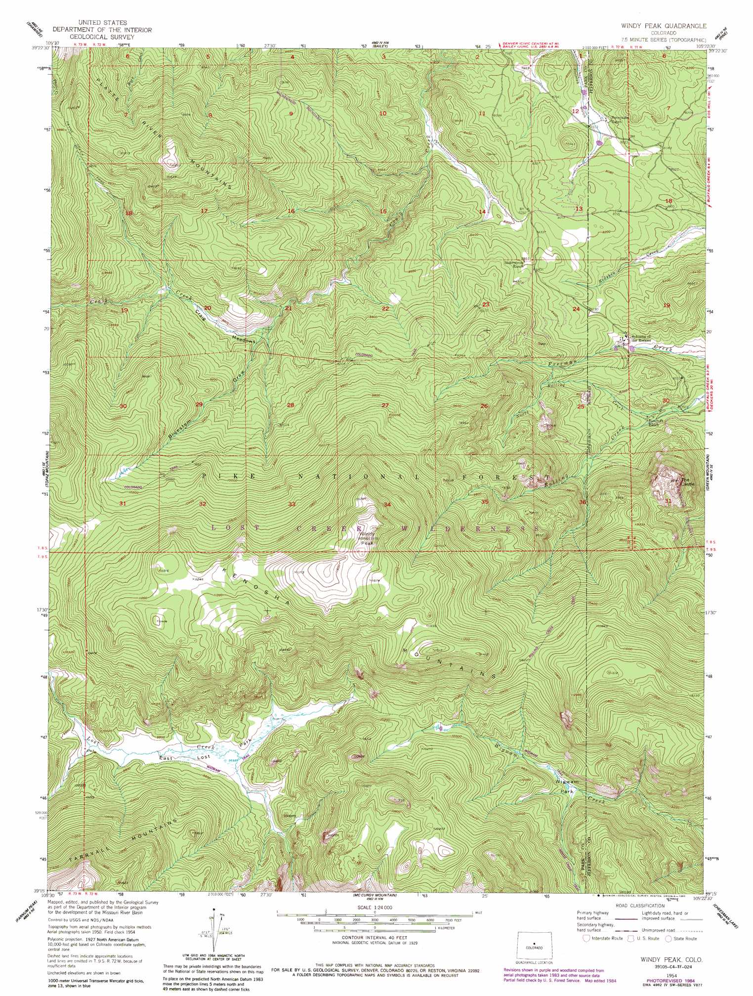
USGS Topo Quad 39105c4 - 1:24,000 scale
| Topo Map Name: | Windy Peak |
| USGS Topo Quad ID: | 39105c4 |
| Print Size: | ca. 21 1/4" wide x 27" high |
| Southeast Coordinates: | 39.25° N latitude / 105.375° W longitude |
| Map Center Coordinates: | 39.3125° N latitude / 105.4375° W longitude |
| U.S. State: | CO |
| Filename: | o39105c4.jpg |
| Download Map JPG Image: | Windy Peak topo map 1:24,000 scale |
| Map Type: | Topographic |
| Topo Series: | 7.5´ |
| Map Scale: | 1:24,000 |
| Source of Map Images: | United States Geological Survey (USGS) |
| Alternate Map Versions: |
Windy Peak CO 1954, updated 1955 Download PDF Buy paper map Windy Peak CO 1954, updated 1955 Download PDF Buy paper map Windy Peak CO 1954, updated 1962 Download PDF Buy paper map Windy Peak CO 1954, updated 1968 Download PDF Buy paper map Windy Peak CO 1954, updated 1968 Download PDF Buy paper map Windy Peak CO 1954, updated 1975 Download PDF Buy paper map Windy Peak CO 1954, updated 1985 Download PDF Buy paper map Windy Peak CO 1954, updated 1985 Download PDF Buy paper map Windy Peak CO 1994, updated 2001 Download PDF Buy paper map Windy Peak CO 2011 Download PDF Buy paper map Windy Peak CO 2013 Download PDF Buy paper map Windy Peak CO 2016 Download PDF Buy paper map |
| FStopo: | US Forest Service topo Windy Peak is available: Download FStopo PDF Download FStopo TIF |
1:24,000 Topo Quads surrounding Windy Peak
Mount Evans |
Harris Park |
Meridian Hill |
Conifer |
Indian Hills |
Mount Logan |
Shawnee |
Bailey |
Pine |
Platte Canyon |
Observatory Rock |
Topaz Mountain |
Windy Peak |
Green Mountain |
Deckers |
Eagle Rock |
Farnum Peak |
Mccurdy Mountain |
Cheesman Lake |
Westcreek |
Sulphur Mountain |
Glentivar |
Tarryall |
Hackett Mountain |
Signal Butte |
> Back to 39105a1 at 1:100,000 scale
> Back to 39104a1 at 1:250,000 scale
> Back to U.S. Topo Maps home
Windy Peak topo map: Gazetteer
Windy Peak: Flats
Craig Meadows elevation 2658m 8720′East Lost Park elevation 2959m 9708′
Wigwam Park elevation 2896m 9501′
Windy Peak: Mines
Aspen Lode Pegmatite Mine elevation 2581m 8467′Lone and Lonesome Lodes Pegmatite Mine elevation 2696m 8845′
Windy Peak: Pillars
The Castle elevation 2873m 9425′Windy Peak: Streams
North Rolling Creek elevation 2427m 7962′Windy Peak: Summits
Windy Peak elevation 3636m 11929′Windy Peak: Trails
Pine Ridge Trail elevation 2779m 9117′Rolling Creek Trail elevation 3172m 10406′
Windy Peak: Valleys
Bluestem Draw elevation 2657m 8717′Windy Peak digital topo map on disk
Buy this Windy Peak topo map showing relief, roads, GPS coordinates and other geographical features, as a high-resolution digital map file on DVD: