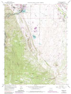
Kassler Topo Map Colorado
To zoom in, hover over the map of Kassler
USGS Topo Quad 39105d1 - 1:24,000 scale
| Topo Map Name: | Kassler |
| USGS Topo Quad ID: | 39105d1 |
| Print Size: | ca. 21 1/4" wide x 27" high |
| Southeast Coordinates: | 39.375° N latitude / 105° W longitude |
| Map Center Coordinates: | 39.4375° N latitude / 105.0625° W longitude |
| U.S. State: | CO |
| Filename: | o39105d1.jpg |
| Download Map JPG Image: | Kassler topo map 1:24,000 scale |
| Map Type: | Topographic |
| Topo Series: | 7.5´ |
| Map Scale: | 1:24,000 |
| Source of Map Images: | United States Geological Survey (USGS) |
| Alternate Map Versions: |
Kassler CO 1945, updated 1956 Download PDF Buy paper map Kassler CO 1945, updated 1956 Download PDF Buy paper map Kassler CO 1948 Download PDF Buy paper map Kassler CO 1948 Download PDF Buy paper map Kassler CO 1965, updated 1967 Download PDF Buy paper map Kassler CO 1965, updated 1967 Download PDF Buy paper map Kassler CO 1965, updated 1968 Download PDF Buy paper map Kassler CO 1965, updated 1973 Download PDF Buy paper map Kassler CO 1965, updated 1973 Download PDF Buy paper map Kassler CO 1965, updated 1980 Download PDF Buy paper map Kassler CO 1965, updated 1985 Download PDF Buy paper map Kassler CO 1965, updated 1987 Download PDF Buy paper map Kassler CO 1965, updated 1987 Download PDF Buy paper map Kassler CO 1994, updated 1998 Download PDF Buy paper map Kassler CO 2011 Download PDF Buy paper map Kassler CO 2013 Download PDF Buy paper map Kassler CO 2016 Download PDF Buy paper map |
| FStopo: | US Forest Service topo Kassler is available: Download FStopo PDF Download FStopo TIF |
1:24,000 Topo Quads surrounding Kassler
> Back to 39105a1 at 1:100,000 scale
> Back to 39104a1 at 1:250,000 scale
> Back to U.S. Topo Maps home
Kassler topo map: Gazetteer
Kassler: Airports
Martin Heliport elevation 1743m 5718′Kassler: Dams
Aurora-Rampart Dam elevation 1804m 5918′Lambert Dam elevation 1787m 5862′
Nelson Dam elevation 1898m 6227′
Platte Canyon Dam elevation 1688m 5538′
Wakeman Dam elevation 1809m 5935′
Kassler: Flats
Roxborough Park elevation 1850m 6069′Kassler: Mines
Duke Pit elevation 1690m 5544′Helmer Lime Quarry elevation 1897m 6223′
Hillside Mine elevation 1784m 5853′
Hogback Number Four Mine elevation 1718m 5636′
Hogback Number Three Mine elevation 1718m 5636′
Hogback Number Two Mine elevation 1718m 5636′
Kassler Quarry elevation 1765m 5790′
Little Quarry elevation 1740m 5708′
Penley Number One Lease Mine elevation 1913m 6276′
Pre-mix Sand and Gravel Incorporated Quarry elevation 1733m 5685′
Roxborough Park Mine elevation 1793m 5882′
Saddle Rock Ranch Mine elevation 2072m 6797′
Slocum Mine elevation 1718m 5636′
Titan Pit elevation 1699m 5574′
Wildcat Mine elevation 1883m 6177′
Kassler: Populated Places
Kassler elevation 1680m 5511′Louviers elevation 1728m 5669′
Pine Nook elevation 2239m 7345′
Roxborough Park elevation 1753m 5751′
Waterton elevation 1670m 5479′
Kassler: Reservoirs
Aurora-Rampart Reservoir elevation 1804m 5918′Lambert Reservoir elevation 1787m 5862′
Nelson Reservoir elevation 1898m 6227′
Platte Canyon Reservoir elevation 1688m 5538′
Wakeman Reservoir elevation 1809m 5935′
Kassler: Streams
Brush Creek elevation 1670m 5479′Indian Creek elevation 1718m 5636′
Little Willow Creek elevation 1690m 5544′
Rainbow Creek elevation 1814m 5951′
West Bear Creek elevation 1876m 6154′
Willow Creek elevation 1668m 5472′
Kassler: Summits
Bennett Mountain elevation 2445m 8021′Cann Hill elevation 1858m 6095′
Carpenter Peak elevation 2173m 7129′
Thomas Hill elevation 2359m 7739′
Wildcat Mountain elevation 2010m 6594′
Kassler: Tunnels
Aurora Rampart Tunnel Number 2 elevation 2007m 6584′Kassler: Valleys
Cottonwood Gulch elevation 1699m 5574′Highlands Gulch elevation 1725m 5659′
Jarre Canyon elevation 1963m 6440′
Lehigh Gulch elevation 1761m 5777′
Mill Gulch elevation 1729m 5672′
Platte Canyon elevation 1679m 5508′
Stevens Gulch elevation 1763m 5784′
Kassler digital topo map on disk
Buy this Kassler topo map showing relief, roads, GPS coordinates and other geographical features, as a high-resolution digital map file on DVD:


