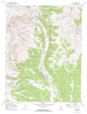
Alma Topo Map Colorado
To zoom in, hover over the map of Alma
USGS Topo Quad 39106c1 - 1:24,000 scale
| Topo Map Name: | Alma |
| USGS Topo Quad ID: | 39106c1 |
| Print Size: | ca. 21 1/4" wide x 27" high |
| Southeast Coordinates: | 39.25° N latitude / 106° W longitude |
| Map Center Coordinates: | 39.3125° N latitude / 106.0625° W longitude |
| U.S. State: | CO |
| Filename: | o39106c1.jpg |
| Download Map JPG Image: | Alma topo map 1:24,000 scale |
| Map Type: | Topographic |
| Topo Series: | 7.5´ |
| Map Scale: | 1:24,000 |
| Source of Map Images: | United States Geological Survey (USGS) |
| Alternate Map Versions: |
Alma CO 1970, updated 1973 Download PDF Buy paper map Alma CO 1994, updated 1998 Download PDF Buy paper map Alma CO 2011 Download PDF Buy paper map Alma CO 2013 Download PDF Buy paper map Alma CO 2016 Download PDF Buy paper map |
| FStopo: | US Forest Service topo Alma is available: Download FStopo PDF Download FStopo TIF |
1:24,000 Topo Quads surrounding Alma
> Back to 39106a1 at 1:100,000 scale
> Back to 39106a1 at 1:250,000 scale
> Back to U.S. Topo Maps home
Alma topo map: Gazetteer
Alma: Basins
Cameron Amphitheatre elevation 4015m 13172′Lincoln Amphitheatre elevation 3740m 12270′
Red Amphitheatre elevation 3865m 12680′
Alma: Canals
Dyer Placer Ditch elevation 3266m 10715′Mosquito Creek Ditch elevation 3197m 10488′
Alma: Dams
Montgomery Dam elevation 3314m 10872′Alma: Flats
High Park elevation 3365m 11040′Mineral Park elevation 3439m 11282′
Alma: Gaps
Hoosier Pass elevation 3515m 11532′Alma: Lakes
Crystal Lake elevation 3569m 11709′Alma: Mines
Alma and South Alma District Survey Mine elevation 3496m 11469′Alma District Claims Mine elevation 3189m 10462′
Alma Placer elevation 3173m 10410′
American Flag Mine elevation 3262m 10702′
American Mine elevation 3655m 11991′
Beaver Creek Iron Mine elevation 3697m 12129′
Bemrose Mine elevation 3423m 11230′
Black Eagle Mine elevation 3224m 10577′
Bonanza Group Mine elevation 3273m 10738′
Buckskin Joe Mine elevation 3309m 10856′
Centennial Tunnel Mine elevation 3868m 12690′
Copper King Prospect Mine elevation 3486m 11437′
Creskill Group Mine elevation 3797m 12457′
Criterion Mine elevation 3366m 11043′
Detroit-Hicks Mine elevation 3394m 11135′
Dolly Varden Mine elevation 4025m 13205′
Dunkin Mine elevation 3269m 10725′
Evening Star Mine elevation 3270m 10728′
Gold Fern Mine elevation 3318m 10885′
Great West Mine elevation 3696m 12125′
Harrisburg and Gettysburg Mine elevation 3606m 11830′
Hock Hocking Mine elevation 3275m 10744′
Hungry Five Mine elevation 3551m 11650′
Iron Mine elevation 3685m 12089′
Jessie Mine elevation 3435m 11269′
Johnson Shaft Mine elevation 3502m 11489′
Ling Mine elevation 3748m 12296′
Logansport-Chicago Group Mine elevation 3519m 11545′
Lone Star Claim Mine elevation 3478m 11410′
Magnolia Mine elevation 3739m 12267′
Mascot Tunnel elevation 3308m 10853′
McCoy Shaft Mine elevation 3472m 11391′
Mineral Park Mine elevation 3480m 11417′
Moose Mine elevation 4200m 13779′
Morning Star-Cresskill Groups Mine elevation 3819m 12529′
Morrison Mine elevation 3317m 10882′
New Bonnet Group Mine elevation 3274m 10741′
Orphan Boy Mine elevation 3287m 10784′
Otis Shaft Mine elevation 3463m 11361′
Oxide Mine elevation 3727m 12227′
Paris Mine elevation 3477m 11407′
Red Cross Mine elevation 3271m 10731′
Russia Mine elevation 4224m 13858′
Security Mine elevation 3647m 11965′
Shelby Group Mine elevation 3349m 10987′
Smith Tunnel Mine elevation 3241m 10633′
Sweet Home Mine elevation 3464m 11364′
Walker and Buffalo Head Mine elevation 3780m 12401′
Weber Shaft Mine elevation 3472m 11391′
Alma: Populated Places
Alma elevation 3158m 10360′Alma Junction elevation 3126m 10255′
Dudley (historical) elevation 3201m 10501′
Park City (historical) elevation 3201m 10501′
Quartzville (historical) elevation 3527m 11571′
Alma: Reservoirs
Columbia Reservoir elevation 3193m 10475′Montgomery Reservoir elevation 3314m 10872′
Alma: Ridges
Beaver Ridge elevation 3664m 12020′Windy Ridge elevation 3576m 11732′
Alma: Streams
Buckskin Creek elevation 3148m 10328′Cooper Creek elevation 3200m 10498′
Moose Creek elevation 3208m 10524′
Mosquito Creek elevation 3116m 10223′
Quartzville Creek elevation 3208m 10524′
Sawmill Creek elevation 3171m 10403′
South Mosquito Creek elevation 3269m 10725′
Alma: Summits
Bald Hill elevation 3479m 11414′Mount Bross elevation 4323m 14183′
Mount Cameron elevation 4335m 14222′
Mount Lincoln elevation 4348m 14265′
Mount Silverheels elevation 4213m 13822′
Alma: Tunnels
Hoosier Pass Tunnel elevation 3552m 11653′Alma: Valleys
Dolly Varden Gulch elevation 3298m 10820′Platte Gulch elevation 3544m 11627′
Poor Mans Gulch elevation 3154m 10347′
Purgatory Gulch elevation 3416m 11207′
Putnam Gulch elevation 3256m 10682′
Scott Gulch elevation 3256m 10682′
Weber Gulch elevation 3418m 11213′
Alma digital topo map on disk
Buy this Alma topo map showing relief, roads, GPS coordinates and other geographical features, as a high-resolution digital map file on DVD:


