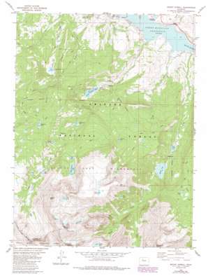
Mount Powell Topo Map Colorado
To zoom in, hover over the map of Mount Powell
USGS Topo Quad 39106g3 - 1:24,000 scale
| Topo Map Name: | Mount Powell |
| USGS Topo Quad ID: | 39106g3 |
| Print Size: | ca. 21 1/4" wide x 27" high |
| Southeast Coordinates: | 39.75° N latitude / 106.25° W longitude |
| Map Center Coordinates: | 39.8125° N latitude / 106.3125° W longitude |
| U.S. State: | CO |
| Filename: | o39106g3.jpg |
| Download Map JPG Image: | Mount Powell topo map 1:24,000 scale |
| Map Type: | Topographic |
| Topo Series: | 7.5´ |
| Map Scale: | 1:24,000 |
| Source of Map Images: | United States Geological Survey (USGS) |
| Alternate Map Versions: |
Mount Powell CO 1980, updated 1980 Download PDF Buy paper map Mount Powell CO 1980, updated 1988 Download PDF Buy paper map Mount Powell CO 1980, updated 1988 Download PDF Buy paper map Mount Powell CO 2011 Download PDF Buy paper map Mount Powell CO 2013 Download PDF Buy paper map Mount Powell CO 2016 Download PDF Buy paper map |
| FStopo: | US Forest Service topo Mount Powell is available: Download FStopo PDF Download FStopo TIF |
1:24,000 Topo Quads surrounding Mount Powell
> Back to 39106e1 at 1:100,000 scale
> Back to 39106a1 at 1:250,000 scale
> Back to U.S. Topo Maps home
Mount Powell topo map: Gazetteer
Mount Powell: Dams
Black Creek Dam elevation 2671m 8763′Hoagland Number 1 Dam elevation 2661m 8730′
Lost Lake Dam elevation 3093m 10147′
Mount Powell: Lakes
Black Lake elevation 2712m 8897′Cliff Lake elevation 3704m 12152′
Eaglesmere Lakes elevation 3170m 10400′
Griffith Lake elevation 3108m 10196′
Lost Lake elevation 3093m 10147′
Lower Cataract Lake elevation 2632m 8635′
Mirror Lake elevation 3226m 10583′
Surprise Lake elevation 3071m 10075′
Tipperary Lake elevation 2975m 9760′
Upper Cataract Lake elevation 3280m 10761′
Mount Powell: Populated Places
Heeney elevation 2452m 8044′Mount Powell: Reservoirs
Black Creek Reservoir elevation 2671m 8763′Hoagland Reservoir Number 1 elevation 2661m 8730′
Lost Lake Reservoir elevation 3093m 10147′
Mount Powell: Streams
Black Creek elevation 2424m 7952′Cataract Creek elevation 2424m 7952′
Martin Creek elevation 2497m 8192′
North Fork Elliott Creek elevation 2850m 9350′
Otter Creek elevation 2424m 7952′
Mount Powell: Summits
Dora Mountain elevation 3649m 11971′Eagles Nest elevation 4057m 13310′
Mount Powell elevation 4135m 13566′
Mount Powell: Trails
Eaglesmere Trail elevation 2921m 9583′Lost Lake Trail elevation 3067m 10062′
Surprise Trail elevation 2929m 9609′
Mount Powell: Valleys
Cottonwood Gulch elevation 2425m 7956′Cox Gulch elevation 2424m 7952′
Mount Powell digital topo map on disk
Buy this Mount Powell topo map showing relief, roads, GPS coordinates and other geographical features, as a high-resolution digital map file on DVD:


