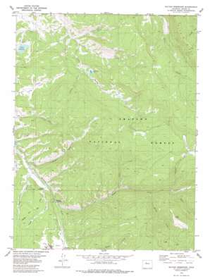
Sylvan Reservoir Topo Map Colorado
To zoom in, hover over the map of Sylvan Reservoir
USGS Topo Quad 39106h1 - 1:24,000 scale
| Topo Map Name: | Sylvan Reservoir |
| USGS Topo Quad ID: | 39106h1 |
| Print Size: | ca. 21 1/4" wide x 27" high |
| Southeast Coordinates: | 39.875° N latitude / 106° W longitude |
| Map Center Coordinates: | 39.9375° N latitude / 106.0625° W longitude |
| U.S. State: | CO |
| Filename: | o39106h1.jpg |
| Download Map JPG Image: | Sylvan Reservoir topo map 1:24,000 scale |
| Map Type: | Topographic |
| Topo Series: | 7.5´ |
| Map Scale: | 1:24,000 |
| Source of Map Images: | United States Geological Survey (USGS) |
| Alternate Map Versions: |
Sylvan Reservoir CO 1979, updated 1979 Download PDF Buy paper map Sylvan Reservoir CO 2011 Download PDF Buy paper map Sylvan Reservoir CO 2013 Download PDF Buy paper map Sylvan Reservoir CO 2016 Download PDF Buy paper map |
| FStopo: | US Forest Service topo Sylvan Reservoir is available: Download FStopo PDF Download FStopo TIF |
1:24,000 Topo Quads surrounding Sylvan Reservoir
> Back to 39106e1 at 1:100,000 scale
> Back to 39106a1 at 1:250,000 scale
> Back to U.S. Topo Maps home
Sylvan Reservoir topo map: Gazetteer
Sylvan Reservoir: Dams
Sylvan Dam elevation 2583m 8474′Sylvan Reservoir: Flats
Long Park elevation 2617m 8585′Ute Park elevation 2628m 8622′
Sylvan Reservoir: Lakes
De Koevend Lake elevation 2639m 8658′Sylvan Reservoir: Reservoirs
Sylvan Reservoir elevation 2583m 8474′Sylvan Reservoir: Streams
Cook Creek elevation 2663m 8736′Cub Creek elevation 2453m 8047′
Kelly Creek elevation 2464m 8083′
Keyser Creek elevation 2574m 8444′
Richey Creek elevation 2727m 8946′
Simpson Creek elevation 2765m 9071′
Timber Creek elevation 2598m 8523′
Upson Creek elevation 2781m 9124′
Ute Creek elevation 2612m 8569′
Sylvan Reservoir: Trails
Horseshoe Sulfur Trail elevation 2685m 8809′Muddy Keyser Trail elevation 3043m 9983′
Sulfur Trail elevation 2437m 7995′
Sylvan Reservoir: Valleys
Morgan Gulch elevation 2531m 8303′Morgan Gulch elevation 2520m 8267′
Pease Gulch elevation 2523m 8277′
Ranger Gulch elevation 2568m 8425′
Sylvan Reservoir digital topo map on disk
Buy this Sylvan Reservoir topo map showing relief, roads, GPS coordinates and other geographical features, as a high-resolution digital map file on DVD:


