Sheephorn Mountain Topo Map Colorado
To zoom in, hover over the map of Sheephorn Mountain
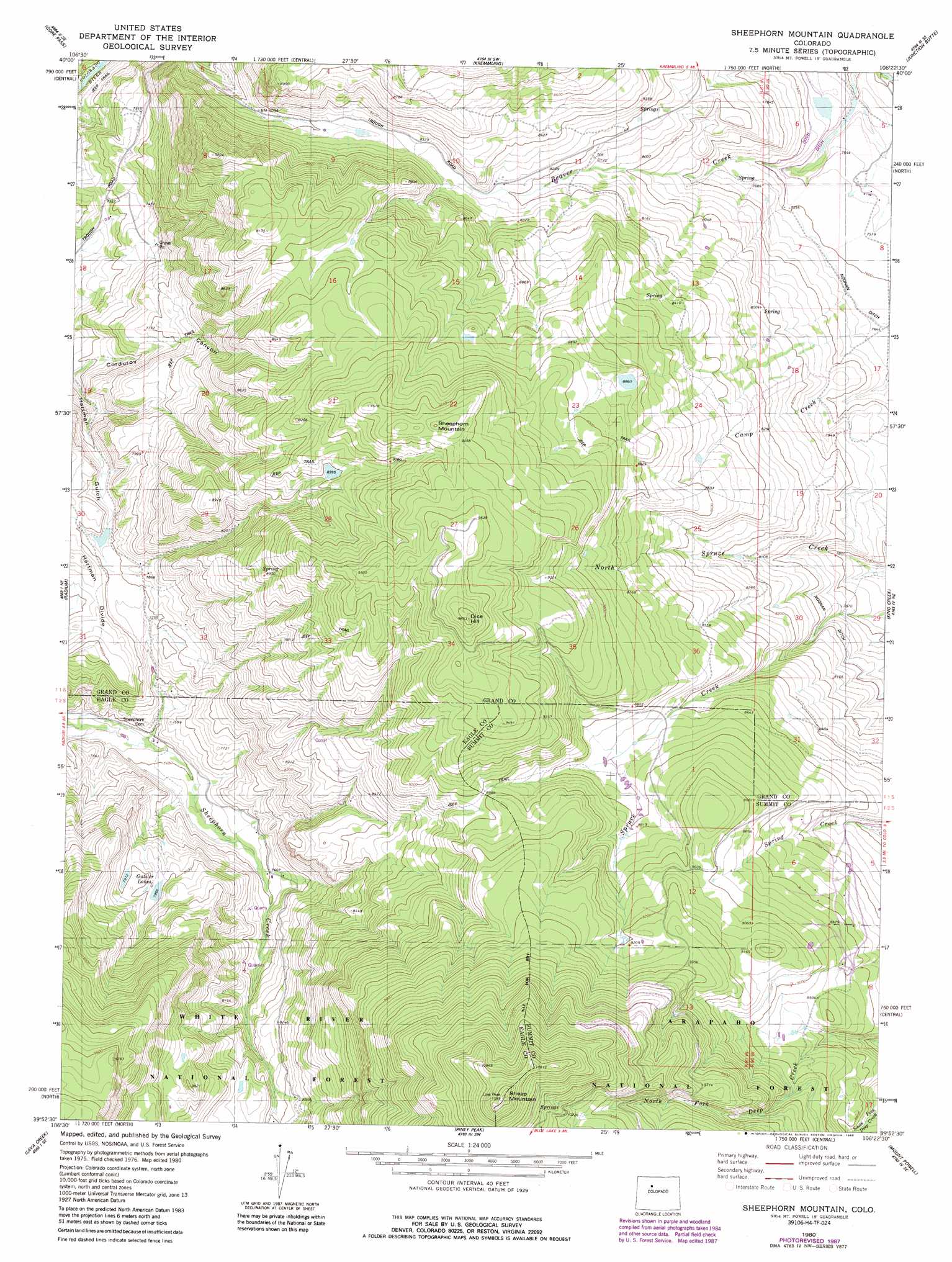
USGS Topo Quad 39106h4 - 1:24,000 scale
| Topo Map Name: | Sheephorn Mountain |
| USGS Topo Quad ID: | 39106h4 |
| Print Size: | ca. 21 1/4" wide x 27" high |
| Southeast Coordinates: | 39.875° N latitude / 106.375° W longitude |
| Map Center Coordinates: | 39.9375° N latitude / 106.4375° W longitude |
| U.S. State: | CO |
| Filename: | o39106h4.jpg |
| Download Map JPG Image: | Sheephorn Mountain topo map 1:24,000 scale |
| Map Type: | Topographic |
| Topo Series: | 7.5´ |
| Map Scale: | 1:24,000 |
| Source of Map Images: | United States Geological Survey (USGS) |
| Alternate Map Versions: |
Sheephorn Mountain CO 1980, updated 1980 Download PDF Buy paper map Sheephorn Mountain CO 1980, updated 1980 Download PDF Buy paper map Sheephorn Mountain CO 1980, updated 1988 Download PDF Buy paper map Sheephorn Mountain CO 2011 Download PDF Buy paper map Sheephorn Mountain CO 2013 Download PDF Buy paper map Sheephorn Mountain CO 2016 Download PDF Buy paper map |
| FStopo: | US Forest Service topo Sheephorn Mountain is available: Download FStopo PDF Download FStopo TIF |
1:24,000 Topo Quads surrounding Sheephorn Mountain
Gore Mountain |
Tyler Mountain |
Hinman Reservoir |
Gunsight Pass |
Corral Peaks |
Lynx Pass |
Gore Pass |
Kremmling |
Junction Butte |
Parshall |
Mccoy |
Radium |
Sheephorn Mountain |
King Creek |
Battle Mountain |
State Bridge |
Lava Creek |
Piney Peak |
Mount Powell |
Squaw Creek |
Wolcott |
Edwards |
Vail West |
Vail East |
Willow Lakes |
> Back to 39106e1 at 1:100,000 scale
> Back to 39106a1 at 1:250,000 scale
> Back to U.S. Topo Maps home
Sheephorn Mountain topo map: Gazetteer
Sheephorn Mountain: Dams
Christensen Dam elevation 2515m 8251′Griggs Dam elevation 2269m 7444′
Jones Dam elevation 2754m 9035′
Way Dam elevation 2714m 8904′
Sheephorn Mountain: Gaps
Hartman Divide elevation 2372m 7782′Sheephorn Mountain: Lakes
Gutzler Lakes elevation 2450m 8038′Sheephorn Mountain: Mines
Clyde Tunnel elevation 2227m 7306′Sheephorn Mountain: Populated Places
Doenz Place elevation 2747m 9012′Sheephorn elevation 2430m 7972′
Sheephorn Mountain: Reservoirs
Christenson Reservoir elevation 2515m 8251′Griggs Reservoir elevation 2269m 7444′
Jones Reservoir elevation 2754m 9035′
Way Reservoir elevation 2714m 8904′
Sheephorn Mountain: Streams
North Spruce Creek elevation 2331m 7647′Sheephorn Mountain: Summits
Dice Hill elevation 2997m 9832′Sheep Mountain elevation 2898m 9507′
Sheephorn Mountain elevation 2917m 9570′
Sheephorn Mountain digital topo map on disk
Buy this Sheephorn Mountain topo map showing relief, roads, GPS coordinates and other geographical features, as a high-resolution digital map file on DVD: