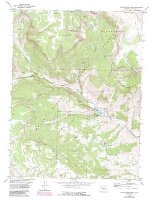
Sweetwater Lake Topo Map Colorado
To zoom in, hover over the map of Sweetwater Lake
USGS Topo Quad 39107g2 - 1:24,000 scale
| Topo Map Name: | Sweetwater Lake |
| USGS Topo Quad ID: | 39107g2 |
| Print Size: | ca. 21 1/4" wide x 27" high |
| Southeast Coordinates: | 39.75° N latitude / 107.125° W longitude |
| Map Center Coordinates: | 39.8125° N latitude / 107.1875° W longitude |
| U.S. State: | CO |
| Filename: | o39107g2.jpg |
| Download Map JPG Image: | Sweetwater Lake topo map 1:24,000 scale |
| Map Type: | Topographic |
| Topo Series: | 7.5´ |
| Map Scale: | 1:24,000 |
| Source of Map Images: | United States Geological Survey (USGS) |
| Alternate Map Versions: |
Sweetwater Lake CO 1977, updated 1978 Download PDF Buy paper map Sweetwater Lake CO 1977, updated 1988 Download PDF Buy paper map Sweetwater Lake CO 2011 Download PDF Buy paper map Sweetwater Lake CO 2013 Download PDF Buy paper map Sweetwater Lake CO 2016 Download PDF Buy paper map |
| FStopo: | US Forest Service topo Sweetwater Lake is available: Download FStopo PDF Download FStopo TIF |
1:24,000 Topo Quads surrounding Sweetwater Lake
> Back to 39107e1 at 1:100,000 scale
> Back to 39106a1 at 1:250,000 scale
> Back to U.S. Topo Maps home
Sweetwater Lake topo map: Gazetteer
Sweetwater Lake: Flats
Tenmile Park elevation 3243m 10639′Turret Creek Meadows elevation 2960m 9711′
Sweetwater Lake: Lakes
Hack Lake elevation 3022m 9914′Johnny Meyers Lake elevation 3000m 9842′
Sweetwater Lake elevation 2351m 7713′
Sweetwater Lake: Springs
Sams Spring elevation 3222m 10570′Sweetwater Lake: Streams
Cease Creek elevation 2299m 7542′Cross Creek elevation 2496m 8188′
Darnell Creek elevation 2534m 8313′
Dry Sweetwater Creek elevation 2554m 8379′
Gruner Creek elevation 2305m 7562′
Hack Creek elevation 2228m 7309′
Lake Creek elevation 2351m 7713′
Riland Creek elevation 2297m 7536′
Turret Creek elevation 2365m 7759′
Sweetwater Lake: Summits
Turret Peak elevation 3498m 11476′W Mountain elevation 3624m 11889′
Sweetwater Lake: Valleys
Tucker Draw elevation 2245m 7365′Sweetwater Lake digital topo map on disk
Buy this Sweetwater Lake topo map showing relief, roads, GPS coordinates and other geographical features, as a high-resolution digital map file on DVD:


