Lo 7 Hill Topo Map Colorado
To zoom in, hover over the map of Lo 7 Hill
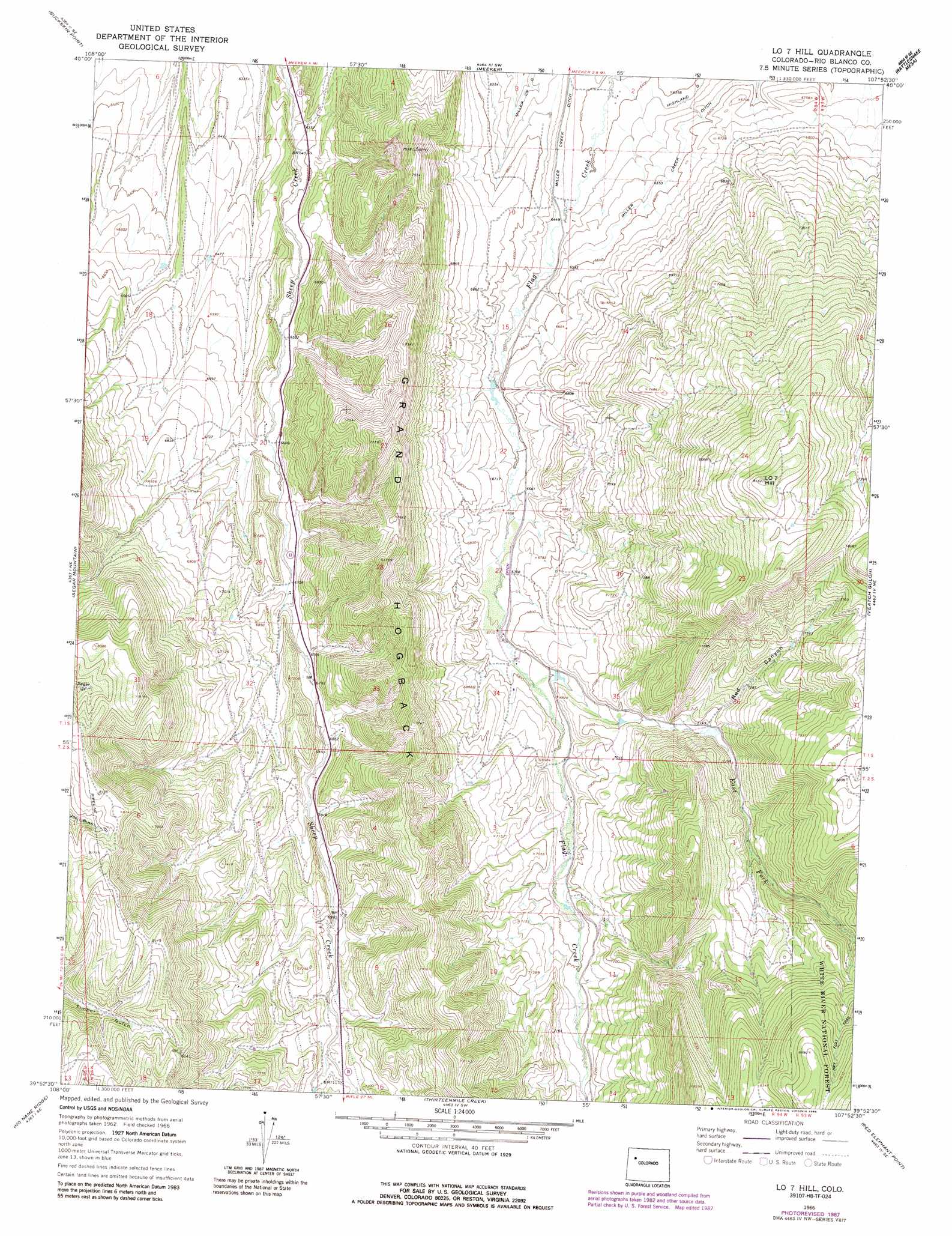
USGS Topo Quad 39107h8 - 1:24,000 scale
| Topo Map Name: | Lo 7 Hill |
| USGS Topo Quad ID: | 39107h8 |
| Print Size: | ca. 21 1/4" wide x 27" high |
| Southeast Coordinates: | 39.875° N latitude / 107.875° W longitude |
| Map Center Coordinates: | 39.9375° N latitude / 107.9375° W longitude |
| U.S. State: | CO |
| Filename: | o39107h8.jpg |
| Download Map JPG Image: | Lo 7 Hill topo map 1:24,000 scale |
| Map Type: | Topographic |
| Topo Series: | 7.5´ |
| Map Scale: | 1:24,000 |
| Source of Map Images: | United States Geological Survey (USGS) |
| Alternate Map Versions: |
Lo 7 Hill CO 1966, updated 1969 Download PDF Buy paper map Lo 7 Hill CO 1966, updated 1969 Download PDF Buy paper map Lo 7 Hill CO 1966, updated 1970 Download PDF Buy paper map Lo 7 Hill CO 1966, updated 1988 Download PDF Buy paper map Lo 7 Hill CO 1966, updated 1988 Download PDF Buy paper map LO 7 Hill CO 2011 Download PDF Buy paper map LO 7 Hill CO 2013 Download PDF Buy paper map LO 7 Hill CO 2016 Download PDF Buy paper map |
| FStopo: | US Forest Service topo LO 7 Hill is available: Download FStopo PDF Download FStopo TIF |
1:24,000 Topo Quads surrounding Lo 7 Hill
Indian Valley |
White Rock |
Devils Hole Gulch |
Ninemile Gap |
Thornburgh |
White River City |
Buckskin Point |
Meeker |
Rattlesnake Mesa |
Sawmill Mountain |
Greasewood Gulch |
Segar Mountain |
Lo 7 Hill |
Veatch Gulch |
Big Beaver Reservoir |
Jessup Gulch |
No Name Ridge |
Thirteenmile Creek |
Red Elephant Point |
Triangle Park |
Cutoff Gulch |
Mccarthy Gulch |
Rio Blanco |
Horse Mountain |
Rifle Falls |
> Back to 39107e1 at 1:100,000 scale
> Back to 39106a1 at 1:250,000 scale
> Back to U.S. Topo Maps home
Lo 7 Hill topo map: Gazetteer
Lo 7 Hill: Canals
Highland Ditch elevation 1965m 6446′Lo 7 Hill: Dams
Wilson Dam elevation 2451m 8041′Lo 7 Hill: Lakes
Swede Lake elevation 2390m 7841′Lo 7 Hill: Reservoirs
Wilson Reservoir elevation 2451m 8041′Lo 7 Hill: Streams
East Fork Flag Creek elevation 2062m 6765′Sheep Creek elevation 2147m 7043′
Lo 7 Hill: Summits
LO 7 Hill elevation 2600m 8530′Lo 7 Hill: Valleys
Red Canyon elevation 2183m 7162′Lo 7 Hill digital topo map on disk
Buy this Lo 7 Hill topo map showing relief, roads, GPS coordinates and other geographical features, as a high-resolution digital map file on DVD: