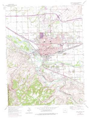
Grand Junction Topo Map Colorado
To zoom in, hover over the map of Grand Junction
USGS Topo Quad 39108a5 - 1:24,000 scale
| Topo Map Name: | Grand Junction |
| USGS Topo Quad ID: | 39108a5 |
| Print Size: | ca. 21 1/4" wide x 27" high |
| Southeast Coordinates: | 39° N latitude / 108.5° W longitude |
| Map Center Coordinates: | 39.0625° N latitude / 108.5625° W longitude |
| U.S. State: | CO |
| Filename: | o39108a5.jpg |
| Download Map JPG Image: | Grand Junction topo map 1:24,000 scale |
| Map Type: | Topographic |
| Topo Series: | 7.5´ |
| Map Scale: | 1:24,000 |
| Source of Map Images: | United States Geological Survey (USGS) |
| Alternate Map Versions: |
Grand Junction CO 1962, updated 1964 Download PDF Buy paper map Grand Junction CO 1962, updated 1975 Download PDF Buy paper map Grand Junction CO 1962, updated 1975 Download PDF Buy paper map Grand Junction CO 1962, updated 1975 Download PDF Buy paper map Grand Junction CO 2010 Download PDF Buy paper map Grand Junction CO 2013 Download PDF Buy paper map Grand Junction CO 2016 Download PDF Buy paper map |
1:24,000 Topo Quads surrounding Grand Junction
> Back to 39108a1 at 1:100,000 scale
> Back to 39108a1 at 1:250,000 scale
> Back to U.S. Topo Maps home
Grand Junction topo map: Gazetteer
Grand Junction: Airports
BLM Fire Center Heliport elevation 1450m 4757′Mountain Bell Heliport elevation 1398m 4586′
Saint Marys Hospital and Medical Center Heliport elevation 1417m 4648′
Walker Field elevation 1470m 4822′
Grand Junction: Canals
Appleton Drain elevation 1391m 4563′Grand Valley Canal elevation 1421m 4662′
Mesa County Ditch elevation 1408m 4619′
The Redlands Power Canal elevation 1394m 4573′
Grand Junction: Dams
Gardner Lake Dam elevation 1445m 4740′Hartman Retention Dam elevation 1470m 4822′
Redlands Dam elevation 1392m 4566′
Grand Junction: Lakes
Connecticut Lake elevation 1383m 4537′Grand Junction: Mines
Abbot Pit elevation 1400m 4593′Amax Uranium Mine elevation 1400m 4593′
Burk Pit elevation 1400m 4593′
C-G-26 Mine elevation 1400m 4593′
Colorado Copper Properties Mine elevation 1400m 4593′
Egger Pit 501 elevation 1400m 4593′
Fireside Enterprises Quarry elevation 1400m 4593′
Herron and Strong Pit elevation 1400m 4593′
Himes Drilling Mine elevation 1400m 4593′
United Sand and Gravel Pit elevation 1421m 4662′
Grand Junction: Parks
Lincoln Park elevation 1408m 4619′Melrose Park elevation 1412m 4632′
Sherwood Park elevation 1405m 4609′
Washington Park elevation 1404m 4606′
Grand Junction: Populated Places
Appleton elevation 1401m 4596′Durham elevation 1387m 4550′
Grand Junction elevation 1400m 4593′
Orchard Mesa elevation 1417m 4648′
Rosevale elevation 1388m 4553′
Grand Junction: Ranges
The Redlands elevation 1419m 4655′Grand Junction: Reservoirs
Gardner Lake Reservoir elevation 1445m 4740′Hartman Retention Reservoir elevation 1470m 4822′
Grand Junction: Streams
Gunnison River elevation 1388m 4553′Indian Wash elevation 1396m 4580′
Ladder Creek elevation 1403m 4603′
Leach Creek elevation 1382m 4534′
Grand Junction: Summits
Horse Point elevation 1563m 5127′Orchard Mesa elevation 1434m 4704′
White Cap elevation 1472m 4829′
Grand Junction: Valleys
Billings Canyon elevation 1408m 4619′No Thoroughfare Canyon elevation 1395m 4576′
Red Canyon elevation 1390m 4560′
Rough Canyon elevation 1408m 4619′
Grand Junction digital topo map on disk
Buy this Grand Junction topo map showing relief, roads, GPS coordinates and other geographical features, as a high-resolution digital map file on DVD:


