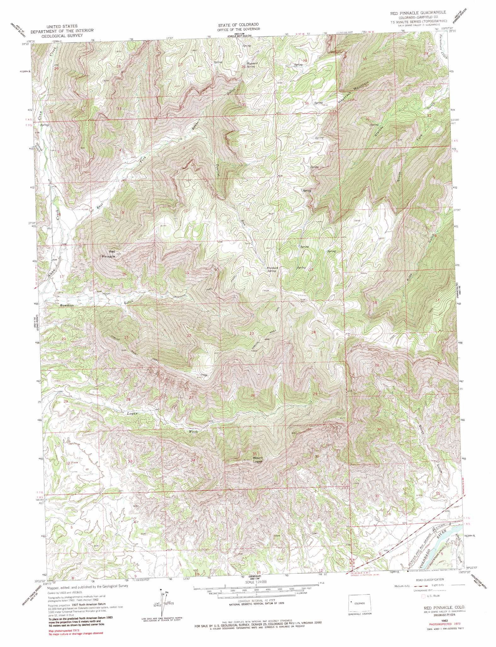
Red Pinnacle Topo Map Colorado
To zoom in, hover over the map of Red Pinnacle
USGS Topo Quad 39108d2 - 1:24,000 scale
| Topo Map Name: | Red Pinnacle |
| USGS Topo Quad ID: | 39108d2 |
| Print Size: | ca. 21 1/4" wide x 27" high |
| Southeast Coordinates: | 39.375° N latitude / 108.125° W longitude |
| Map Center Coordinates: | 39.4375° N latitude / 108.1875° W longitude |
| U.S. State: | CO |
| Filename: | o39108d2.jpg |
| Download Map JPG Image: | Red Pinnacle topo map 1:24,000 scale |
| Map Type: | Topographic |
| Topo Series: | 7.5´ |
| Map Scale: | 1:24,000 |
| Source of Map Images: | United States Geological Survey (USGS) |
| Alternate Map Versions: |
Red Pinnacle CO 1962, updated 1964 Download PDF Buy paper map Red Pinnacle CO 1962, updated 1964 Download PDF Buy paper map Red Pinnacle CO 1962, updated 1972 Download PDF Buy paper map Red Pinnacle CO 1962, updated 1987 Download PDF Buy paper map Red Pinnacle CO 2010 Download PDF Buy paper map Red Pinnacle CO 2013 Download PDF Buy paper map Red Pinnacle CO 2016 Download PDF Buy paper map |
1:24,000 Topo Quads surrounding Red Pinnacle
Figure Four Spring |
Bull Fork |
Cutoff Gulch |
Mccarthy Gulch |
Rio Blanco |
Desert Gulch |
Mount Blaine |
Circle Dot Gulch |
Forked Gulch |
Anvil Points |
The Saddle |
Long Point |
Red Pinnacle |
Parachute |
Rulison |
Winter Flats |
Wagon Track Ridge |
De Beque |
Housetop Mountain |
Hawxhurst Creek |
Round Mountain |
Cameo |
Mesa |
Molina |
Collbran |
> Back to 39108a1 at 1:100,000 scale
> Back to 39108a1 at 1:250,000 scale
> Back to U.S. Topo Maps home
Red Pinnacle topo map: Gazetteer
Red Pinnacle: Ridges
Haystack Mountain elevation 2296m 7532′Red Pinnacle: Springs
Hayward Spring elevation 2467m 8093′Pritchard Spring elevation 2542m 8339′
Red Pinnacle: Streams
Alkali Creek elevation 1522m 4993′East Fork Conn Creek elevation 1742m 5715′
Tourist Run elevation 1897m 6223′
Red Pinnacle: Summits
Mount Logan elevation 2561m 8402′Red Pinnacle elevation 2401m 7877′
Red Pinnacle: Trails
Bowdish Trail elevation 1921m 6302′Spruce Point Trail elevation 2479m 8133′
Red Pinnacle: Valleys
Gilman Gulch elevation 1790m 5872′Smith Gulch elevation 1578m 5177′
South Fork Starkey Gulch elevation 1711m 5613′
Red Pinnacle digital topo map on disk
Buy this Red Pinnacle topo map showing relief, roads, GPS coordinates and other geographical features, as a high-resolution digital map file on DVD: