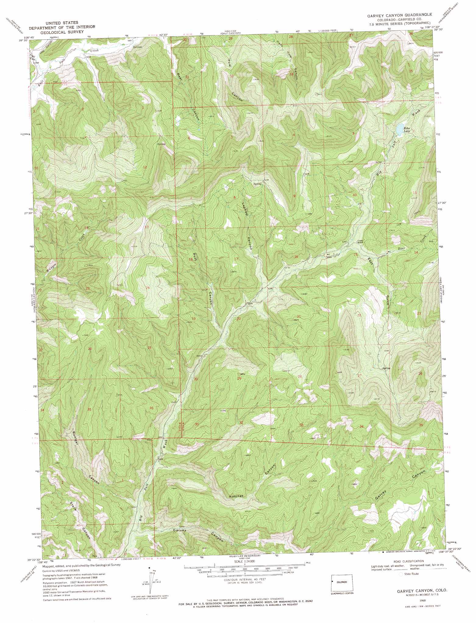
Garvey Canyon Topo Map Colorado
To zoom in, hover over the map of Garvey Canyon
USGS Topo Quad 39108d6 - 1:24,000 scale
| Topo Map Name: | Garvey Canyon |
| USGS Topo Quad ID: | 39108d6 |
| Print Size: | ca. 21 1/4" wide x 27" high |
| Southeast Coordinates: | 39.375° N latitude / 108.625° W longitude |
| Map Center Coordinates: | 39.4375° N latitude / 108.6875° W longitude |
| U.S. State: | CO |
| Filename: | o39108d6.jpg |
| Download Map JPG Image: | Garvey Canyon topo map 1:24,000 scale |
| Map Type: | Topographic |
| Topo Series: | 7.5´ |
| Map Scale: | 1:24,000 |
| Source of Map Images: | United States Geological Survey (USGS) |
| Alternate Map Versions: |
Garvey Canyon CO 1968, updated 1972 Download PDF Buy paper map Garvey Canyon CO 2010 Download PDF Buy paper map Garvey Canyon CO 2013 Download PDF Buy paper map Garvey Canyon CO 2016 Download PDF Buy paper map |
1:24,000 Topo Quads surrounding Garvey Canyon
East Evacuation Creek |
Big Foundation Creek |
Brushy Point |
Razorback Ridge |
Figure Four Spring |
Baxter Pass |
Douglas Pass |
Calf Canyon |
Henderson Ridge |
Desert Gulch |
Carbonera |
Howard Canyon |
Garvey Canyon |
Middle Dry Fork |
The Saddle |
Badger Wash |
Highline Lake |
Ruby Lee Reservoir |
Corcoran Peak |
Winter Flats |
Ruby Canyon |
Mack |
Fruita |
Corcoran Point |
Round Mountain |
> Back to 39108a1 at 1:100,000 scale
> Back to 39108a1 at 1:250,000 scale
> Back to U.S. Topo Maps home
Garvey Canyon topo map: Gazetteer
Garvey Canyon: Mines
Bunniger Mine elevation 1781m 5843′Garvey Canyon: Reservoirs
Echo Lake elevation 2024m 6640′Garvey Canyon: Streams
Deer Creek elevation 1894m 6213′Garvey Canyon: Valleys
Buniger Canyon elevation 1683m 5521′East Gulch elevation 1903m 6243′
Garvey Canyon elevation 1655m 5429′
Hatchet Canyon elevation 1702m 5583′
Hay Canyon elevation 1760m 5774′
Lapham Canyon elevation 1859m 6099′
Post Canyon elevation 1794m 5885′
Trail Canyon elevation 1759m 5770′
Garvey Canyon digital topo map on disk
Buy this Garvey Canyon topo map showing relief, roads, GPS coordinates and other geographical features, as a high-resolution digital map file on DVD: