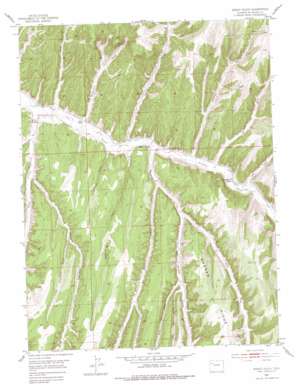
Jessup Gulch Topo Map Colorado
To zoom in, hover over the map of Jessup Gulch
USGS Topo Quad 39108g2 - 1:24,000 scale
| Topo Map Name: | Jessup Gulch |
| USGS Topo Quad ID: | 39108g2 |
| Print Size: | ca. 21 1/4" wide x 27" high |
| Southeast Coordinates: | 39.75° N latitude / 108.125° W longitude |
| Map Center Coordinates: | 39.8125° N latitude / 108.1875° W longitude |
| U.S. State: | CO |
| Filename: | o39108g2.jpg |
| Download Map JPG Image: | Jessup Gulch topo map 1:24,000 scale |
| Map Type: | Topographic |
| Topo Series: | 7.5´ |
| Map Scale: | 1:24,000 |
| Source of Map Images: | United States Geological Survey (USGS) |
| Alternate Map Versions: |
Jessup Gulch CO 1952, updated 1954 Download PDF Buy paper map Jessup Gulch CO 1952, updated 1954 Download PDF Buy paper map Jessup Gulch CO 1952, updated 1965 Download PDF Buy paper map Jessup Gulch CO 1952, updated 1971 Download PDF Buy paper map Jessup Gulch CO 1952, updated 1971 Download PDF Buy paper map Jessup Gulch CO 1952, updated 1977 Download PDF Buy paper map Jessup Gulch CO 2010 Download PDF Buy paper map Jessup Gulch CO 2013 Download PDF Buy paper map Jessup Gulch CO 2016 Download PDF Buy paper map |
1:24,000 Topo Quads surrounding Jessup Gulch
> Back to 39108e1 at 1:100,000 scale
> Back to 39108a1 at 1:250,000 scale
> Back to U.S. Topo Maps home
Jessup Gulch topo map: Gazetteer
Jessup Gulch: Airports
CB-1 Heliport elevation 2069m 6788′Jessup Gulch: Streams
Willow Creek elevation 1908m 6259′Jessup Gulch: Valleys
Big Jimmy Gulch elevation 1928m 6325′Collins Gulch elevation 1946m 6384′
Cottonwood Gulch elevation 1939m 6361′
East Fork Stewart Gulch elevation 1992m 6535′
East Twin Gulch elevation 2049m 6722′
Gardenhire Gulch elevation 1935m 6348′
Jessup Gulch elevation 1963m 6440′
Jones Gulch elevation 1994m 6541′
Little Scandard Gulch elevation 2031m 6663′
Middle Fork Stewart Gulch elevation 1992m 6535′
Oldland Gulch elevation 1975m 6479′
P. L. Gulch elevation 1928m 6325′
Prechtle Gulch elevation 2079m 6820′
Scandard Gulch elevation 1950m 6397′
Sorghum Gulch elevation 1943m 6374′
Stewart Gulch elevation 1940m 6364′
West Fork Stewart Gulch elevation 1965m 6446′
West Twin Gulch elevation 2045m 6709′
Jessup Gulch digital topo map on disk
Buy this Jessup Gulch topo map showing relief, roads, GPS coordinates and other geographical features, as a high-resolution digital map file on DVD:


