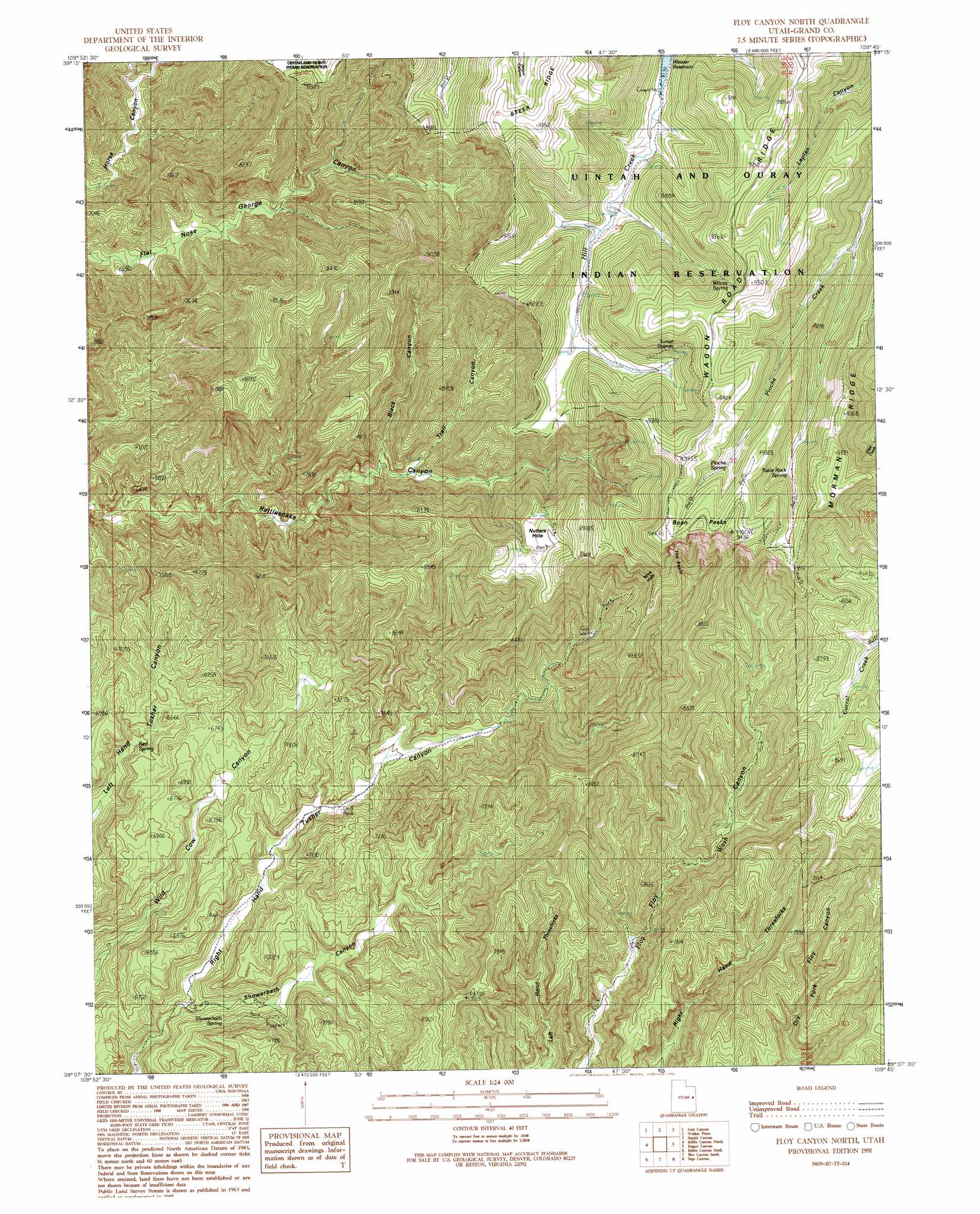
Floy Canyon North Topo Map Utah
To zoom in, hover over the map of Floy Canyon North
USGS Topo Quad 39109b7 - 1:24,000 scale
| Topo Map Name: | Floy Canyon North |
| USGS Topo Quad ID: | 39109b7 |
| Print Size: | ca. 21 1/4" wide x 27" high |
| Southeast Coordinates: | 39.125° N latitude / 109.75° W longitude |
| Map Center Coordinates: | 39.1875° N latitude / 109.8125° W longitude |
| U.S. State: | UT |
| Filename: | o39109b7.jpg |
| Download Map JPG Image: | Floy Canyon North topo map 1:24,000 scale |
| Map Type: | Topographic |
| Topo Series: | 7.5´ |
| Map Scale: | 1:24,000 |
| Source of Map Images: | United States Geological Survey (USGS) |
| Alternate Map Versions: |
Floy Canyon North UT 1991, updated 1991 Download PDF Buy paper map Floy Canyon North UT 2011 Download PDF Buy paper map Floy Canyon North UT 2014 Download PDF Buy paper map |
1:24,000 Topo Quads surrounding Floy Canyon North
Chandler Falls |
Moonwater Point |
Chicken Fork |
Black Knolls |
Tenmile Canyon North |
Three Fords Canyon |
Lion Canyon |
Walker Point |
Supply Canyon |
Tenmile Canyon South |
Butler Canyon |
Bobby Canyon North |
Floy Canyon North |
Bogart Canyon |
Tepee Canyon |
Tusher Canyon |
Bobby Canyon South |
Floy Canyon South |
Sego Canyon |
Calf Canyon |
Green River Ne |
Hatch Mesa |
Crescent Junction |
Thompson |
Sagers Flat |
> Back to 39109a1 at 1:100,000 scale
> Back to 39108a1 at 1:250,000 scale
> Back to U.S. Topo Maps home
Floy Canyon North topo map: Gazetteer
Floy Canyon North: Basins
Nine Hole elevation 2814m 9232′Nutters Hole elevation 2646m 8681′
The Basin elevation 2611m 8566′
Floy Canyon North: Springs
Pioche Spring elevation 2762m 9061′Red Spring elevation 1944m 6377′
Showerbath Spring elevation 1991m 6532′
Table Rock Spring elevation 2698m 8851′
Wilcox Spring elevation 2737m 8979′
Floy Canyon North: Summits
Roan Peaks elevation 2873m 9425′Floy Canyon North: Trails
Sunset Dugway elevation 2736m 8976′Floy Canyon North: Valleys
Black Canyon elevation 2224m 7296′Showerbath Canyon elevation 1909m 6263′
Trail Canyon elevation 2237m 7339′
Floy Canyon North digital topo map on disk
Buy this Floy Canyon North topo map showing relief, roads, GPS coordinates and other geographical features, as a high-resolution digital map file on DVD: