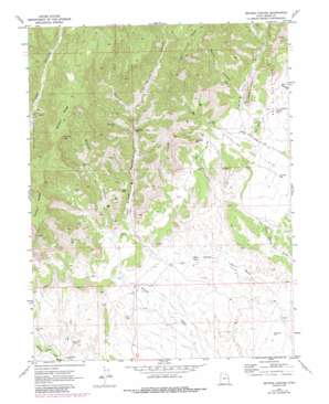
Bryson Canyon Topo Map Utah
To zoom in, hover over the map of Bryson Canyon
USGS Topo Quad 39109c2 - 1:24,000 scale
| Topo Map Name: | Bryson Canyon |
| USGS Topo Quad ID: | 39109c2 |
| Print Size: | ca. 21 1/4" wide x 27" high |
| Southeast Coordinates: | 39.25° N latitude / 109.125° W longitude |
| Map Center Coordinates: | 39.3125° N latitude / 109.1875° W longitude |
| U.S. State: | UT |
| Filename: | o39109c2.jpg |
| Download Map JPG Image: | Bryson Canyon topo map 1:24,000 scale |
| Map Type: | Topographic |
| Topo Series: | 7.5´ |
| Map Scale: | 1:24,000 |
| Source of Map Images: | United States Geological Survey (USGS) |
| Alternate Map Versions: |
Bryson Canyon UT 1970, updated 1973 Download PDF Buy paper map Bryson Canyon UT 1970, updated 1987 Download PDF Buy paper map Bryson Canyon UT 2011 Download PDF Buy paper map Bryson Canyon UT 2014 Download PDF Buy paper map |
1:24,000 Topo Quads surrounding Bryson Canyon
> Back to 39109a1 at 1:100,000 scale
> Back to 39108a1 at 1:250,000 scale
> Back to U.S. Topo Maps home
Bryson Canyon topo map: Gazetteer
Bryson Canyon: Benches
Lion Bench elevation 1673m 5488′Bryson Canyon: Ridges
Bryson Ridge elevation 2143m 7030′Saddle Ridge elevation 2011m 6597′
Bryson Canyon: Summits
Hat Rock elevation 1807m 5928′Taylor Point elevation 1733m 5685′
Bryson Canyon: Valleys
Bryson Canyon elevation 1640m 5380′San Arroyo Canyon elevation 1576m 5170′
Taylor Canyon elevation 1695m 5561′
Trap Canyon elevation 1718m 5636′
Bryson Canyon digital topo map on disk
Buy this Bryson Canyon topo map showing relief, roads, GPS coordinates and other geographical features, as a high-resolution digital map file on DVD:


