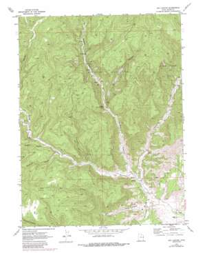
Dry Canyon Topo Map Utah
To zoom in, hover over the map of Dry Canyon
USGS Topo Quad 39109c3 - 1:24,000 scale
| Topo Map Name: | Dry Canyon |
| USGS Topo Quad ID: | 39109c3 |
| Print Size: | ca. 21 1/4" wide x 27" high |
| Southeast Coordinates: | 39.25° N latitude / 109.25° W longitude |
| Map Center Coordinates: | 39.3125° N latitude / 109.3125° W longitude |
| U.S. State: | UT |
| Filename: | o39109c3.jpg |
| Download Map JPG Image: | Dry Canyon topo map 1:24,000 scale |
| Map Type: | Topographic |
| Topo Series: | 7.5´ |
| Map Scale: | 1:24,000 |
| Source of Map Images: | United States Geological Survey (USGS) |
| Alternate Map Versions: |
Dry Canyon UT 1970, updated 1973 Download PDF Buy paper map Dry Canyon UT 1970, updated 1987 Download PDF Buy paper map Dry Canyon UT 2011 Download PDF Buy paper map Dry Canyon UT 2014 Download PDF Buy paper map |
1:24,000 Topo Quads surrounding Dry Canyon
> Back to 39109a1 at 1:100,000 scale
> Back to 39108a1 at 1:250,000 scale
> Back to U.S. Topo Maps home
Dry Canyon topo map: Gazetteer
Dry Canyon: Flats
Pear Park elevation 1940m 6364′Dry Canyon: Oilfields
Bryson Canyon Gas Field elevation 1921m 6302′Pear Park Gas Field elevation 1902m 6240′
Westwater Gas Field elevation 2098m 6883′
Dry Canyon: Summits
Potato Hill elevation 1569m 5147′Dry Canyon: Valleys
Bull Canyon elevation 1729m 5672′Dark Canyon elevation 1646m 5400′
Dry Canyon elevation 1544m 5065′
East Canyon elevation 1576m 5170′
Hay Canyon elevation 1741m 5711′
Maverick Canyon elevation 1681m 5515′
Middle Canyon elevation 1585m 5200′
Rough Canyon elevation 1693m 5554′
Dry Canyon digital topo map on disk
Buy this Dry Canyon topo map showing relief, roads, GPS coordinates and other geographical features, as a high-resolution digital map file on DVD:


