Tenmile Canyon South Topo Map Utah
To zoom in, hover over the map of Tenmile Canyon South
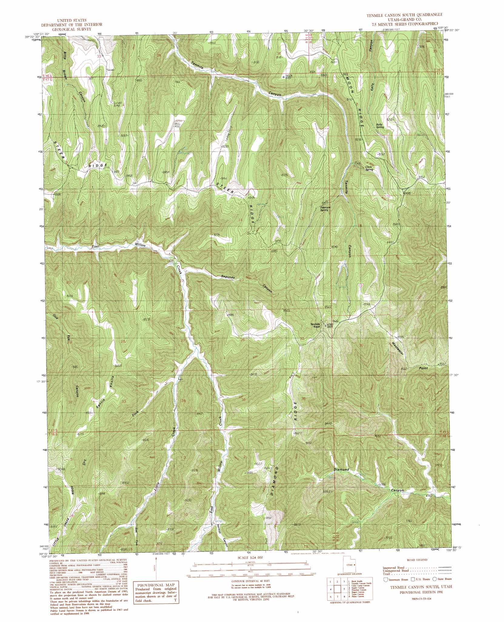
USGS Topo Quad 39109c5 - 1:24,000 scale
| Topo Map Name: | Tenmile Canyon South |
| USGS Topo Quad ID: | 39109c5 |
| Print Size: | ca. 21 1/4" wide x 27" high |
| Southeast Coordinates: | 39.25° N latitude / 109.5° W longitude |
| Map Center Coordinates: | 39.3125° N latitude / 109.5625° W longitude |
| U.S. State: | UT |
| Filename: | o39109c5.jpg |
| Download Map JPG Image: | Tenmile Canyon South topo map 1:24,000 scale |
| Map Type: | Topographic |
| Topo Series: | 7.5´ |
| Map Scale: | 1:24,000 |
| Source of Map Images: | United States Geological Survey (USGS) |
| Alternate Map Versions: |
Tenmile Canyon South UT 1991, updated 1991 Download PDF Buy paper map Tenmile Canyon South UT 2011 Download PDF Buy paper map Tenmile Canyon South UT 2014 Download PDF Buy paper map |
1:24,000 Topo Quads surrounding Tenmile Canyon South
Wolf Flat |
Flat Rock Mesa |
Wolf Point |
Pine Spring Canyon |
Seep Canyon |
Chicken Fork |
Black Knolls |
Tenmile Canyon North |
Cedar Camp Canyon |
P R Spring |
Walker Point |
Supply Canyon |
Tenmile Canyon South |
Preacher Canyon |
Dry Canyon |
Floy Canyon North |
Bogart Canyon |
Tepee Canyon |
Flume Canyon |
Antone Canyon |
Floy Canyon South |
Sego Canyon |
Calf Canyon |
Cisco Springs |
Danish Flat |
> Back to 39109a1 at 1:100,000 scale
> Back to 39108a1 at 1:250,000 scale
> Back to U.S. Topo Maps home
Tenmile Canyon South topo map: Gazetteer
Tenmile Canyon South: Ridges
Diamond Ridge elevation 2678m 8786′Little Creek Ridge elevation 2699m 8854′
Steer Ridge elevation 2542m 8339′
Steer Ridge elevation 2569m 8428′
Tenmile Canyon South: Springs
Clark Spring elevation 2426m 7959′Kelly Spring elevation 2412m 7913′
Peterson Spring elevation 2458m 8064′
Tenmile Canyon South: Streams
Dry Fork elevation 2245m 7365′East Fork Little Creek elevation 2347m 7700′
Little Creek elevation 2224m 7296′
Tenmile Canyon South: Summits
Santio Knolls elevation 2624m 8608′Tenmile Knoll elevation 2708m 8884′
Tenmile Canyon South: Valleys
Harmes Canyon elevation 2317m 7601′Segundo Canyon elevation 2206m 7237′
Tenmile Canyon South digital topo map on disk
Buy this Tenmile Canyon South topo map showing relief, roads, GPS coordinates and other geographical features, as a high-resolution digital map file on DVD: