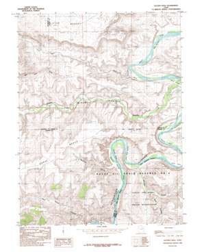
Duches Hole Topo Map Utah
To zoom in, hover over the map of Duches Hole
USGS Topo Quad 39109g8 - 1:24,000 scale
| Topo Map Name: | Duches Hole |
| USGS Topo Quad ID: | 39109g8 |
| Print Size: | ca. 21 1/4" wide x 27" high |
| Southeast Coordinates: | 39.75° N latitude / 109.875° W longitude |
| Map Center Coordinates: | 39.8125° N latitude / 109.9375° W longitude |
| U.S. State: | UT |
| Filename: | o39109g8.jpg |
| Download Map JPG Image: | Duches Hole topo map 1:24,000 scale |
| Map Type: | Topographic |
| Topo Series: | 7.5´ |
| Map Scale: | 1:24,000 |
| Source of Map Images: | United States Geological Survey (USGS) |
| Alternate Map Versions: |
Duches Hole UT 1985, updated 1985 Download PDF Buy paper map Duches Hole UT 2011 Download PDF Buy paper map Duches Hole UT 2014 Download PDF Buy paper map |
1:24,000 Topo Quads surrounding Duches Hole
> Back to 39109e1 at 1:100,000 scale
> Back to 39108a1 at 1:250,000 scale
> Back to U.S. Topo Maps home
Duches Hole topo map: Gazetteer
Duches Hole: Airports
Sand Wash Airport elevation 1558m 5111′Duches Hole: Bars
Blue Stem elevation 1411m 4629′Slough Grass elevation 1426m 4678′
Duches Hole: Benches
Horse Bench elevation 1845m 6053′Duches Hole: Bends
Boat Bottom elevation 1408m 4619′Duches Hole elevation 1407m 4616′
Gold Hole elevation 1407m 4616′
Little Horse Bottom elevation 1404m 4606′
Maverick Bottom elevation 1409m 4622′
Duches Hole: Parks
Desolation Canyon Historical Landmark elevation 1441m 4727′Duches Hole: Streams
Nine Mile Creek elevation 1409m 4622′Duches Hole: Valleys
Maverick Canyon elevation 1422m 4665′Ninemile Canyon elevation 1413m 4635′
Sand Wash elevation 1426m 4678′
Tabyago Canyon elevation 1442m 4730′
West Tabyago Canyon elevation 1447m 4747′
Duches Hole digital topo map on disk
Buy this Duches Hole topo map showing relief, roads, GPS coordinates and other geographical features, as a high-resolution digital map file on DVD:


