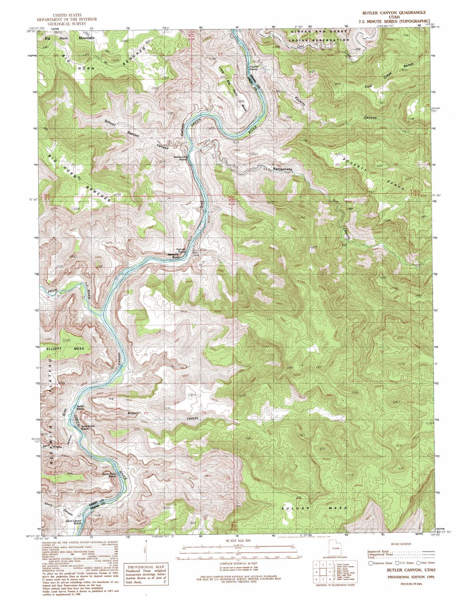
Butler Canyon Topo Map Utah
To zoom in, hover over the map of Butler Canyon
USGS Topo Quad 39110b1 - 1:24,000 scale
| Topo Map Name: | Butler Canyon |
| USGS Topo Quad ID: | 39110b1 |
| Print Size: | ca. 21 1/4" wide x 27" high |
| Southeast Coordinates: | 39.125° N latitude / 110° W longitude |
| Map Center Coordinates: | 39.1875° N latitude / 110.0625° W longitude |
| U.S. State: | UT |
| Filename: | o39110b1.jpg |
| Download Map JPG Image: | Butler Canyon topo map 1:24,000 scale |
| Map Type: | Topographic |
| Topo Series: | 7.5´ |
| Map Scale: | 1:24,000 |
| Source of Map Images: | United States Geological Survey (USGS) |
| Alternate Map Versions: |
Butler Canyon UT 1991, updated 1991 Download PDF Buy paper map Butler Canyon UT 2011 Download PDF Buy paper map Butler Canyon UT 2014 Download PDF Buy paper map |
1:24,000 Topo Quads surrounding Butler Canyon
Lila Point |
Lighthouse Canyon |
Chandler Falls |
Moonwater Point |
Chicken Fork |
Woodside |
Turtle Canyon |
Three Fords Canyon |
Lion Canyon |
Walker Point |
Cliff |
Jenny Canyon |
Butler Canyon |
Bobby Canyon North |
Floy Canyon North |
Desert |
Blue Castle Butte |
Tusher Canyon |
Bobby Canyon South |
Floy Canyon South |
Jessies Twist |
Green River |
Green River Ne |
Hatch Mesa |
Crescent Junction |
> Back to 39110a1 at 1:100,000 scale
> Back to 39110a1 at 1:250,000 scale
> Back to U.S. Topo Maps home
Butler Canyon topo map: Gazetteer
Butler Canyon: Benches
Big Horn Benches elevation 1780m 5839′Coal Creek Bench elevation 1734m 5688′
Poverty Bench elevation 1851m 6072′
Butler Canyon: Streams
Price River elevation 1262m 4140′Butler Canyon: Summits
Big Horn Mountain elevation 1920m 6299′Suluar Mesa elevation 1883m 6177′
Butler Canyon: Valleys
Butler Canyon elevation 1263m 4143′Poverty Canyon elevation 1296m 4251′
Rattlesnake Canyon elevation 1274m 4179′
Sand Knolls Canyon elevation 1265m 4150′
Short Canyon elevation 1265m 4150′
Butler Canyon digital topo map on disk
Buy this Butler Canyon topo map showing relief, roads, GPS coordinates and other geographical features, as a high-resolution digital map file on DVD: